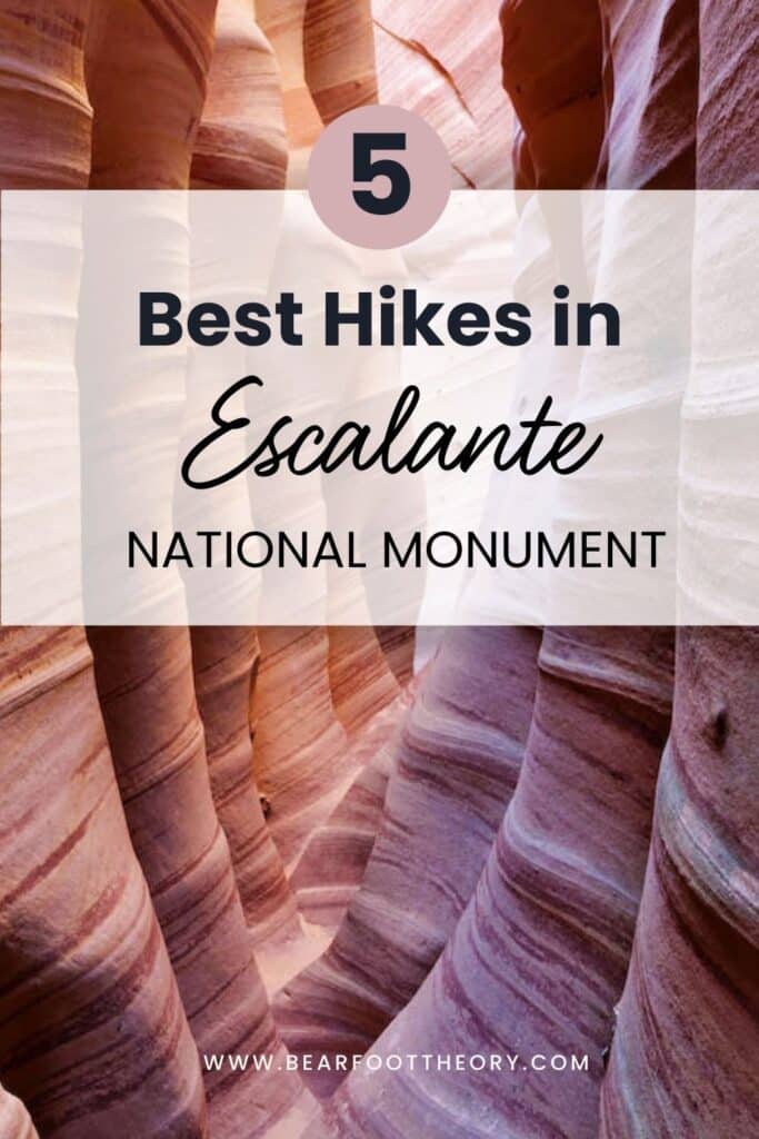
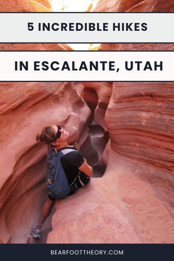
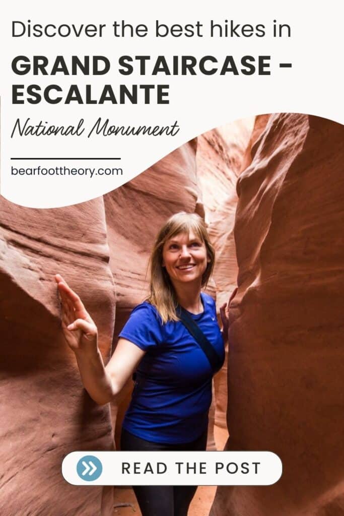
5 Incredible Grand Staircase-Escalante Hikes
Discover the best Grand Staircase Escalante hikes with these epic hiking trails including waterfalls, slot canyons, views, and more.
Grand Staircase-Escalante National Monument is one of those places in Utah that a lot of people have never heard of. It often gets overshadowed by Utah’s National Parks including Zion, Bryce, and Arches. But that doesn’t mean that Escalante should fall to the bottom of your list. There are some amazing Grand Staircase-Escalante hikes that any outdoor enthusiast will enjoy.
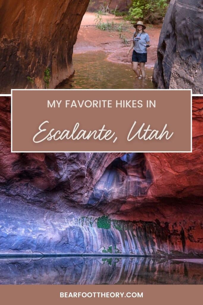
During my first visit to Escalante, I was shocked to find waterfalls, desert rivers, endless miles of slickrock, isolated camping, and some of the craziest canyons I’ve ever traveled through. I’ve been back many times since for camping, hiking, and backpacking, and I even packrafted the Escalante River.
If you are planning your first trip to Escalante and want to do some hiking, here are five trail options to get you started. All of these hikes are non-technical so all you need is your normal day hiking essentials (and a camera!) and you’ll be ready to explore some of Utah’s finest landscapes.
Ready to explore Utah’s canyon country? Here are five great hikes in Grand Staircase-Escalante for first-time visitors
This post may contain affiliate links.
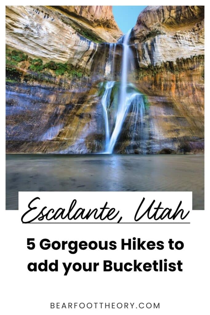
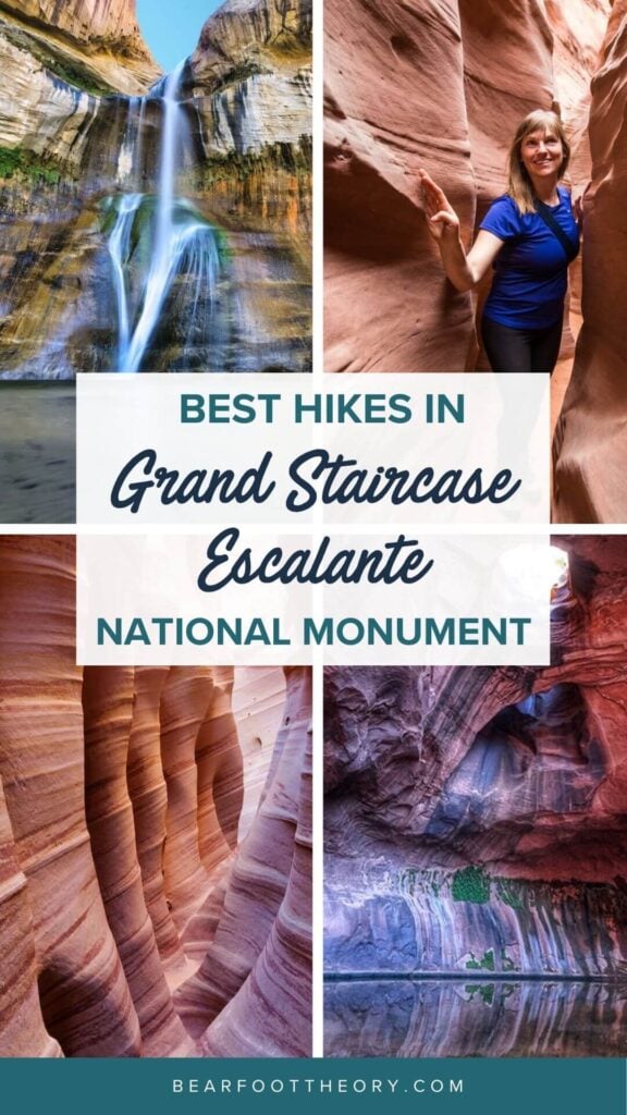
1. Lower Calf Creek Falls
- Length: 6.7 miles roundtrip
- Elevation gain: 866 ft
- Trail type: Out & back
- Difficulty: Moderate
- Dogs allowed: On-leash
The trail to Lower Calf Creek Falls is one of the more accessible and popular hikes in Grand Staircase-Escalante partly because the trailhead is directly on the main highway (unlike most of the other trails in Escalante that require driving on a dirt road).
This 6.7-mile round-trip trail travels through a broad but beautiful canyon leading to the soaring a 126-foot waterfall. The majority of the trail is flat and easy to follow, making it a great hike for beginners or first-time visitors.
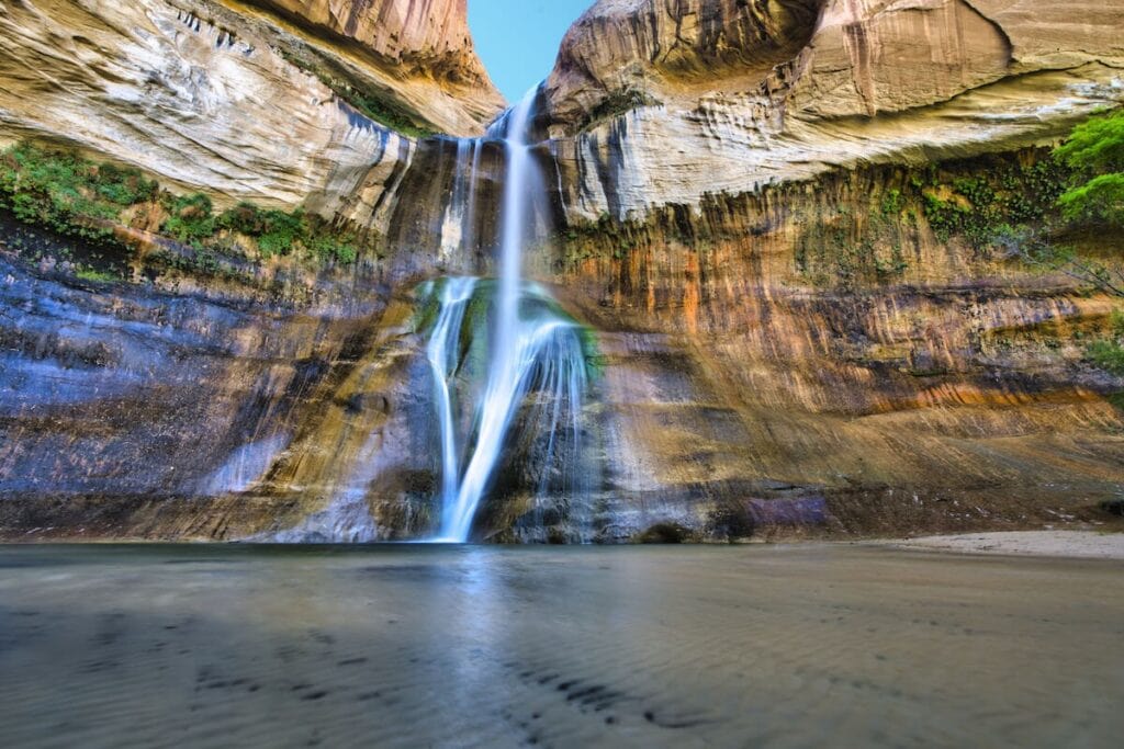
Once you reach the falls, you’ll be tempted by the inviting pool that forms below the waterfall, but be prepared to brave the cold. The water was FREEZING everytime I’ve been there. Even if you aren’t up for a swim, you’ll be mesmerized by the amphitheater’s colorful walls.
How to get to Lower Calf Creek Falls trailhead:
The Lower Calf Creek Falls trailhead is located 16 miles from the town of Escalante on Highway 12. There is a parking area at the Calf Creek campground where you’ll also find the trailhead.
Save this post!
Enter your email & I'll send this post to your inbox! You'll also receive my weekly newsletter full of helpful advice for planning your adventures.
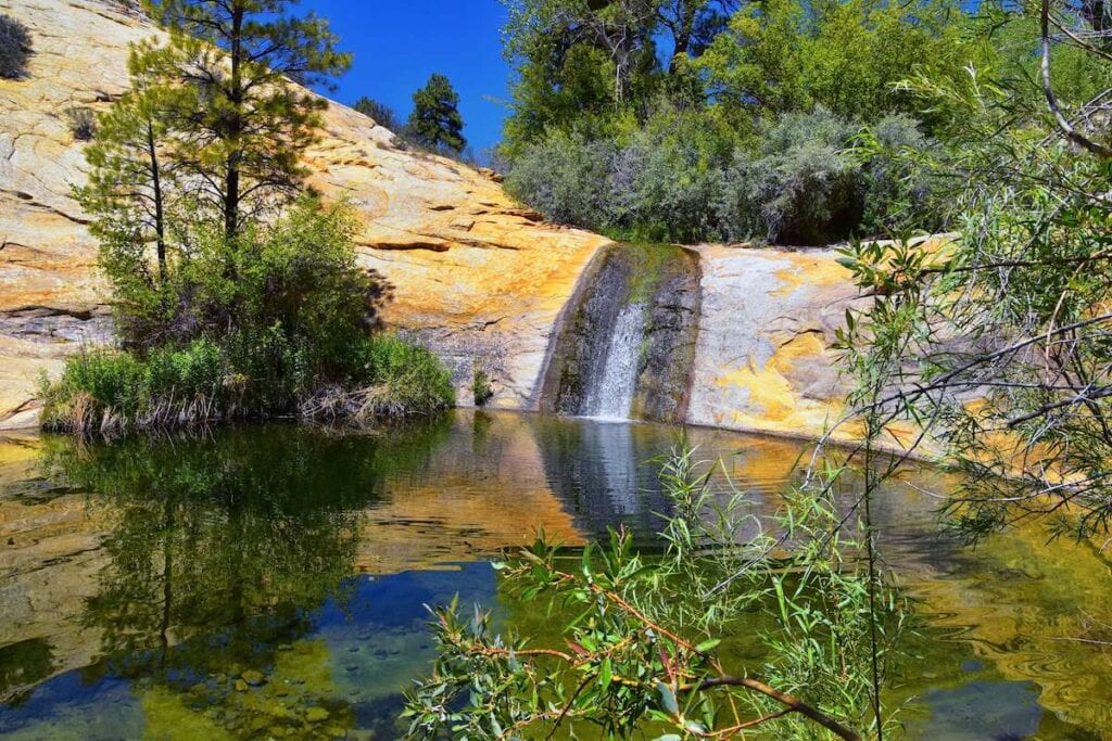
2. Upper Calf Creek Falls
- Length: 2.1 miles roundtrip
- Elevation gain: 606 feet
- Trail type: Out & back
- Difficulty: Moderate
- Dogs allowed: Yes
If you’re looking for a shorter hike in Grand Staircase-Escalante that still lands you at a beautiful waterfall, check out Upper Calf Creek Falls. This trail is located up river from Lower Calf Creek Falls and traverses over slickrock for one mile. The trail ends at a desert oasis with a beautiful waterfall cascading into a crystal clear pool.
This trail is very exposed with no shade until you get to the river, so bring plenty of water and sun protection. The trail is also not clearly defined as you descend down to the falls, so you’ll want to keep an eye out for trail makers (also known as cairns)
Getting to Upper Calf Creek Falls
The Upper Calf Creek Falls trailhead is located about 21 miles from the town of Escalante on Highway 12. There is a small parking area on the left side of the highway as you travel north. It’s easy to miss so keep an eye out.
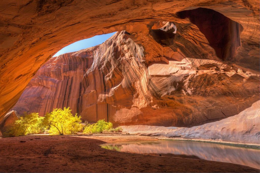
3. Golden Cathedral & Neon Canyon
- Length: 9.1 miles roundtrip
- Elevation gain: 1,581 ft
- Trail type: Out & back
- Difficulty: Moderate
- Dogs allowed: On-leash
This is a moderately challenging hike in Grand Staircase-Escalante mostly due to the distance and the ascent as you make your way back to the trailhead. I’ve done it twice – once as a round-trip day hike and another time as the start of my Escalante River packrafting trip.
Navigation to on this Escalante hike can also be a bit tricky, so make sure you have a map or GPS app downloaded to your phone and pay close attention to your surroundings.
The 9-mile round trip Golden Cathedral & Neon Canyon trail begins with an immediate and steep descent down into a slickrock bowl. After this initial descent, the elevation change becomes gradual again until the last drop down to the Escalante River.
As you make your way towards the Escalante River, you are treated with vast views of the red landscape that makes up the National Monument. Notice the rock cairns that mark the location of the trail. Keep an eye on these, since they will let you know that you are still on track with the trail.
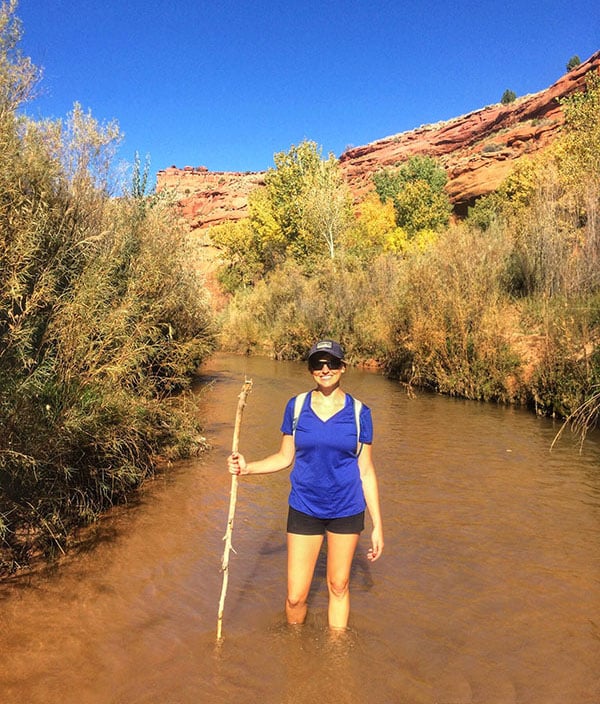
Once you reach the Escalante River, be prepared to wade downriver and eventually cross it, sometimes in knee-deep water. The current wasn’t swift when I visited, but conditions can change depending on the time of year. I suggest bringing a pair of Tevas or other water sandals that you can change into once you get to this point.
Also, feel free to pick up a walking stick that you can use to gauge the depth of the river and help maintain your balance or bring your own trekking poles.
After a few crossings, keep an eye out on the left for the opening to Neon Canyon. This is where the landscape really starts to get interesting. As you travel deeper into Neon Canyon, you’ll find huge boulders scattered throughout and canyon walls that rapidly rise on either side, making you feel very small.
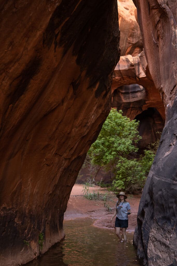
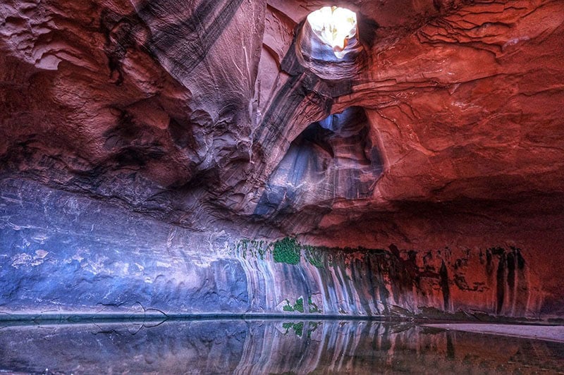
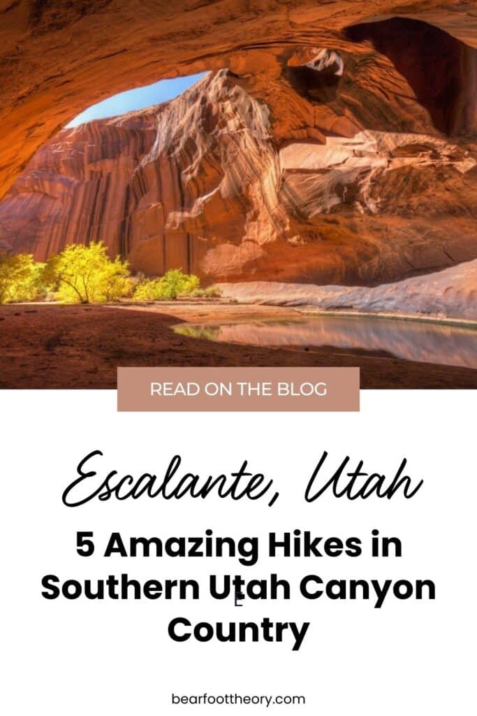
The grand finale of this hike is the Golden Cathedral, located at the end of Neon Canyon. This is a mind-blowing grotto with a ceiling punctured by two cavernous holes. If you arrive at the right time of day when the sun is at the right angle, the sunbeams through the holes lighting up the canyon walls and emerald pool below.
Once you are ready to head back, retrace your footsteps, fording the Escalante River again until you get back to the main trail. Then start your ascent back up.
Be sure to give yourself plenty of time. This hike took longer than we expected and with our 12:30 pm start, we ended up making the final push in the dark which was not ideal considering the trail is hard enough to follow in the day time. Avoid this by starting early and bring a headlamp just in case.
Getting to the Golden Cathedral & Neon Canyon trailhead
The trailhead to Neon Canyon takes some effort to get to, but it’s worth it. First, you’ll drive 16.3 miles down Hole-in-the-Rock Road which intersects with HWY 12, then take a left on Egypt Bench Road and drive another 9.9 miles. This took us over an hour in a Toyota 4-Runner and I would not suggest attempting Egypt Bench Road unless you have a 4WD, high-clearance vehicle.
4. Peek-a-boo Canyon and Spooky Canyon
- Length: 5.7 miles
- Elevation gain: 633 ft
- Trail type: Loop or out & back
- Difficulty: Moderate
- Dogs allowed: No
Escalante is also home to some of the narrowest non-technical and easily accessible slot canyons in Southern Utah. Peek-a-boo and Spooky Canyons are just a short hike from the trailhead and can be explored in just a few hours.
When you first hit the trail, you will follow frequent rock cairns down into Dry Fork Coyote Gulch. Once down into the dry bed, turn right, go about 100 yards, and Peek-a-boo Canyon will be there on your left.
The initial entrance into Peek-a-boo requires stretching those legs and a bit of fancy footwork, but once you are in, the canyon is easy, taking about 30 minutes to reach the end.
Rather than turning around and heading back the way you came, go right when you exit Peek-a-boo and follow a low ridge for about 15 minutes until you reach a sandy wash. Here, turn right again and follow the wash until you reach the top end of the second slot canyon called Spooky Gulch. This slot canyon is longer, darker, more narrow, and slightly more technical than Peek-a-boo.
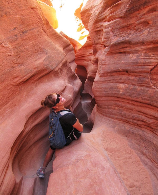
The sandstone patterns and textures in these two slot canyons offer some pretty remarkable photo ops, so try to visit midday for the best sunlight. Also, in Spooky Canyon there were a few spots that were a little tricky, so if at any point you feel uncomfortable, simply turn around and come back down Peek-a-boo instead.
There is also a third slot canyon in the area called Brimstone Gulch that we didn’t have time to explore. I hear that this often has deep pools of water that make passage impossible during certain seasons. This is also the narrowest of the three slot canyons so if you are feeling adventurous, go explore Brimstone until it gets too narrow or wet to continue.
For this Escalante hike, I highly recommend packing light while bringing adequate water, snacks and sun protection. The canyons get very narrow, and with a big, bulky backpack you will find it difficult to pass through.
Getting to Peek-a-boo and Spooky Canyons
To get to the Lower Dry Fork trailhead that provides access to Peek-a-book and Spooky Canyon, drive 26 miles down Hole-in-the-Rock Road. Make a left on the dirt road headed towards Dry Fork Coyote Gulch. When you come to the fork, go left and reach the road’s end and trailhead parking at 1.7 miles.
A 4WD vehicle is recommended for this hike. However, a regular car under normal conditions can make it most of the way there. At whatever point it gets too rough on the road to Dry Fork Coyote Gulch, park and walk the rest of the way to the trailhead. It might add a little bit of distance to your hike, but once you are hiking in those slot canyons, you’ll have no regrets!
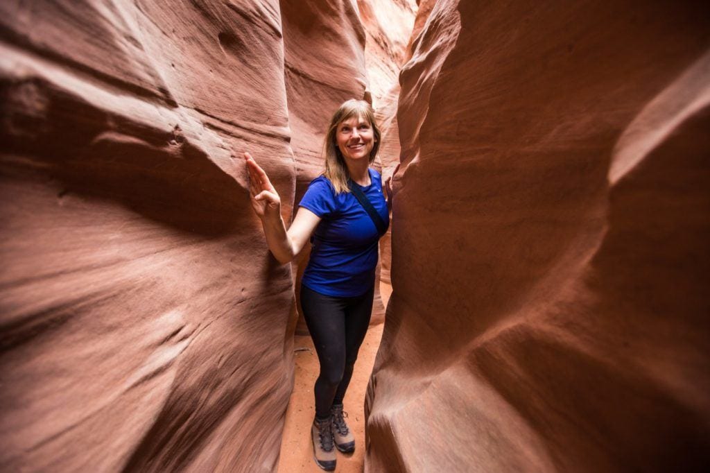
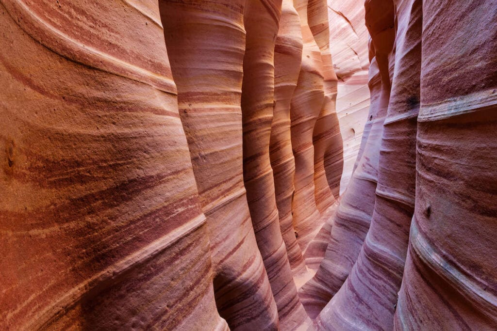
5. Zebra Canyon
- Length: 5.2 miles roundtrip
- Elevation gain: 377 ft
- Trail type: Out & back
- Difficulty: Moderate
- Dogs allowed: On leash
Zebra Canyon is a popular hike in Escalante and for good reason. The trail starts off with a 45 minute hike to the entrance, which is quite exposed, so bring plenty of water, a sun hat, and sunscreen. But as you hike into Zebra slot canyon, you’ll find some shade and will start to see beautiful pink and white stripes along the canyon walls. It becomes narrower and narrower and depending on time of year and recent weather, you may encounters pools of water that can reach waist deep. Like Peek-a-boo and Spooky, you’ll want a small backpack so you can squeeze through the narrow passageways.
If you want to make this hike longer, you can do the Tunnel Slot canyon loop, which adds an additional 1.4 miles and is typically filled with water. Connect back into Zebra Canyon via Harris Wash.
Getting to Zebra Canyon trailhead
Drive down Hole-in-the-Rock Road just outside Escalante for about 8 miles. The Zebra Canyon Trailhead and parking area will be on the right. This trailhead is more accessible than Peek-a-boo and Spooky Canyon if you don’t have a car with 4WD.
Read More
Desert Hiking Tips
Best Camping Near these Trails
Campgrounds in Escalante
There are two main established car campgrounds within Escalante National Monument. The first is Calf Creek Campground at the Lower Calf Creek Falls Trailhead. The 13 sites here are $15 per night and are first-come, first-served. Try to get there early because sites get snatched up fast!
The other car campground is the Deer Creek Campground located 9 miles southeast of Boulder on the Burr Trail, which is a paved county road. The 7 first-come, first-served campsites here are $10 per night and there’s no potable water available so be sure to bring your own.
Dispersed Camping in Escalante
If you are looking for something a little more off-the-beaten-path, one of the really great things about Escalante is that it is managed by the Bureau of Land Management (BLM) and there are numerous free campsites scattered throughout the monument.
All of these are primitive sites with no facilities or restrooms. You must pack out your trash and the BLM asks that you only camp in already disturbed areas. That means if it looks like someone has set up there before, you are allowed to camp there too. Most of these primitive sites are quite obvious. Some of them have signs indicating camping is allowed and have established fire rings (check on current fire regulations at the Visitors Center before heading out).
A free overnight permit is required for dispersed camping outside of developed campgrounds.
Overnight Backcountry Trips in Escalante
If day hiking in Escalante makes you want to you explore further, there are some amazing backcountry trips in Escalante. Coyote Gulch is a great 13-22 mile backpacking trip (depending on your route) located right off Hole-in-the-Rock Road. The trail travels in the river bed through a deep canyon with camping along the sandy benches on each side. I did this as a 2-day / 1-night trip which you can read about in my detailed backpacking guide to Coyote Gulch.
How to get to Grand Staircase-Escalante National Monument
Grand Staircase-Escalante is located near the Grand Canyon, Zion National Park, and Bryce National Park, but it has far fewer crowds.
It spans a huge area (over 1.8 million acres) and has 4 different visitors centers located in Kanab (also home to the famous Wave hike), Big Water, Cannonville, and the town of Escalante.
For the purposes of the hikes mentioned in this blog post, you’ll want to base yourself in the town of Escalante which gives you direct access to Hole-in-the-Rock road where most of the best hiking in Escalante in located.
The town of Escalante is located 278 miles (5 hours) from Salt Lake City or 303 miles (5 hours) from Las Vegas.
The 5 Grand Staircase-Escalante hiking trails detailed below are all marked on this map. Click the icons on the map to get more info on each point of interest.
Additional Tips for Hiking in Grand Staircase-Escalante
- Amenities in the towns of Escalante are pretty limited. There is a General Store in Escalante where you can buy basic groceries and ice and there are also a few restaurants. However, it is good to come prepared with everything you might need including food, water, ice, and car camping gear.
- It’s always a good idea to stop by one of the four Escalante National Monument Visitors Center. They have maps and trail descriptions and can give you an idea of current trail and road conditions.
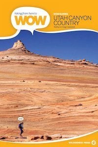
- All of the trails listed here are described in detail in the book “Wow Guides: Utah Canyon Country.” This is an excellent book with beautiful photos. I highly recommend you pick this up if you are headed to Escalante or anywhere else in Southern Utah.
What questions do you have about hiking in Grand Staircase-Escalante? What are your favorite hikes in the area? Let us know in the comments below!
READ NEXT
More Southern Utah Adventures
Amazing site, useful details and beautiful photos. Loved it. All the best.
Thank you so much! I really appreciate that. -Kristen
Neon Canyon isn’t in the national monument…. Glen Canyon NRA.
You’re right. Thanks for clarifying Steve.
great article, thanks for promoting our beautiful area…Escalante Outfitters has everything you need if you return. cabins, campground, great little café, outfitter’s store with maps, camping gear, and lots of folks that will help you have a great visit.
Thanks Dana! I really appreciate that. I will most definitely be returning and will absolutely get in touch. Thanks for your support! -Kristen
Let’s give Escalante a little more love 😉 I worked at Escalante Outfitters for several years. Besides being a top-notch gear store, they have a campground and the information they have and share readily is based on years of traveling the area . . . not to mention it’s the only liquor store with a hundred mile radius . . . the Best Pizza for miles . . . and Nate will take you to some amazing little streams for trout fishing . . . And as for Neon . . . WELL worth the time and effort. When I was narrowing down my search for where to live and work in Utah (where I’d guided rafting trips, and traveled much already) I saw one photo of the Golden Cathedral and immediately started looking for the closest town to it.
Scott – Totally! Golden Cathedral was absolutely stunning. I saw a picture of it and when I planned my trip there it was a must-do. Totally worth the effort to get there. That’s so cool you got to live and work there! Just checked out your website by the way…beautiful photos! Thanks for sharing the info about Escalante Outfitters. Hoping I can make it back to that cute little town sometime soon. Thanks again! Kristen
🙂 Thank you Kristen for the nice words about my site.
Another great and easy hike in the area is simply walking down the Escalante River Canyon. Just beyond and above the cemetery, about a mile east of town (and over an increasingly rutted dirt road), is the access to the Escalante River. From there to the Highway 12 bridge is about 14 miles. The upper half of the walk is especially nice, with a pretty narrow canyon. About seven miles down is an enormous overhang with pictographs. Just a 1/2 mile below this is the confluence with a gorgeous, clear sidestream – nice camping in that area (and generally better water than the Escalante). Just a couple of miles from the bridge there is a natural arch that is difficult to see. Once you get to the highway, a walk back into the parking area will allow a climb/scramble up to another overhang, called the 100 Hands Wall. Anasazi handprints cover a large wall. There is also some kiva remains in that area.
And of kivas . . . just up the hill from the parking lot on highway 12 is the Kiva Cafe. Some nice fresh baked items. The Kiva also sports two very nice rooms (and two rooms only!) GREAT location in the fall when the cottonwoods along the Escalante are going off.
Oooh that hike sounds awesome. Is there a time of year that it’s best based on temps and water levels?
Kristen, I’ve hiked it from late March through October – which is (if you’re prepared for a possible late snow 😉 ) Prime Time. Water in the river depends on the snowpack up on the Aquarius Plateau: there are years where it’s really a small stream, rather than a river . . . and there are years where you can float the river (small inflatable kayaks/Pak Rafts/etc) to Lake Powell, starting at the Highway 12 bridge mentioned here.
Water in the Southwest – as you know – can save your life, and it can kill you. In general I’d suggest really checking weather and snow pack conditions before setting out, and also, for the duration of your stay. People at the Outfitters can answer questions . . . many of them float the river when possible.
There can be bugs down there during certain years, mosquitoes, etc. They show up mostly when it’s been a wet winter with lots of standing water around. I found early in the season Delightful. Freezing, barely, most nights, but days are warm. I’ve also walked across frozen snow bridges on the river in March. Just a nice, mellow 14 mile downhill walk.
Great advice. Thanks Scott. I’m going to get in touch with them and see if we can’t get something organized. Glad we connected!
They’ll take good care of you, Kristen. Some really good people there.
Ask them about the goatpacking trips 🙂
If you’re interested in a conservation angle, Kris – the wife of Nate (one of the owners of the Outfitters) – runs crews down along the river in the summer. They’re removing Russian Olive trees, an invasive species, much like tamarisk – but with really sharp thorns.
Thank you, Kristen. I’m glad we connected too.
Wow! Those photos are incredible! So much to see in that state. What fantastic adventures 🙂
Thanks Aaron! Yeah every time I go to Utah, it totally blows me away. Thanks for checking out my site. -Kristen
Nice article, while we’ve never been to that part of the world..yet, it’s really great to read such a detailed post!
Hey guys! Appreciate the comment! Hope you can make it over to this part of the states soon. Southern Utah is unlike anywhere I’e ever been. Thanks for checking out my blog! Kristen
Hey guys I’ve made a lot of videos I know you’ll like that would work well on your blog! Here is one of my videos of the subway in Zion national park and I’m coming out with a video of neon canyon next week. I would live to work with you guys movie forward just let me know. Thanks guys! Love your blog!https://youtu.be/793rW-2oCPM
Hey Aaron – Thanks for sharing your Subway video. You did a great job. Looks like you had a complete blast. Looking forward to checking out your Neon Canyon video! -Kristen
Looking forward to receiving Bearfoot’s Theory monthly emails.
Awesome to hear Nancy! Thanks for signing up!
Luv
Thanks Debra!
For the Neon Canyon/Golden Cathedral trail, is there a way to reach the trailhead without a 4WD/high clearance vehicle? Is there a spot I could start at (I assume it’ll be further away), or should I just not attempt it?
Thanks!
Elliot
Hey Elliot – I don’t believe there is another way to access the trail. You should call the rangers station in Escalante and ask them. They will be able to tell you about current road conditions as it changes depending on rain.
Hi, I loved reading your post about one of my most favorite areas in all of Utah!! I’ve been down to this area a few times for hiking but have never done the Neon Canyon/Golden Cathredal hike that you wrote about. I definitely want to do it this June when I’ll be back out there. But I have a question for you, does it require rappelling to get in/out of the canyon?
Hey Megan – There are two ways to access Golden Cathedral. One is a out and back day hike as described in the post. This doesn’t require any rapelling gear. For experienced canyoneers, there is also another way to access Golden Cathedral where you can rappel down from the top.
Is there a way to climb up and rappel down through the hole at Golden Cathedral if I take the trail you suggest here?, I’m hoping to get pictures so I’d have to setup my camera at the bottom first.
When I went to the Golden Cathedral, I walked in and spent the night. Was glad I did . . . got a Great shot (IMHO 😉 ) of the sun rising on a pictograph on a panel down by the river. A good route to the Cathedral, without rapelling, can be found on Tom’s Canyoneering site . . . well worth the trip.
Hi Kristin,
I stumbled upon your website doing research on Grand Stair hikes – its a great site and love the pics!
I am wondering if you can suggest any “short” but decent hikes as well vista points if I were to leave Boulder in the morning and drive via Scenic Hwy 12 and aim to be in Bryce Canyon by early evening. I know it’s a short timeframe, but we have limited time…any suggestions would be appreciated. Many thanks!
Hello, I love your site — and this post is very helpful. I’m considering a 5 day backpacking trip in the Escalante area in mid-June (that’s the only time I can go), and I wonder what you think about that time of year. I understand that temperatures really start rising in June, but I’m hoping it’s still viable to backpack. What do you think? Thanks so much!
I think you can find something that is down in the canyons where you’ll have some shade or water, i think it’s still doable. Just make sure you bring sunscreen, a hat, and carry plenty of water.
Love your site Kristen! So helpful. I\’m planning a trip with me, my mom, and my sister in mid May this year, and I wanted to know if peek a boo and spooky slots were okay for my mom who is in her early fifties. I just don\’t want to push her in to all these activities and have them be too strenuous for her! From what I can tell Peek a boo will be just fine, but if Spooky is borderline just let me know!
Thank you! (I also followed on Insta and love all your pics!)
Hey kristen – We definitely saw people in that age group in the slots, although it depends on her personal comfort level and fitness. If she isn’t comfortable in spooky, then you can always go back down peek a boo. Have fun!
I’m planning a trip with my family in late May, early June. We would like to do some backpacking in this area. Are these hikes good for backpacking? Are there others you would recommend? Can’t wait to check it out!!
Hey John,
Yes there is definitely good backpacking in the area. I highly recommend checking out this Utah hiking book. It’s never steered me wrong: http://amzn.to/2kT2lPp
We have a dog and are interested in a 4 night max backpacking trip this May. any suggestions? Paria Canyon does not have permits available.
I believe they reserve some permits for walkups so you might look into that. I’m not as familiar with dog-friendly backpacking trips down there, so I don’t really have any solid suggestions. Sorry about that!
We only have a total of about 72 hours to do both Bryce Canyon National Park and Escalante. Want to maximize our hiking time. Do you have a recommendation on which place we should do more hiking in? We are average hikers. We hiked about 35 miles last year in Glacier in 3 days to give you some idea of what we can do. Just starting this hiking thing and loving it 🙂 We want to do a new National Park every year. Thanks for any info.
The hiking in Escalante provides a little more variety than Bryce. However, getting around Escalante takes quite a bit of time due to the roads, so keep that in mind.
Question: if I only did the peekaboo part of the trail would I be able to take a 4 and 5 year old?
You would probably be able to do part of the trail! The entrance to one of the slots is a little tricky but you could try and see what happens. Might end up being a great experience!
Hey, Kristen
How much time should I allow for a fit group to spend on hike #2,? Not including any drive time. You were coyly vague about you late start. Or did you do #3 then #2 on the same day?
Hi Jake, Neon Canyon is a 9-mile hike so it really depends on how fast your group hikes. I wouldn’t recommend doing both hikes on the same day. Find an awesome spot to set up camp and enjoy two full days in Utah’s Canyon Country.
I absolutely loved lower calf creek falls in the summer. I wish I would have brought a swim suit but I definitely swam to the waterfall anyways! Great hikes!
The hike to the waterfall is no joke. Walking through sand for 6 miles isn’t easy especially in 100 degree weather with the sun beating down on you. Bring plenty of water — 2L for each person. We were not prepared because this post said the hike was easy.
Hi Helen, so sorry to hear you felt the hike was difficult. Hope you enjoyed the portion you got to experience.
Thank you for sharing your adventures!!! I will be hiking; Golden Cathedral, Peek A Boo, Mossy Cove, Narrows, Subway, and Kanarraville Falls in September.. looking so forward to this trip!! From your blog, and others….the shoes, the shoes, the shoes!!! I own a pair of Bestard Canyon Guide boots, and I have the neoprene socks.. My question: aside from the Narrows, and Subway, which of the other hikes would you suggest wearing the “water boots?” And/or, which combo of shoes would you recommend since I know this is not a one shoe for all hikes adventure… Thank you in advance for your reply.. Happy Trails..
Hi there Randi, it is really only for the Subway and for the Narrows that you need water shoes.
Are any of these trails accessable by RV (24′ trailer)?
Hi Janyce, I would inquire with the local rangers at Escalante about current conditions. For Peek-A-Book & Spooky Gulches, a 4WD vehicle is recommended for both. However, a regular car under normal conditions can make it most of the way there. At whatever point it gets too rough on the road to Dry Fork Coyote Gulch, park and walk the rest of the way to the trailhead. It might add a little bit of distance to your hike, but once you are hiking in those slot canyons, you’ll have no regrets. In terms of Neon Canyon & Golden Cathedral, it took over an hour in a Toyota 4-Runner, and I would not suggest attempting Egypt Bench Road unless you have a 4WD, high-clearance vehicle.
Thank you so much for the very helpful information.
You are amazing !
Thanks so much for the love and thank you for being here!
Hi! Love your blog. I’m planning a trip to Escalate and am so curious about what you prefer to hike in. I live in the Rockies in Montana and have recently been all about hiking in Hoka’s…backpacking in Hoka’s, climbing mountains in Hoka,’s,catching me here I feel clueless on the Southern terrain and wonder what your preferred footgear is? Thanks!
Hi Tammy, glad you like our blog! Kristen love’s her Oboz hiking boots and shoes, which we’ve included in our list of favorite hiking boots. The Sawtooth would be great for desert hiking.
Kristen,
Love your blog and YouTube channel.
After reading this, I really want to try Neon Canyon, but I don’t think my car can hang with Egypt Road. I was thinking about trying to take the car as far as 25 Mile Wash and then hoofing it to the trailhead, but I can’t determine if that is wise given the terrain. Any thoughts?
Thanks,
Ben
Twenty-Five-mile wash is about two miles down Egypt Road and it’s about another ~8 miles to the trailhead after that. So if you didn’t drive to the trailhead, you would have ~16 miles roundtrip of hiking on Egypt road past Twenty-Five mile wash. It’s best to do this canyon with a 4×4 high clearance vehicle.
I hiked Golden Cathedral Neon Canyon in May 2021 using AllTrails pro. Followed Fence Canyon route and returned back the same way. 11.4 miles. I would suggest reading all the comments on AllTrails App. It was strenuous and challenging for me as a 56-year-old woman but definitely worth it! Getting to the the Egypt trailhead was an adventure in itself. I relied on the app and paid close attention to my surroundings so we wouldn’t get lost which has happened to other groups. We camped overnight at the trailhead and left at 7:00 a.m. the next morning. Took breaks during the hike and also spent about a half hour at the Golden Cathedral. Got back to the trailhead at 5:00 p.m.
Thanks for sharing your trail experience, Susan!
coming from the phoenix area, then going on to zion, what hike would you do? shorter side because we have non hikers with us, that may be waiting at a visitor center? any suggestions? or things to do for non hikers? while the hikers hike? thanks.
The quickest, easiest hike would be lower calf creek falls. The non-hikers could drive Highway 12 after dropping you off at the trailhead.
beautiful places.
thank you for sharing.