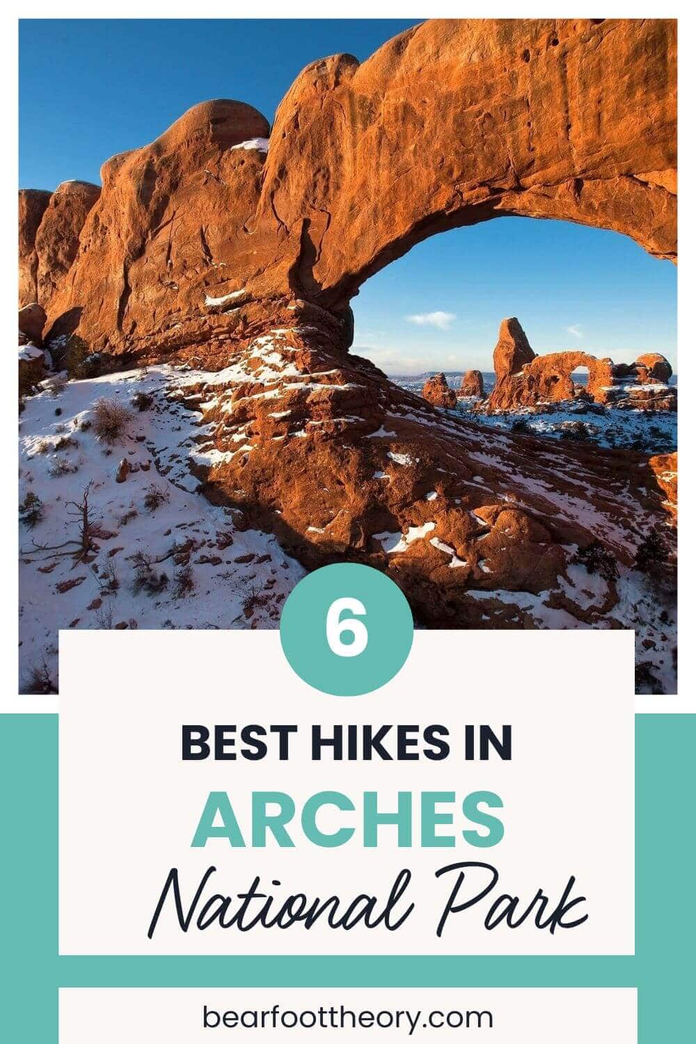
6 Best Arches National Park Hikes
Arches National Park in Southern Utah is a day-hikers paradise. Learn about our favorite hikes, where to camp, and the best seasons to plan your visit.
Arches National Park in Moab, Utah has no shortage of amazing day hikes, each featuring its own (or several) world-famous sandstone arch formations.
The longest Arches National Park hike is just 7 miles round-trip, which means you can cross off several bucket-list trails in a short weekend or even a single day.
I love exploring Arches National Park and in this blog post, I share 6 of the best Arches National Park hikes that feature incredible rock formations, epic views, and great photo opportunities.
You’ll also find trail maps for each hike and advice for the best time to visit Arches National Park, info on camping, and other tips for a successful visit.
No matter what time of year you visit, you’ll be blown away by the incredible, otherworldly, red rock landscape, perfect to explore via the hikes below. Just be sure to stay on the trail so you don’t mistakenly damage the delicate desert cryptobiotic soil.
This post may contain affiliate links.
1. The Windows Hike
- Trailhead & Parking Area: The Windows Trailhead
- Distance: 1.2 mile roundtrip
- Difficulty: Easy
- Elevation Gain: 154 feet
- Time Needed: 30-60 minutes
- Dogs Allowed: No
- Map: Windows Loop & Turret Arch Trail
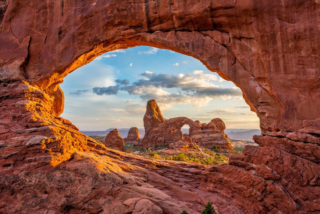
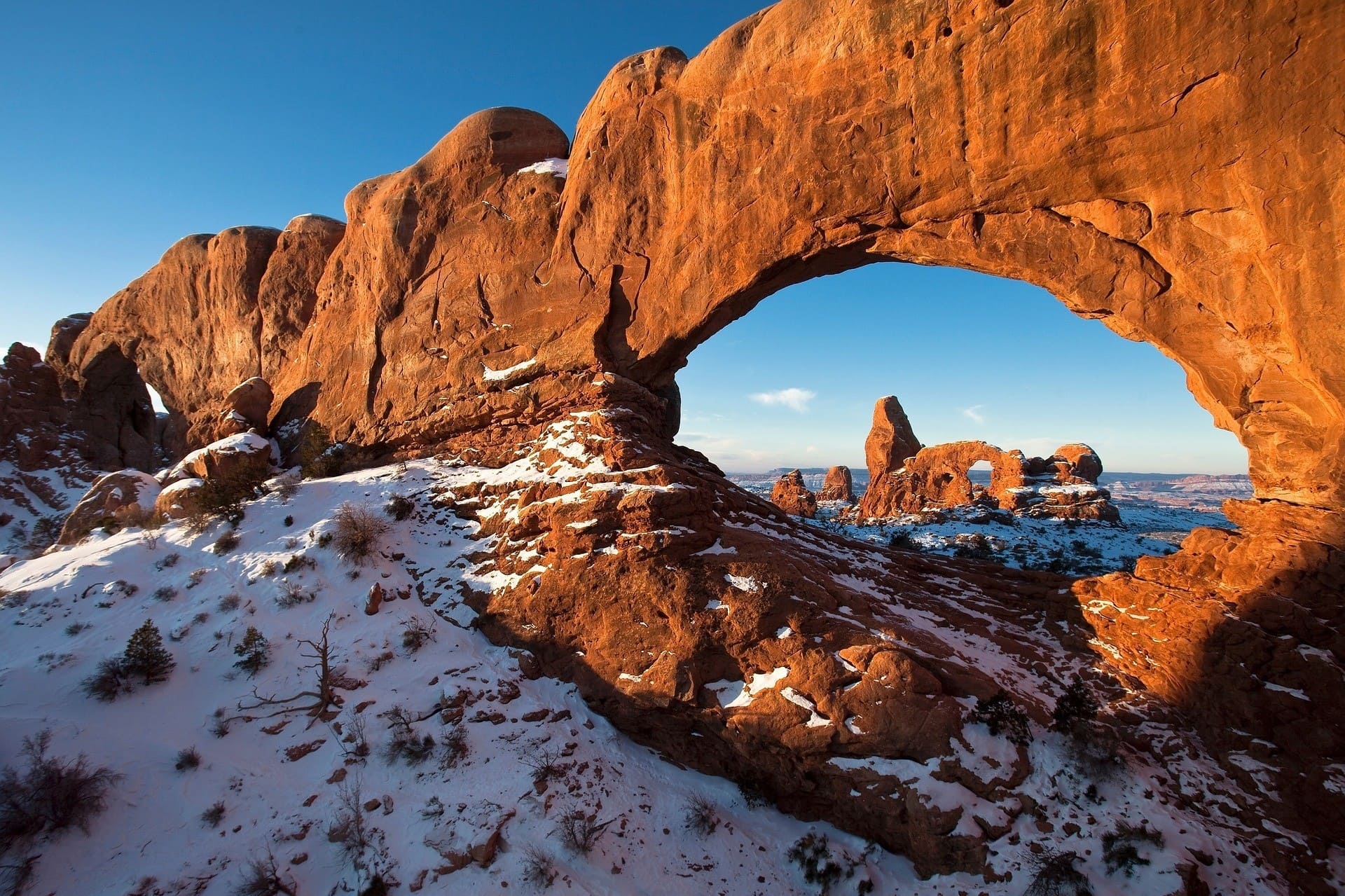
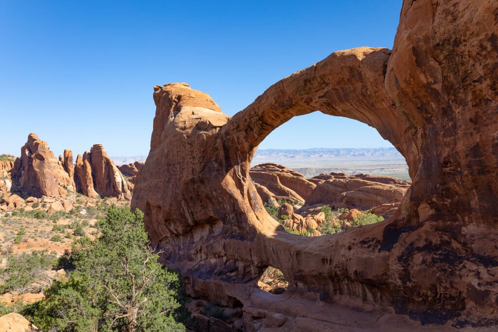
The Windows area of Arches National Park is a great place to get out of the car and see the unique rock formations that define Arches National Park up close.
The Windows is a gravel loop trail that will take you to the North Window, South Window, and Turret Arch. The North and South Windows stand side by side and are often referred to as “the Spectacles” since they resemble a pair of eyeglasses separated by a large “nose.”
If you continue past Turret Arch you can continue to Double Arch and the Parade of Elephants. The Parade of Elephants is an immense rock formation that resembles a herd of elephants traveling in a single file line holding one another’s tails.
If it’s your first time visiting, The Windows is a great starting hike in Arches but don’t expect to find solidarity due to its easy access.
For a bit quieter experience, follow the signs to the primitive trail, which is slightly longer and starts at the South Window viewpoint.
Read next: Worried about the crowds? Hike to Corona Arch, which is outside the National Park, but still a great hike with impressive views.
Save this post!
Enter your email & I'll send this post to your inbox! You'll also receive my weekly newsletter full of helpful advice for planning your adventures.
2. Broken Arch Loop
- Trailhead & Parking Area: Sand Dune Arch
- Distance: 1.7 miles roundtrip
- Difficulty: Easy
- Elevation Gain: 167 feet
- Time Needed: 1 hour
- Dogs Allowed: No
- Map: Broken Arch Trail
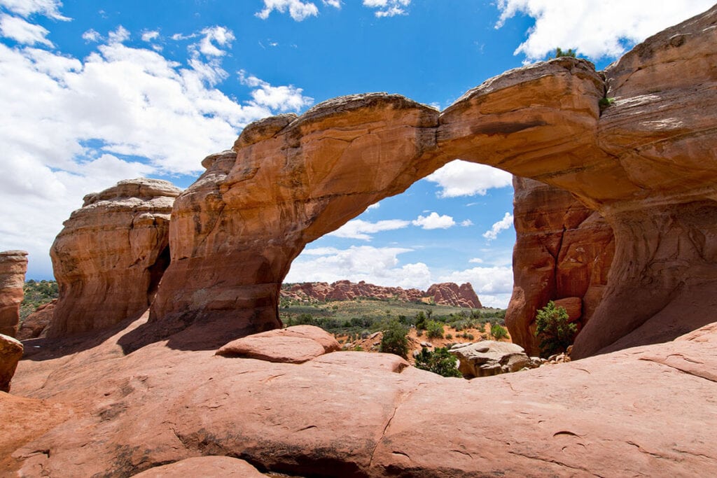
Broken Arch is a great loop hike with a lot of diversity in the landscape. Hikers will see two arches along the way – Broken Arch and Tapestry Arch.
The trail begins at the Devil’s Garden Campground and crosses a large area covered in desert shrubs. Next, you’ll weave in and out of a series of fractured rocks protruding from the ground called fins.
The landscape then transforms to slickrock with a short easy scramble before returning to the parking lot.
We love this trail for the simple fact that it’s a wee bit off the beaten path and not as packed as other Arches National Park hikes.
Read More
Desert Hiking Gear
3. Delicate Arch
- Trailhead & Parking Area: Wolfe Ranch
- Distance: 3.2 miles roundtrip
- Difficulty: Moderate
- Elevation Gain: 629 feet
- Time Needed: 2-3 hours
- Dogs Allowed: No
- Map: Delicate Arch Trail

Delicate Arch is one of the most famous arches in Utah. It may look familiar as it’s the one that appears on Utah license plates — the arch is a state symbol and a must-do hike in the park!
The first half mile of the Delicate Arch trail is well-defined, and then the real fun comes shortly afterward. The next section of the trail follows multiple rock cairns, steadily climbing 500 feet up Utah slickrock.
Eventually, you curve up and around a large rock mound and Delicate Arch comes into view.
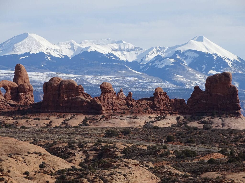
Since the trail gains about 600 feet in elevation, hikers are rewarded with incredible views of the park’s desert floor and the La Sal mountain range in the distance.
We highly recommend hiking out to Delicate Arch for sunset, although you won’t be the only person out there. Sunset presents some pretty incredible photo ops and what’s nice is that the arch can be seen from a variety of angles so no matter how many people are there, you’ll be able to find a place to sit and enjoy the spectacular views.
If you are feeling extra adventurous, pack a picnic dinner, headlamps, and warm clothes and stay for some stargazing.
Lastly, don’t miss the opportunity to view ancient petroglyphs near the trailhead.
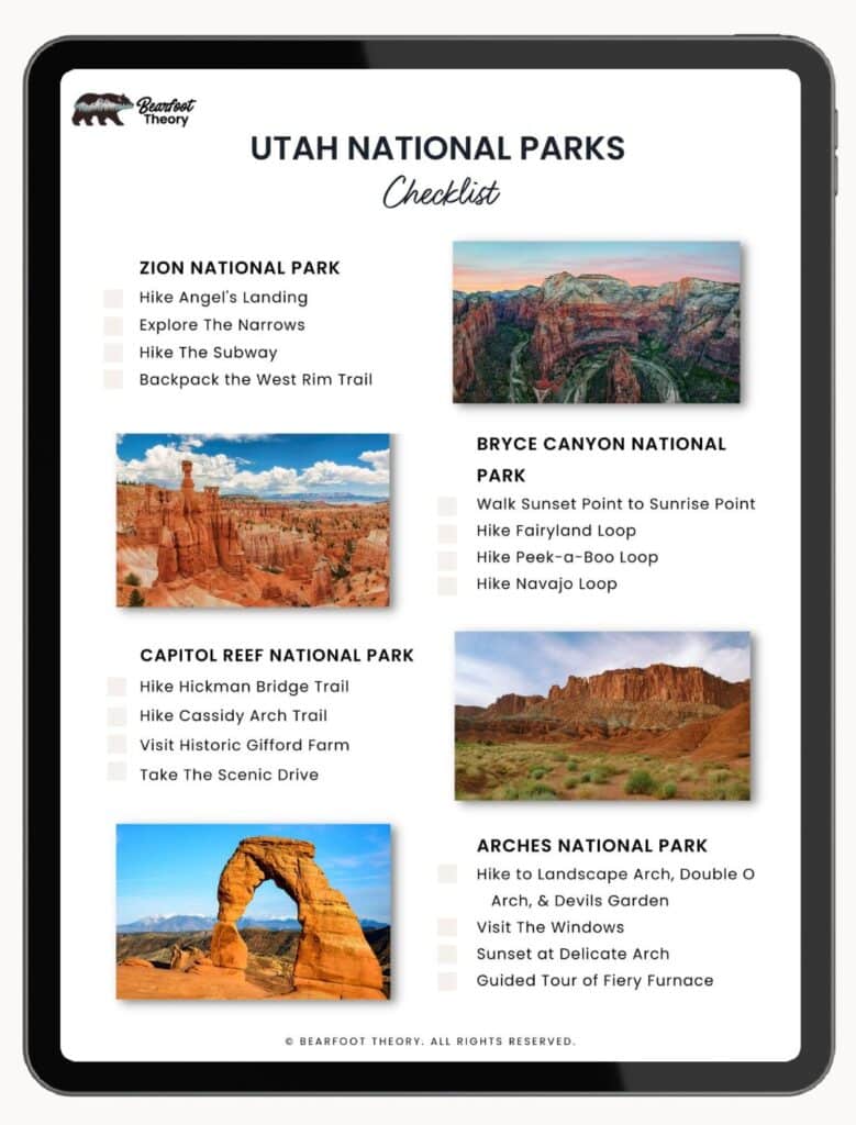
Get my Utah National Parks Checklist
Enter your email below to get this PDF guide on your phone, so you don’t miss anything on your Utah Road Trip!
4. Landscape Arch
- Trailhead & Parking Area: Devil’s Garden Trailhead
- Distance: 1.9 miles roundtrip
- Difficulty: Easy
- Elevation Gain: 252 feet
- Time Needed: 30-60 minutes
- Dogs Allowed: No
- Map: Landscape Arch Trail

This Arches National Park hike is great for a short warm-up hike. The trail is a relatively flat path that is even accessible to wheelchairs with assistance.
The famous Landscape Arch spans more than a football field in length and is rumored to be the largest arch on the planet.
On the way to the arch don’t miss the sign on the left side of the trail that talks about in 1991 when a 73-foot slab of rock fell from underneath the thinnest section of the arch. In 1995, two additional masses of rock fell from the arch leaving it even thinner. At its thinnest section, it is currently only 6 feet thick. Eventually landscape Arch might only exist in photos, so go see it now!
On the way to Landscape Arch, you’ll also see another trail to the right where you can take a short detour to see Tunnel Arch and Pine Tree Arch.
If you’re not ready to head back to the car quite yet, keep hiking past the Landscape Arch on the primitive trail towards Devil’s Garden for an incredible loop featuring several more arches (see hike below for more details).
5. Primitive Trail at Devil’s Garden
- Trailhead & Parking Area: Devil’s Garden Trailhead
- Distance: 7.9 miles roundtrip
- Difficulty: Challenging
- Elevation Gain: 1,085 feet
- Time Needed: 3-5 hours
- Dogs Allowed: No
- Map: Primitive Trail
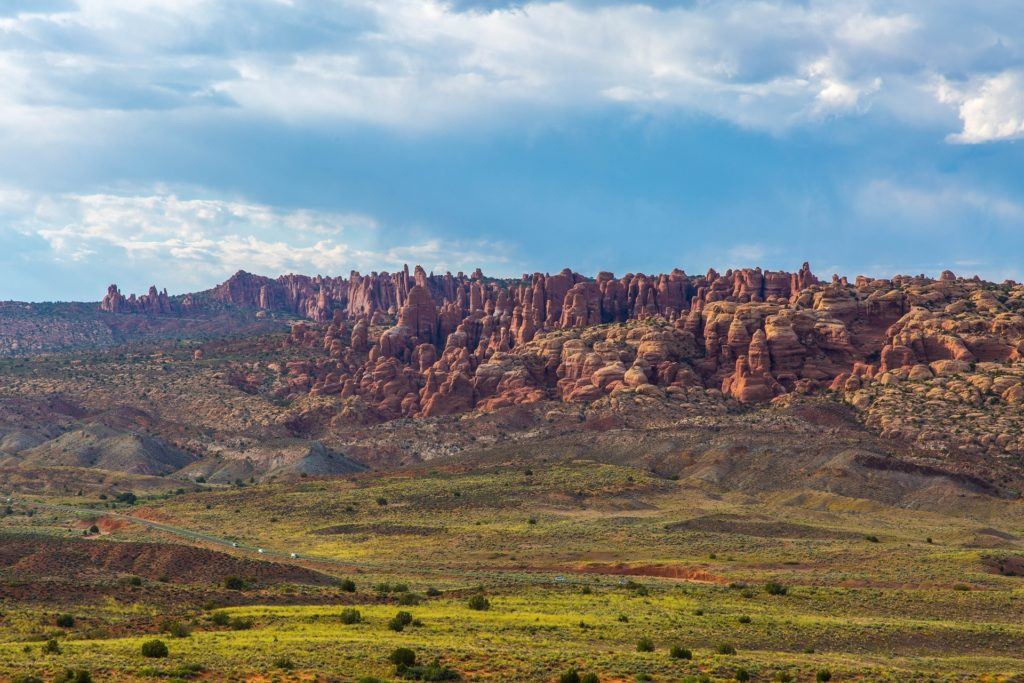
Continuing past Landscape Arch, you’ll enter an area called the Devil’s Garden. This is the longest and most challenging continually maintained trail in Arches National Park.
After reaching Landscape Arch the trail gets a little more rugged as you climb over sandstone slabs and walk on narrow ledges and exposed fins. As you climb the narrow sandstone fins you’ll have sprawling views of Arches National Park.
Don’t forget that the park is continually evolving and changing. The fins you are walking across will someday potentially be arches themselves!
About a mile and a half past Landscape Arch, you’ll find Double O Arch, an awesome place with plenty of shady spots to stop for a picnic lunch.
After Double O Arch, the trail becomes even more primitive and difficult to navigate, so you’ll need to pay attention to the rock cairns that mark the trail.
If you have extra time, you can take a short side trail to the Dark Angel, a unique 150-foot sandstone tower.
As you continue on the primitive trail it’ll loop back to Landscape Arch and then back out to the trailhead. This trail is among our favorites in the park as it’s a little more adventurous than the other trails. As you continue past Landscape Arch the crowds will also die down, giving you a bit of solitude in a generally very busy park.
Make sure you have plenty of water and sun protection for this trail, especially if you’re hiking in warm weather.

6. Firey Furnace
- Trailhead & Parking Area: Fiery Furnace
- Distance: Varies depending on route
- Difficulty: Advanced (requires ranger or permit)
- Elevation Gain: 492 feet
- Time Needed: Varies depending on route
- Dogs Allowed: No
- Map: Firey Furnace Trail

One Arches hike I still need to cross off my bucket list is the “Fiery Furnace” which can only be accessed on a 3-hour ranger-guided tour or by obtaining a hiking permit at the visitor center.
The Fiery Furnace is a labyrinth of narrow sandstone canyons and is one of the most exciting Arches National Park hikes due to its tricky route-finding and challenging terrain.
The area got its name from its tall giant rock fins that rise up against the bright blue sky and resemble a fiery red furnace.
We technically shouldn’t call this a “trail” since there is not one designated route or trail. Instead, you’ll find a vast and complicated network of narrow slots, boulders, and fins that you have to navigate your way through.
If you opt to go self-guided, you’ll need to watch a short video in the visitor’s center about the area that has safety information and tips for route finding in the Fiery Furnace.
Picking the ranger-guided tour option gives you the opportunity to learn firsthand from a ranger about the geology of Arches National Park. If you want to do the guided tour, make sure to plan ahead as the tours get booked up fast.
You can learn more about Arches National Park hikes on the official park website here, as well as check for updates and closures.
Tips for Hiking In Arches National Park
Before heading out on a hike (or hikes!) in Arches National Park, you’ll want to be prepared for the desert climate. Here are our best tips for enjoying a safe and fun time out on the trails:
Best Time to Hike in Arches National Park
Spring and Fall
Arches National Park can be visited any time of year but you definitely need to be prepared for the weather based on the season you visit.
The most popular (and busy) seasons to visit are Spring (April-May) & Fall (Sept-Oct). In Spring and Fall, daytime temperatures in Arches range from 60-80 degrees, with lows averaging 30-50 degrees. This is perfect hiking weather!
Important Note: From April 1-October 31, 2023, visitors will need to obtain a timed entry reservation to visit Arches National Park between the hours of 7am-4pm.
Summer
During summer, daytime temperatures in Arches National Park can easily reach over 100 degrees. There is also no shade in the park.
Personally, I’d avoid summer in Arches National Park, but if it is the only time you can visit, make sure to drink a TON of water and be prepared with lots of sun protection.
I’d also suggest starting your day at (or before) sunrise so you can get some hiking and exploring in before the mid-day heat.
Winter
Winter in Arches can be cold with temperatures ranging from 30 to 50 degrees during the day and nighttime lows from 0 to 20 degrees.
If you catch a nice sunny day, though, winter can be one of the best times of year to visit. Crowds are thin in the winter, and you’ll find a lot more solitude.
Plus if you’re lucky enough to catch these desert landscapes covered in a little snow, it creates a gorgeous contrast with the red sandstone. Read my guide to winter hiking layers and cold weather clothes to pack for chilly temps.
Camping in Arches National Park
The Devil’s Garden Campground is the only campground in Arches National Park. It features 50 sites and each site can accommodate up to 10 people. I haven’t stayed at the campground myself, but I drove through it and it’s spacious and full of wide-open views. Just make sure to make a reservation, as spots fill up far in advance. If you’re unable to get a site in Arches, here are some other places to camp or glamp around Moab.
There is no food available in Arches National Park but there are four great picnic areas, so make sure to plan ahead and pack plenty of food to fuel your Arches National Park hikes and adventures.
Getting To and Around Arches National Park
Arches National Park is in eastern Utah just outside of Moab, UT. The park is:
- 3.5 hours from Salt Lake City, UT
- 5 hours from Denver, CO
- 6 hours from Las Vegas, NV
Arches National Park is also within 30 minutes of Canyonlands National Park and 2 hours of Capitol Reef National Park. All three of these make for a great one-week Utah National Parks road trip.
As far as navigating, Arches is an incredibly easy national park to get around, making it great for beginners or those looking for a one-day visit.
There is one main entrance, one visitor’s center, one campground, and one main road through the Park with a couple of off-shoots to access additional trailheads.
There is no shuttle service, so you will need a car to explore.
It takes about an hour to drive from the entrance to the very end of Arches National Park if you only stop and take a few pictures, so give yourself time to enjoy the scenic drive and stop for lots of views and these best hikes along the way.
READ NEXT
Looking to make a trip of it? Check out these related blog posts for fun things to do in Southern Utah:
What hike are you most excited about? What are your favorite hikes in Arches National Park? Leave your questions and comments below!
These arches look amazing! Thanks for sharing them!
Love from Singapore,
Yeeling
http://artelounge.net
Great information! Definitely on my spring list!
Thank you again! We are planning an awesome Utah road trip in May 2019 to hit all 5 Utah National Parks. We will spend 3 nights in the Arches National Park area so we can also visit Canyonlands National Park also. (we are staying at Red Cliffs Lodge) Thanks again for the great information and pictures.
Ah! Have SO much fun! I’m a bit jealous hearing all of this. Can’t wait to see the pictures! I encourage you to join our Bearfoot Theory Community Facebook group & share images of your travels.