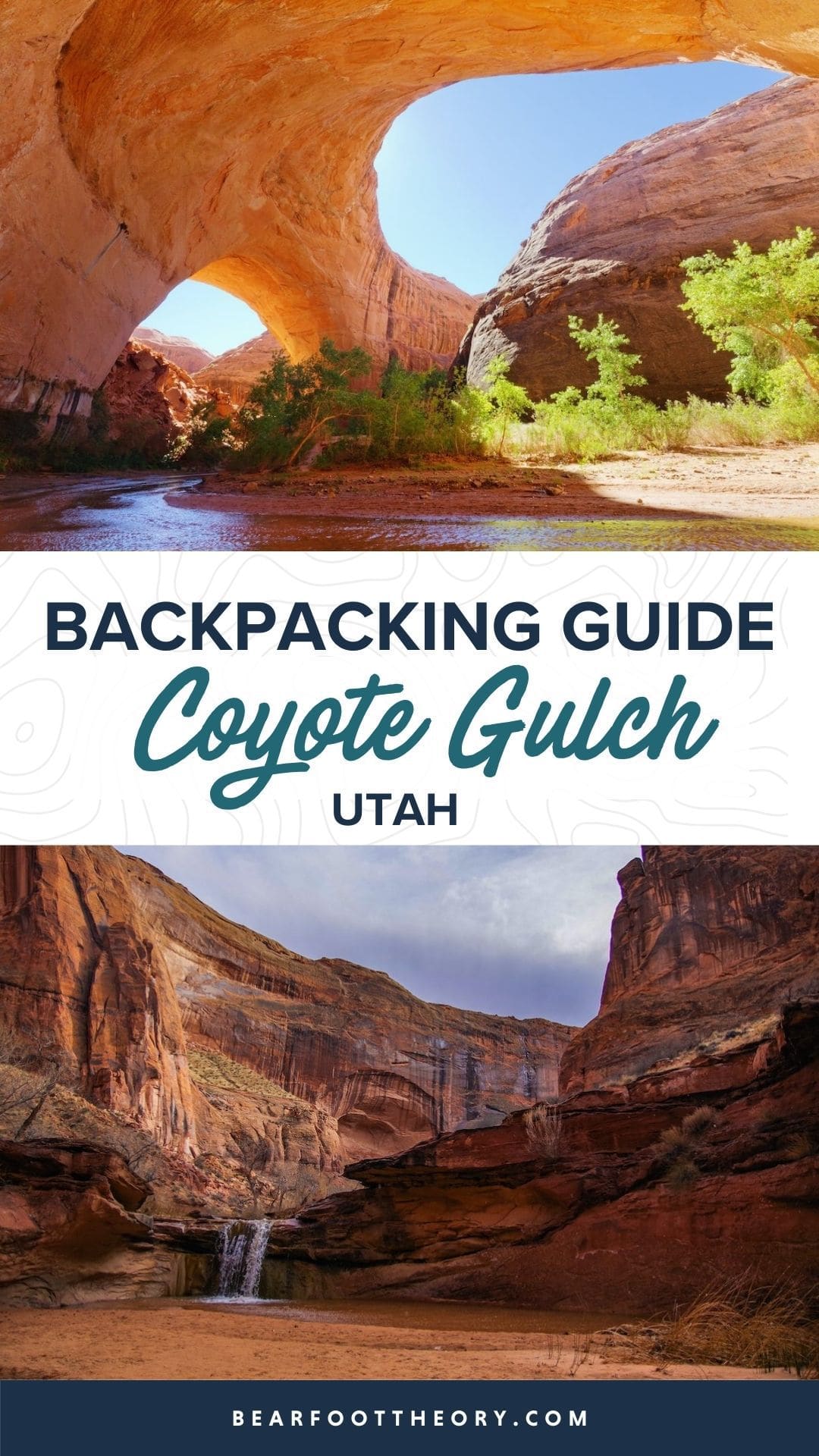
Coyote Gulch Backpacking Guide
Plan your Coyote Gulch backpacking trip through slot canyons in Utah’s Escalante National Monument with our guide to gear, permits, & more.
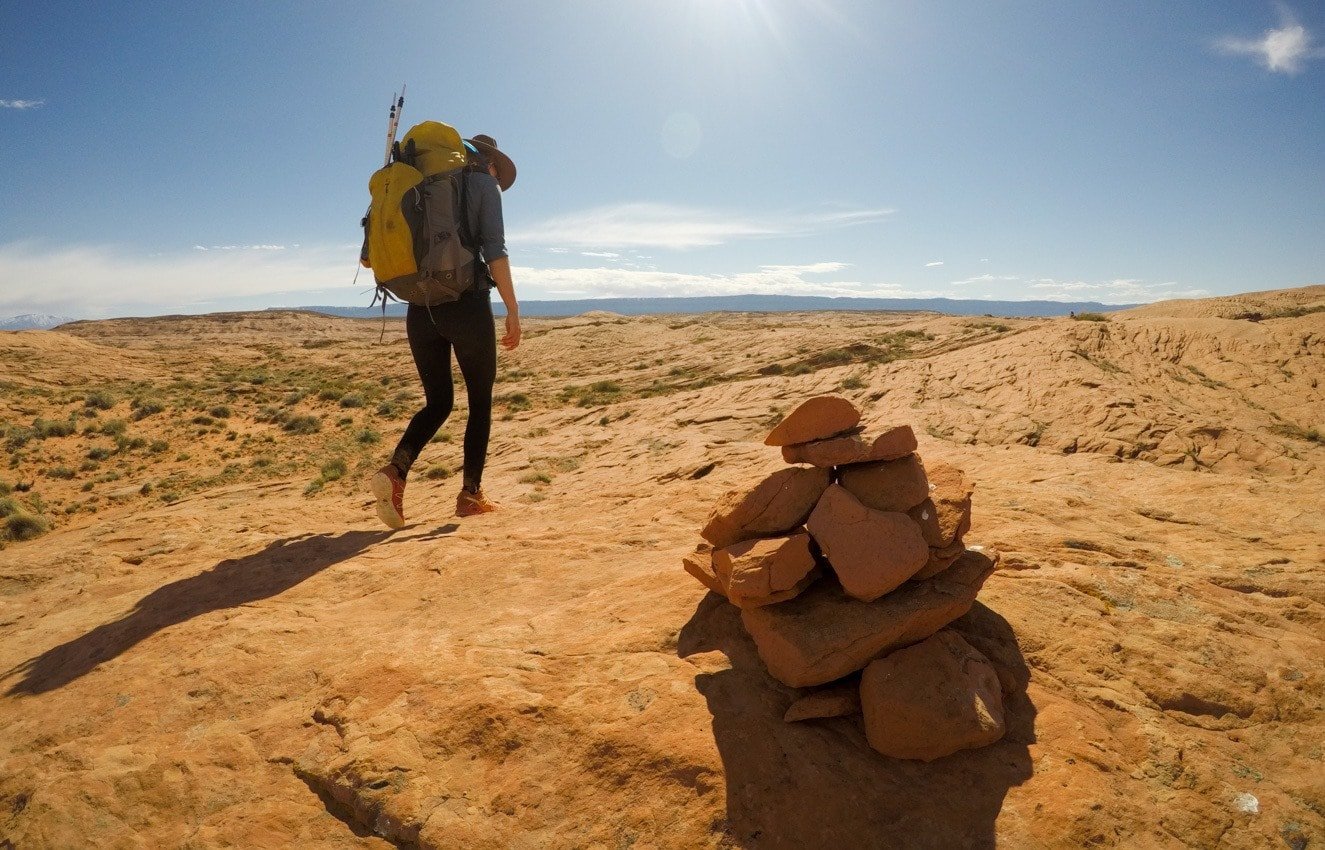
I’ve done a number of backpacking trips in Southern Utah and Coyote Gulch stands out as one of my favorites. It is a stunning slot canyon that sits on the edge of Utah’s Grand Escalante National Monument and Glen Canyon National Recreation Site about 6 hours from Salt Lake City.
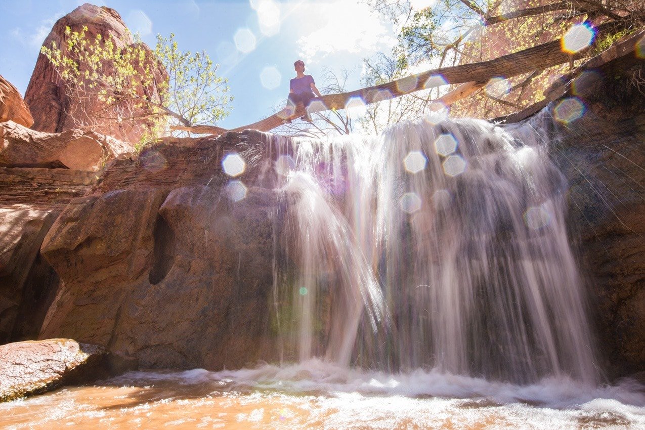
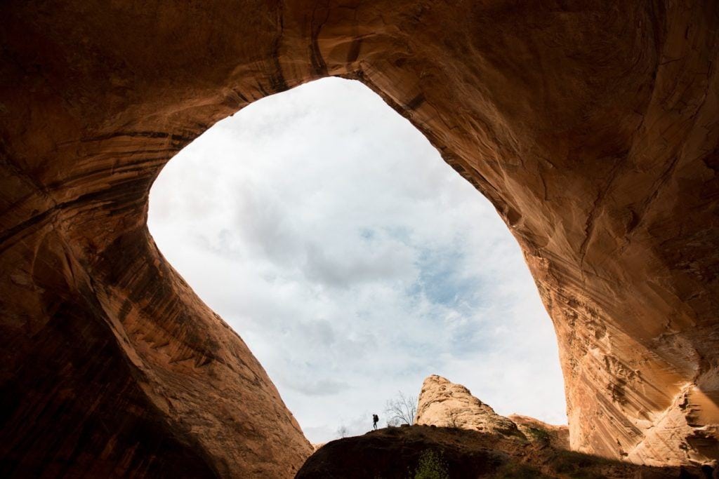
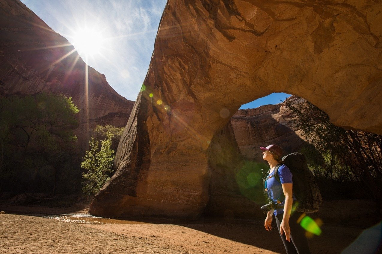
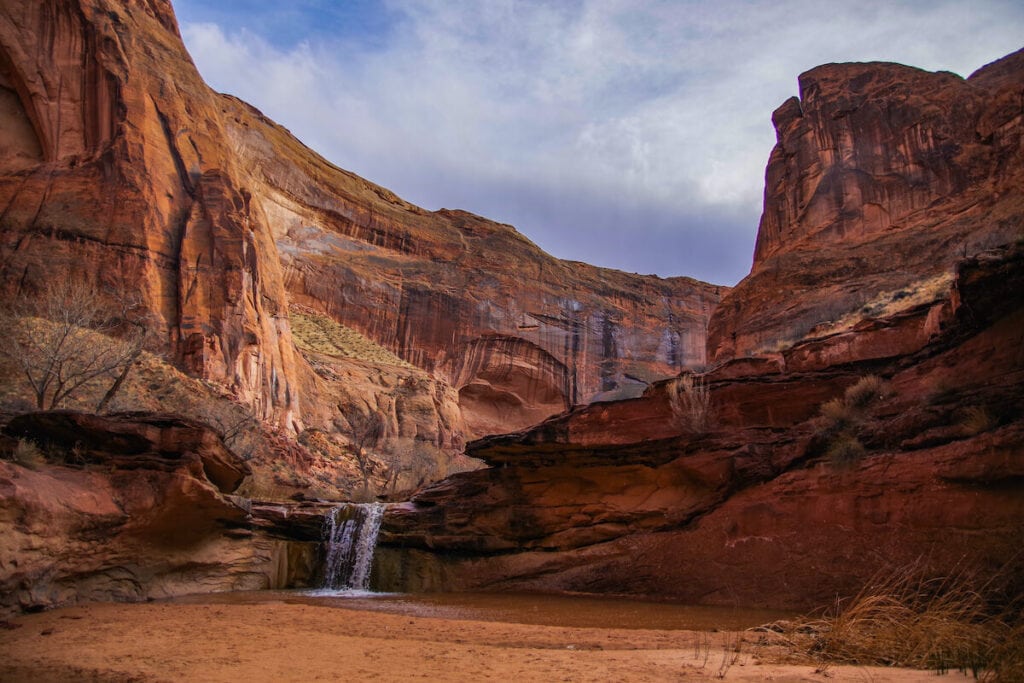
It’s a great backpacking trip for beginners due to the fairly level terrain, water availability, and the fact that you can hike it in 1-2 nights. The trail showcases towering canyon walls, a large mystic arch, a natural bridge, and numerous waterfalls along the route – a collection of geologic features that you’d be hard-pressed to find together on another trail.
There are many ways to hike Coyote Gulch. I started at Hurricane Wash and exited via Crack in the Wall. In this guide, I share the details of my trip and all of the info you need to plan your own Coyote Gulch backpacking trip.
This post may contain affiliate links.
Coyote Gulch Trail Basics
Coyote Gulch is an awesome backpacking trip or day hike destination. Here’s what you need to know:
- Trail Type: Point-to-Point, or Out-and-Back
- Distance: 13-22 miles, depending on your route (our route was 15 miles)
- Suggested Time: 2D/1N (for the route we did)
- Difficulty: Moderate
- Permits: Yes, for backpacking
- Dogs allowed: No
- Campfires allowed: No
- Group Size Limit: 12 people
Short on time? There are a ton of options when it comes to your route, and you can even conquer the best parts of Coyote Gulch in a long day hike if desired.
Save this post!
Enter your email & I'll send this post to your inbox! You'll also receive my weekly newsletter full of helpful advice for planning your adventures.
Coyote Gulch YouTube Video
Watch my YouTube video from our overnight backpacking trip in Coyote Gulch!

Getting to Coyote Gulch, Utah
Coyote Gulch sits on the edge of Escalante National Monument and Glen Canyon National Recreation Area. All of the trailheads are located just east of the small town of Escalante, UT off of Hole in the Rock Road, which starts at mile 64.8 on HWY 12.
From Escalante, UT you’ll take HWY 12 east for five miles, and as the highway makes a left curve, the unpaved Hole in the Rock Road will be on the right side of the road. There should be a sign near the curve that says “Hole in the Rock Road.” Turn right off of Hwy 12 here.
From the turnoff onto Hole in the Rock Road, you’ll want to reset your trip odometer, so you can determine your distance, as there are very few marked trailheads and parking lots off of Hole in the Rock Road. Be warned, Hole in the Rock Road is about as washboard as it gets, and the further you drive, the rougher it gets.
You don’t necessarily need 4wd, but you should check the status of the road at the Rangers Station in Escalante (where you’ll also get your permit) before you set out. After a rainstorm, the road can get muddy and rutted. Depending on your vehicle and how crowded the road is it can take anywhere from 45-90 minutes to reach the trailheads once you’ve turned onto Hole in the Rock Road.
Best Time to Backpack Coyote Gulch
Spring (March to June) or Fall (September to October) are perfect for Coyote Gulch backpacking trips. Generally, in the late summer, it can get incredibly hot in Utah’s desert, and in the winter it gets very cold so it is important to check the weather before heading out.
Another consideration is water levels. Because Coyote Gulch is a slot canyon, it does experience flash floods. Avoid hiking Coyote Gulch if a rainstorm is imminent.
Coyote Gulch is also a very popular trail, so you should avoid the peak of Spring Break and right after school gets out if you are hoping for any solitude.
Coyote Gulch Backpacking Permits
Backcountry permits are required if you plan to camp. You can obtain a permit at the Escalante Interagency Visitor Center in the town of Escalante or at either Crack in the Wall or Hurricane Wash trailheads. Permits are not required for day-hiking Coyote Gulch but for your own safety, you are encouraged to sign the trail register before beginning from any of the trailheads. Permit information can be found here.
My Coyote Gulch Route
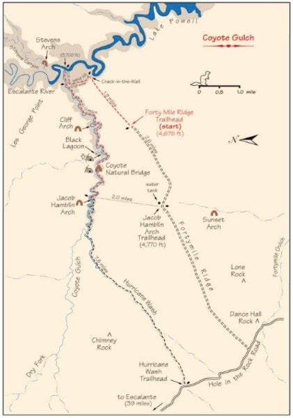
There are numerous ways to hike Coyote Gulch as either a round-trip route or a one-way route. We chose to hike one way from Hurricane Wash (where I parked my car) to Crack in the Wall (where a friend parked their car).
If you have two cars and can do a shuttle, then I’d highly suggest doing a one-way route. I personally liked the direction we walked from Hurricane Wash to Crack in the Wall, even though exiting Crack in the Wall meant we left the steepest uphill to the end. The pros of hiking this direction were that you get the “boring” scenery out of the way first and leave some of the best scenery and waterfalls for last.
Day 1
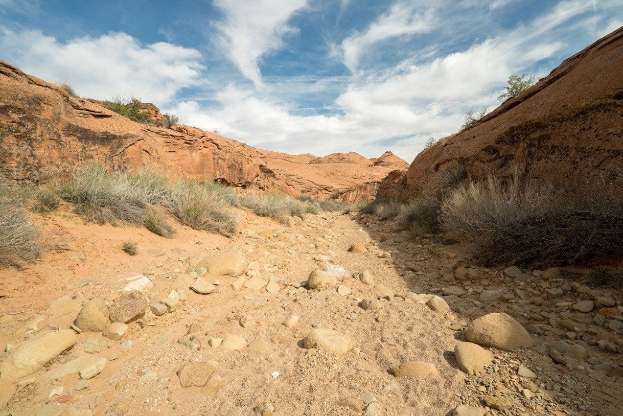
Hurricane Wash is where we started our Coyote Gulch hike. This is the easiest trailhead for accessing Coyote Gulch which means it is also very popular. The trailhead is 33.8 miles down Hole-in-the-Rock Road at a large pull-off on the right. You’ll cross the road and walk along the wash to a trail register. From this trailhead, you’ll be hiking in dry sandy wash (with no water availability) for about 5.5 miles before you reach the river and enter Coyote Gulch.
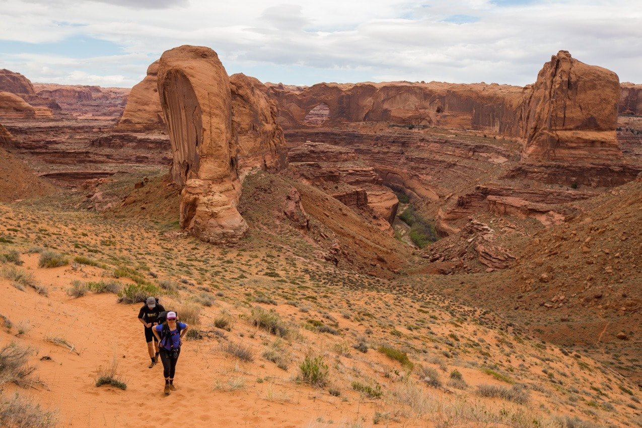
Shortly after reaching the river, the canyon quickly narrows and you’ll start to notice campsites on benches on both sides of the river. You can camp wherever you want in the canyon, and I’d suggest you keep going until you reach Jacob Hamblin Arch at 7 miles. There are some nice (but non-private, and non-shady campsites across from the arch), and one of the better campsites, if it’s available, is just around the corner.
We decided to continue on in search of more privacy, but once you get past here, there aren’t too many great campsites until you get to Coyote Natural Bridge at mile 8.5, where we chose to stay.
Day 2
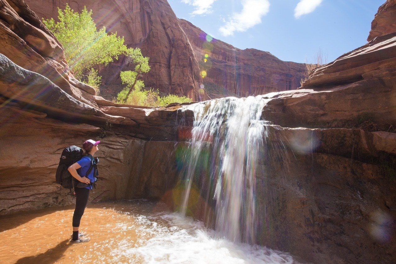
The second day, I thought the scenery in Coyote Gulch got even better. From mile 11 to mile 13, where we turned right to go up towards Crack in the Wall (see the next section), there were a number of gorgeous waterfalls to play around in and the canyon walls were absolutely massive.

Just make sure to pay attention to your surroundings at mile 13. The sandy trail up to Crack in the Wall is on your right and wouldn’t be hard to miss. If you continue 0.4 miles past that junction, you’ll reach the Escalante River which I explored on a packrafting trip.
If you choose to exit this route as we did, one of the last sections of the trail is a sandy 700ft climb. It wasn’t too bad, but it can be strenuous to climb for beginners or those not used to climbing on sand, and you’ll want to make sure you have plenty of water.
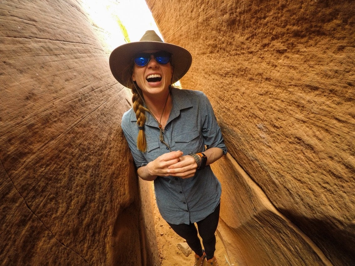
The stream bed is 2.5 miles (one way) from the Crack in the Wall Trailhead. And just in case you were curious, yes, there is a “Crack in the Wall” that will require you to slither through an 18-inch wide crack! You will need a rope (which you need to pack with you) to pull your bags up once you are above the Crack, as it’s way too narrow to shimmy through with your big backpack.
One thing to note about the Crack in the Wall trailhead is the last bit before the parking lot is not that easy to follow. You’ll see a bunch of big rock cairns that mark the trail. These are for navigation, so please don’t make new cairns for fun, as it can confuse hikers. As always, I’d also suggest having a trail map, and I generally like to save a trail guide to my phone for reference using one of my favorite hiking apps.
Crack in the Wall was our exit trailhead, and where we finished our hike. From there, it’s a 7 mile drive to Hole-in-the-Rock Road and another 36 miles back to the highway. Just be prepared, the first two miles from Crack in the Wall travel through deep sand are not suitable for low-clearance vehicles.
Sidenote: If you want to hike as much of Coyote Gulch as you can as a day hike, Crack in the Wall is a good trailhead choice that allows you to see all of the waterfalls. The Natural Bridge would be a good turn-around point for a day-hike starting and ending here, which would be 13-miles round trip. If you do this, I’d camp near the trailhead and get a very early start.
Alternative Trailheads
Red Well Trailhead
We didn’t do this trailhead, so I don’t know too much about it. According to the map, Red Well Trailhead is 30.7 miles down the Hole-in-the-Rock Road, and you’ll see a BLM sign that says, “Red Well 1.5 mi.” You can follow this track towards the trailhead and trail register.
Forty-Mile Ridge Water Tanks Trailhead
Only have a day to explore and feel a little more adventurous? The quickest way down into Coyote Gulch is the Water Tanks Trailhead which drops you into the Gulch right at Jacob Hamblin Arch. The route requires a short scramble, and you’ll want a rope. My friend Kristin (the awesome solo female traveler behind Be My Travel Muse) did this hike by herself and wrote up a detailed Coyote Gulch day hiking guide on her blog. Make sure to check it out if you are looking to day hike.
Water Availability in Coyote Gulch
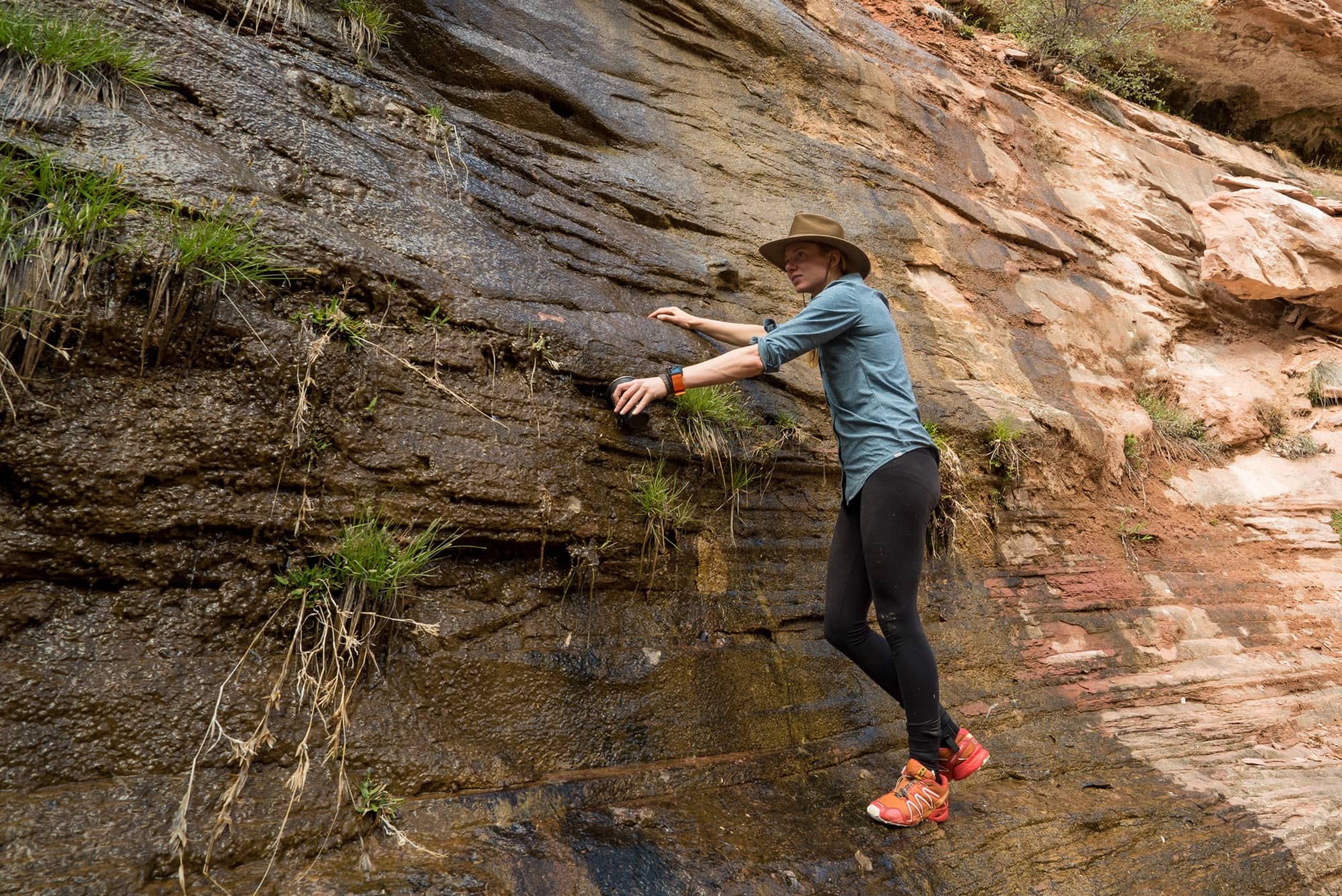
Before you start your hike, I’d recommend packing in at least 3 liters of water, especially in the warmer summer months. Then once you are down in the Gulch, water is available year-round in the canyon. The safest place to fill up your water bottles or hydration reservoirs is at one of the numerous natural rock springs where water seeps right out of the canyon walls. The most reliable spring is located just around the corner from Jacob Hamblin Arch at mile 7 on the left if you are hiking from Hurricane Wash. Make sure to have a full 3 liters when you leave this spring.
We also found another spring on the left side of the river just before starting our hike up to Crack in the Wall. Our guidebook also said there was a spring near the Natural Bridge, but we couldn’t find one there.
Don’t forget to pack a lightweight water filter or water purification tablets just in case you need to drink water from the river.
Coyote Gulch Backpacking Gear
Like any backpacking trip, you should always check the weather before you start your Coyote Gulch hike so you can pack accordingly. In addition to your typical backpacking gear list, there are a few special gear considerations for a Coyote Gulch backpacking trip:
- Shoes: Depending on the time of year, much of your hike will likely be through ankle-deep water. I’d recommend an old pair of tennis shoes or a pair of non-waterproof hiking shoes (waterproof boots will hold in water making it harder to hike) and some neoprene socks for hiking and then a comfy pair of sandals for camp so your feet can dry out at night.
- Rope: Bring a 10 foot rope if you plan to enter or exit via Crack in the Wall. You can use it to hoist your bags up and over the crack.
- Wag Bags: You are required to pack out your poop in Coyote Gulch. This rule was instituted due to the number of people hiking and camping here. Imagine if everyone was pooping in the watershed, it would be really gross. If you’ve never used a wag bag….the bag you poo in contains a special blend of polymers that breaks down the waste and turns it into a deoderized gel. You seal that bag up and then this goes inside a second securely sealed ziplock bag that keeps it all contained. Once you are back in civilization, the entire wag bag goes into the garbage. Please follow the rules and buy wag bags as its essential for keeping the area clean for everyone else.
- Clothes: You’ll want to wear clothes that protect your skin. Check out my post What to Wear Hiking in the Desert for specific recommendations. Also make sure to wear a sun hat!

Nearby Resources (aka the Nearest Town)
Escalante, UT is the closest town to the trailhead. Escalante is also only 50 miles east of Bryce Canyon National Park which makes Bryce Canyon & Coyote Gulch a great combo for a Spring getaway. The town of Escalante is rather small but does have all the basic services for visitors. Escalante Outfitters is an outfitter with some backpacking basics. If you are in need of a shower and hot meal, they also offer cabins, tent sites, and delicious homemade pizza.
Have you been to Coyote Gulch or are you planning a trip there? Leave us a comment below!
Last year I went in and out using the Redwell TH. The main reason I used this TH was to explore a side canyon called Sleepy Hollow. It has undercuts in the canyon walls at least as big as the ones in Coyote Gulch near Jacob Hamblin Arch. I spent 2 nights near Hamblin Arch. I went in on a Sunday. The place was pretty much deserted and only saw about 8 people. I did a day hike from my campsite to the Escalante River and back on my second day. Got to experience my first flash flood. Water went from ankle-deep to 4 feet deep in some places. After a few hours the water level was back to normal. Got a lot of nice pictures. My favorite place was the Black Lagoon.
I have also been in this canyon as a day hike a few years before. I went in through crack-in-the-wall, and came out at Jacob Hamblin Arch.
Hey Mike! Sounds like you had a great trip (minus the flash flood). I’ll have to find that Black Lagoon next time. 🙂
Hi Kristen, great write up on this trail! I might have to plan a trip soon. Can I ask what brand your button up shirt is? As you probably know it’s hard to find “cute” camp clothes and that shirt looks really comfy! Thanks!
Just discovered this hike. What do you suggest if we are coming from LA and only driving one car. Is there an actual shuttle so we can do the one way or would we have to do a round trip kind of hike?
Just reading your blog post and trying to figure out the best plan for us. Love the idea of seeing the entire thing sine we are coming from so far. thank you!
Hi Kimberly, glad you enjoyed the post. There is a company that does offer shuttle service for Coyote Gulch, you can find their information via a simple google search. Let us know how your trek goes! Have fun.
Do you need to apply online for a backpacking permit in advance for this trip? Or do you get the permit at the visitors center before you take off?
Hi Rowan, no you don’t need to apply online. Backcountry permits are required if you plan to camp. You can obtain a permit at the Escalante Interagency Visitor Center in the town of Escalante or at either Crack in the Wall or Hurricane Wash trailheads. Permits are not required for day-hiking Coyote Gulch but for your own safety, you are encouraged to sign the trail register before beginning from any of the trailheads.
Hey Kristen, I can’t seem to find information anywhere on parking by Crack in the Wall. Am I allowed to park near it or do I have to park at the tanks? Also, there does seem to be parking near Hurricane Wash. Can you confirm that? Thank you!
Hey Kristen,
Thanks for the write up. Thinking of doing this as a loop starting at the crack and heading back up to Hamblin to exit. Watched a few vids of the crack descent and noticed you have 10 feet of rope in your gear list. Looks like a much longer drop than that, are you able to do it with several small hoists? Would rather not carry 100 feet of rope if not necessary.
Thanks!
Couple things. The visitors center in Escalante no longer gives out wag bags. Did the hike in March 2017 and they gave us bags. Did it in April 2018 and they charged us $4 ber person. I think you can purchase them elsewhere cheaper, but please use them. This canyon is getting over used and the biggest issue is human waste. Second thing is that in the near future, this will be a lottery hike (i.e., you will have to get a permit and they will be limited in number).
I’ve hiked it 8 times in the last decade and it is my favorite. I always go in at the Crack and out at Jacob Hamblin. I think that lets you see the best part of the canyon (with a side trip down to the Escalante River and sometimes up the Escalante and up Stevens Canyon), plus you get to go down the sand hill and not up.
Thanks so much, Alan, for letting us know! Glad to hear you’ve experienced the canyon more than once!
How long of a hike is it that way? And is there camping in between?
How long of a hike is it that way? And is there camping in between the crack trail and Jacob Hamblin arch?
Would you recommend this hike in August? Or is the heat too much?
Hi Jill, it can be really hot in August. If you do choose to hike in August make sure you hydrate and bring plenty of water. Also, start early so you’re not hiking in the heat of the day as much. We have an entire post on desert hiking tips that you might find helpful.
Very informative. Thanks for the info!
Hello! I’ve done this hike starting at Hurricane Wash and am considering going with friends from Crack in the Wall. Watched a few videos, is crack #3 really 18″ wide? It seemed thinner! Trying to decide if I can tolerate the short amount of narrowness for the rest of the hike. Thanks!
Great blog, thank you.
Is there a specific map you’d recommend? Tom Harrison?
Thank you.
You can download the map on alltrails. The Escalante National Monument Visitors Center in the town of Escalante will also have maps available.
i did Coyote Gulch in May 24 and was amazing. Came in via Crack in the Wall, which was easy to get down for me, and then hiked through to exit at the sneaker route. Climb out was ok until it started raining & then became a bit more spicy & having rope there was helpful. Would suggest having All Trials or Ryans Outdoor on your phone as route from sneaker route to water tank can get tricky at times & cairns aren’t always obvious especially when you hurrying to avoid the thunderstorm bearing down on you