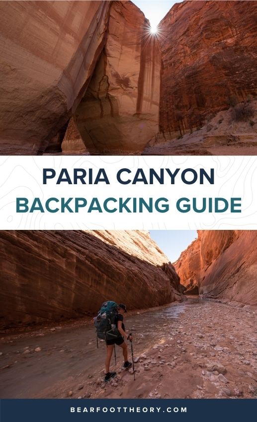
Paria Canyon Backpacking Guide
This is hands down my favorite backpacking trip in Southern Utah. Get the full details on hiking through Paria Canyon here.
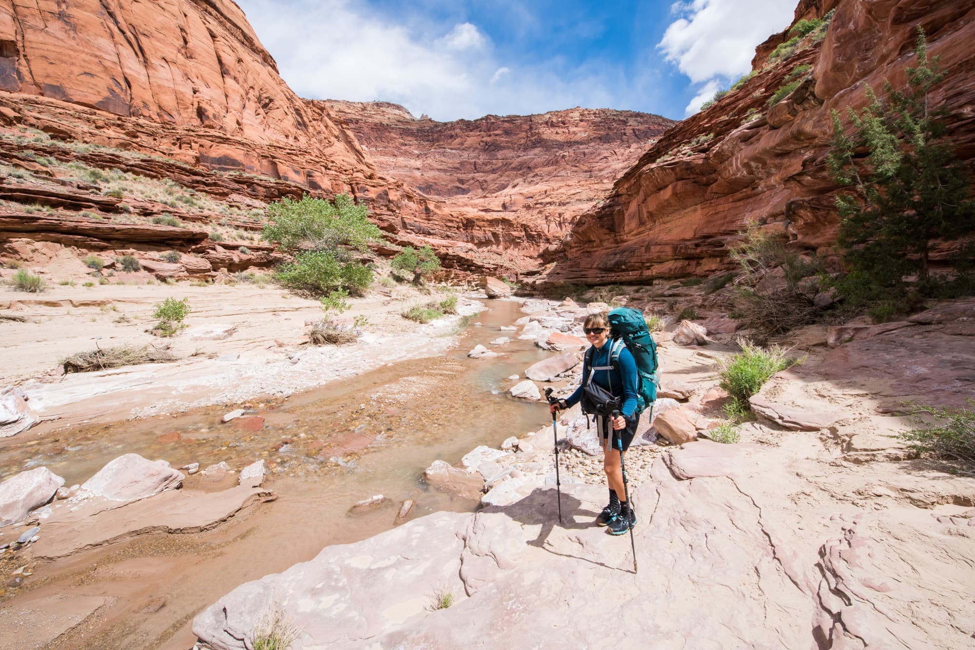
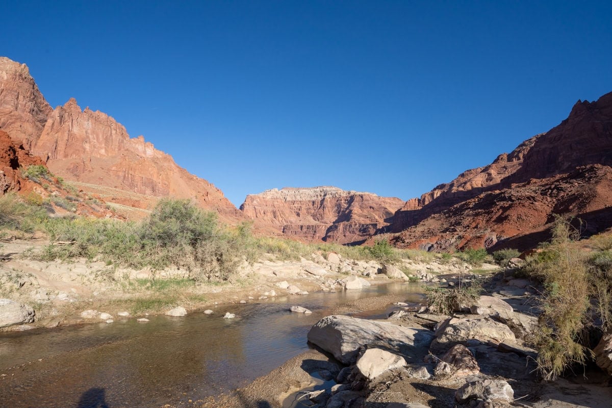
Located on the Utah/Arizona border in the Paria Canyon-Vermillion Cliffs Wilderness, backpacking Paria Canyon involves 38 miles of hiking down the meandering riverbed in between two enormous walls of Navajo sandstone.
I’ve done this backpacking trip twice now – spending four days hiking through this winding, peaceful canyon, and in my opinion, Paria Canyon has the best of what Utah has to offer.
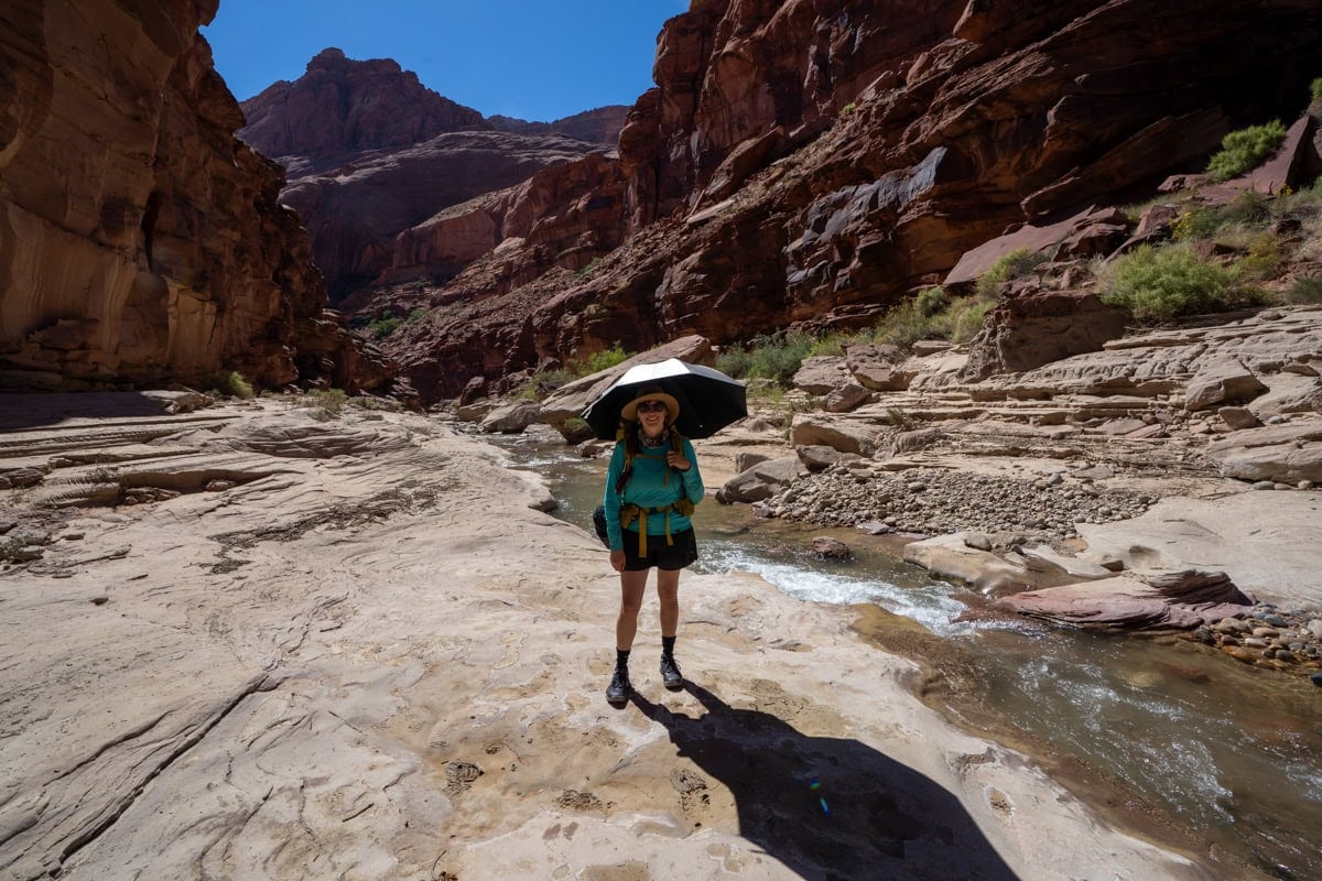
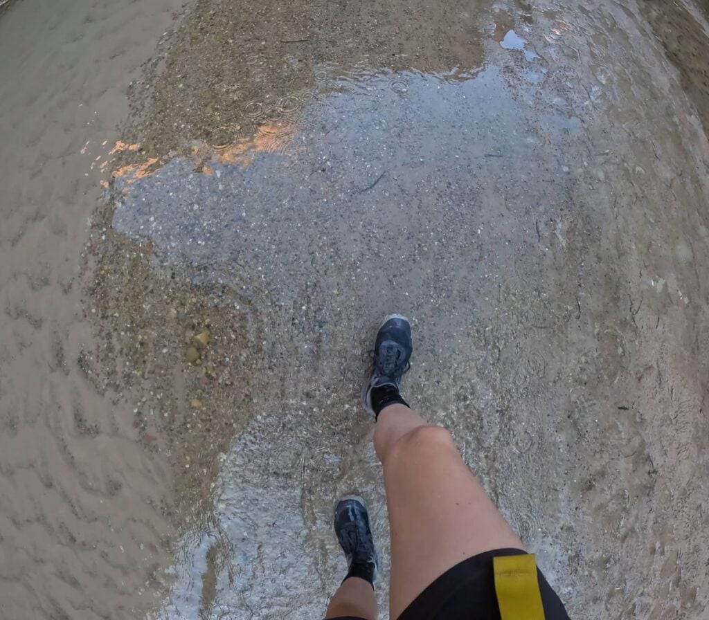
A Paria Canyon backpacking trip requires wading downriver, with dozens of crossings – in some ways similar to hiking the Narrows in Zion, but more remote and isolated. Your feet will be wet the entire time. Due to the nature of the trail (or lack of trail), the hiking is slow, but it is nothing short of spectacular and worth every ounce of effort.
What made it even better is that this trail is very quiet. The first time I hiked it, we only saw one other pair of hikers. The second time, we only saw a few small groups on the first and last day. Both times, we had the canyon all to ourselves, meaning that the BLM’s permit process is working well to keep this place wild.
In this Paria Canyon Backpacking Guide, I share everything you need to know to plan your own backpacking trip.
This post may contain affiliate links.
Paria Canyon Hike Overview
Trail Basics
My Route
While there are three different starting trailheads for Paria Canyon, the best way to experience it is a one-way hike from the White House Trailhead near the Paria Contact Station and finish at Lee’s Ferry. This is the route I followed on both of my trips.
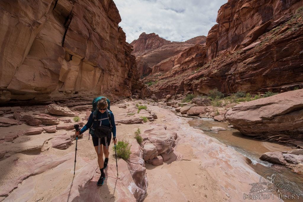
This route is 38 miles long and gradually loses 1,600 feet in elevation over the course of the trip. The trail is mostly easy to follow, as a majority of the hiking is done in the riverbed.
Both times, I did the Paria Canyon hike in 4 days/3 nights and found the pace to be just right. It honestly would have been difficult to do it in less. We met one couple doing it in 3 days/2 nights. If that is all the time you have, then it is doable, but be prepared for very long days. It’s important to keep in mind that hiking in the river is surprisingly slow, especially if water levels are high.
My most recent trip was in late September when the days were shorter. We woke up at 6:30am each day and hiked at a leisurely pace until about 4:30pm. That gave us 2 hours until sunset to set up and enjoy camp.
Alternative Routes
There are a few alternative routes you might consider, depending on how much time you have and what kind of challenge you are looking for:
If you want to start at White House like I did, you can travel through the Paria Narrows and then still explore a bit of the bottom of Buckskin Gulch once you reach the Confluence on Day 1. While not as constricted as Buckskin Gulch, the walls of the Paria Narrows close in to about 6 feet across at some points, meaning you still get to experience some deep slot canyon hiking.
Save this post!
Enter your email & I'll send this post to your inbox! You'll also receive my weekly newsletter full of helpful advice for planning your adventures.
Paria Canyon Map and Navigation
This is the map the ranger will provide you when you pick up your permit at the Paria Contact Station. You can click on it to view a magnified version. As you can see, it’s not very detailed, and they had no other maps available for sale.
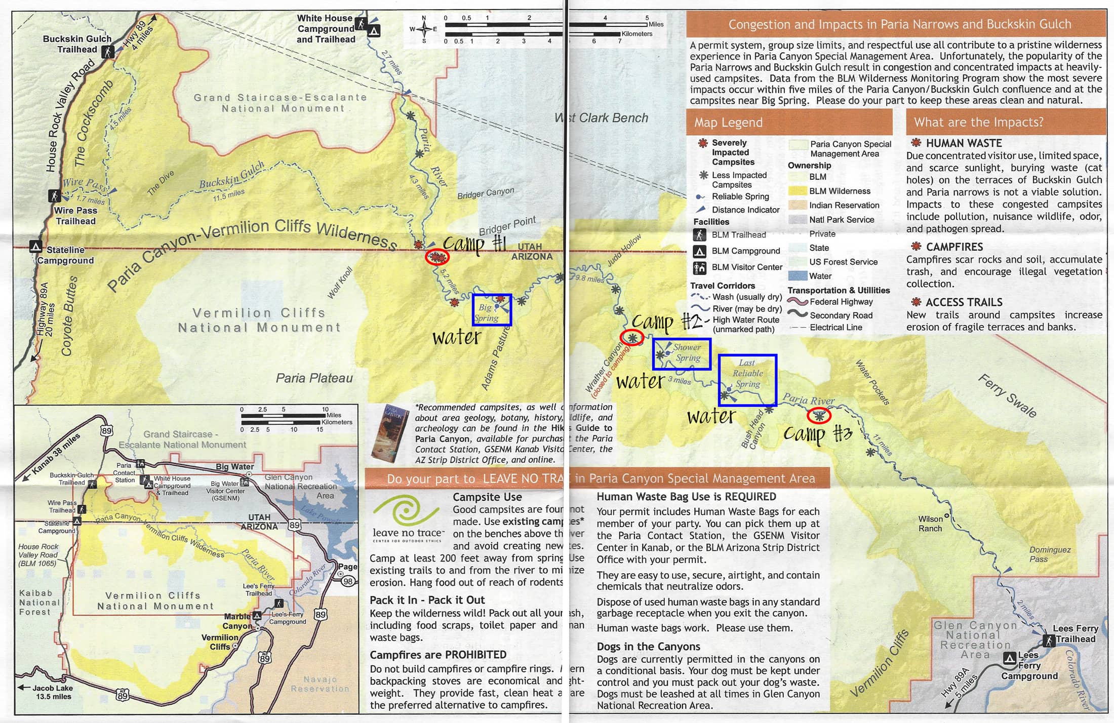
While navigation through Paria Canyon is easy (it’s impossible to get lost), there are very few reference points that can help you determine your location. For this reason, I highly recommend you carry a GPS on your trip.
To help you, I created a GPS file with the location of the campsites and springs, so you can track your location in real-time on the hike. Download my GPS file here. Just click “Export” and choose GPX, and then you can upload that file to your GPS.
If you don’t have a GPS already, I use the Garmin Inreach which is also acts as an emergency satellite communicator.
Best Time to Hike Paria Canyon
Although the canyon is open year-round for backpacking, the air temperatures in late spring and early fall are going to be the most comfortable. These are also the most popular times, so you need to plan far in advance to make sure you get a permit through the lottery system.
The risk of flash floods is the highest in July, August, and early September. Flash floods in Paria Canyon, particularly in the Narrows, can be very dangerous since there are places where there is no high ground.
In the days leading up to your trip, be sure to check Paria Canyon weather, as well as the weather at Bryce Canyon since rain in Bryce Canyon flows down into the Paria watershed. If the forecast is calling for a chance of rain, call the Rangers station to seek their advice about whether or not it is safe to hike.
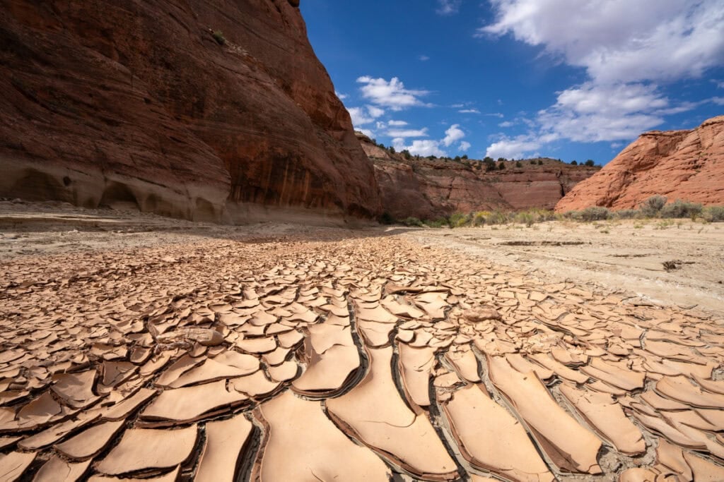
Even after dry periods, the river banks can be very muddy and slippery. For this reason, I probably wouldn’t do this hike right after a lot of heavy rain. Recent storms mean that the river will be deep, extra muddy, and too silty to filter from.
Paria Canyon Permits
Permits are required for both day hiking and overnight trips in Paria Canyon and Buckskin Gulch. Walk-up permits are available for day hiking at the trailheads (no limit on day hikers – $6 fee), but overnight permits must be obtained through the Paria Canyon online permit application system.
No same-day overnight permits are granted. Permits must be picked up within 10 days of your start date from the Vermillion Cliffs National Monument office in Saint George, the Paria Contact Station, which is right near the White House Trailhead, or the Kanab BLM field office.
The BLM only allows a total of 20 people per day to enter the canyon on overnight permits, and that is across all of the trailheads. There is a $6 reservation fee per group, and an additional $5 permit fee per person per day. Dogs are also allowed for an extra fee of $5 per dog per day. When making a reservation, you will reserve the number of days you plan to spend in the canyon, not nights.
For overnight permits, the reservation system opens up at 12pm Mountain Time on the 1st of every month, 3 months before the month of your hike. For example, on February 1 permits for May would open.
On the permit application website, the calendar shows you when there is availability. If a date is blue, it means there are permits available to enter the canyon to backpack on that day, and the number shown indicates the number of spaces (one space = one person) that are available. Gray dates mean there are no permits available to start on that day.
For the best chance of getting a permit for the busiest spring and fall months, you should plan on being on the website right at noon on the day that permits become available.
Paria Canyon Trail Campsites
Campsites are spread throughout Paria Canyon and tend to be on sandy beaches above the river. The BLM asks that you choose existing campsites that are at least 200ft away from water and also appear to be worn to avoid creating new sites.
It was pretty obvious where most of these campsites were, and you can see the three campsites I stayed at on my first trip marked on the map above. The main thing to take into consideration when camping is the location of the fresh water springs. Depending on how much sediment is in the river, the springs may be the easiest places to obtain water.
You will need to filter your water even from the springs, so be sure to bring a backpacking water filter. Campfires are not allowed at any of the sites.
Based on my two trips, my recommendations for campsites are:
Water Availability in Paria Canyon
Water availability is something to take into account when you are planning your Paria Canyon backpacking itinerary, which might seem strange considering you are hiking down a river.
Filtering from the river
The Paria River can be very silty, and a lot of water filters simply can’t handle the grit and can get clogged. However, I lucked out on both of my trips. It hadn’t rained for a while, and the water flowing in the river was relatively clear. This meant we were able to filter right out of the river without any issues.
Due to animals that live upstream, I’ve heard that if you are going to drink water out of the river, you should both filter and purify it to get rid of bacteria and viruses. We only filtered water and didn’t use a purifier, and neither of us got sick, but if the water had looked dirtier or there had been a lot of recent rain, I would have thrown some purification tablets in just in case.
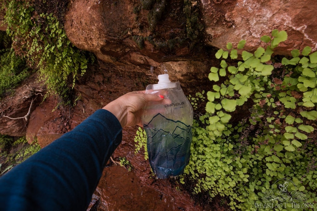
For filtering: I used the CNOC Outdoors 2 liter water container to fill from the river and then ran the water through my Versa Flow Lightweight water filter into my Platypus Soft Bottles. This system is incredibly light, was very fast, and is easy to backflow if it happens to get clogged (which I did not experience).
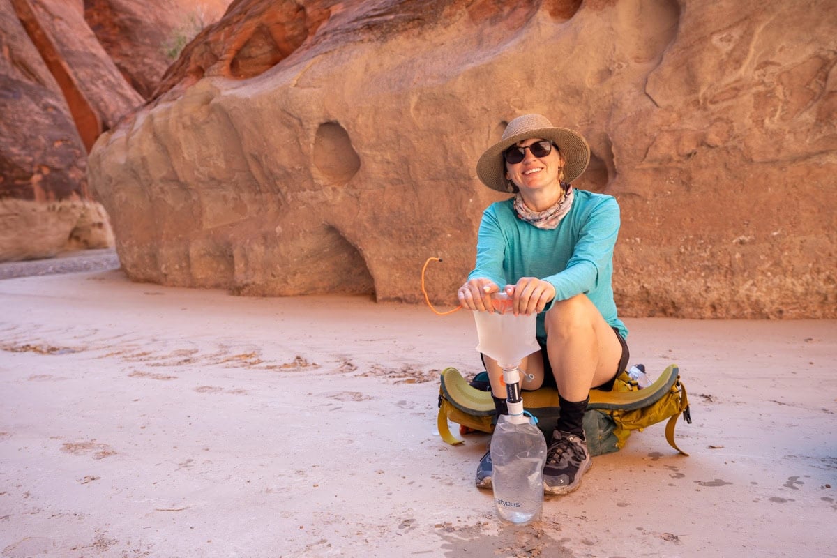
If there is lots of sediment in the river, there are a couple of tricks you can use to prevent your filter from getting clogged. First, you can use a buff, bandana or shirt to pre-filter the water. Next, you can let the water and silt settle in some sort of container before running the water through your filter. You can also bring something called Alum Powder which can be a life saver in the desert. You just add a small amount of alum to the water, and it causes the silt to quickly sink to the bottom. Once that happens, you can carefully pour the clear water into whatever you are using to treat/filter it.
Filling up at the springs
If the river is really silty, your best bet is going to be to fill up at the reliable freshwater springs that provide a source of drinking water. These are seeps where the water flows right out of the cracks in the sides of the canyon walls. This water should also be filtered for safety, but the sediment won’t be an issue.
Many of the springs are easy to miss, so it’s important to be on the close lookout. Lush vegetation growing out of the canyon walls is a sign that a spring might be present.
The most reliable springs are marked on the map above (and on the GPS file) and are located at:
Please note water access may have changed since I was there – always check with a ranger before heading out for the most up-to-date water information.
If you can’t easily filter from the river, camping at sites near these springs is best because it means you don’t have to carry additional water for cooking your backpacking meals. You just fill up when you arrive at camp and before you leave in the morning. In this case, I’d recommend carrying at least 4-5 liters per person to get you from one spring to the next.
It should be noted that you should fill up all of your water bottles at the Last Reliable Spring. Beyond that, the trail has virtually no shade and can be very hot.
Paria Canyon Backpacking
Trip Report
Day 1
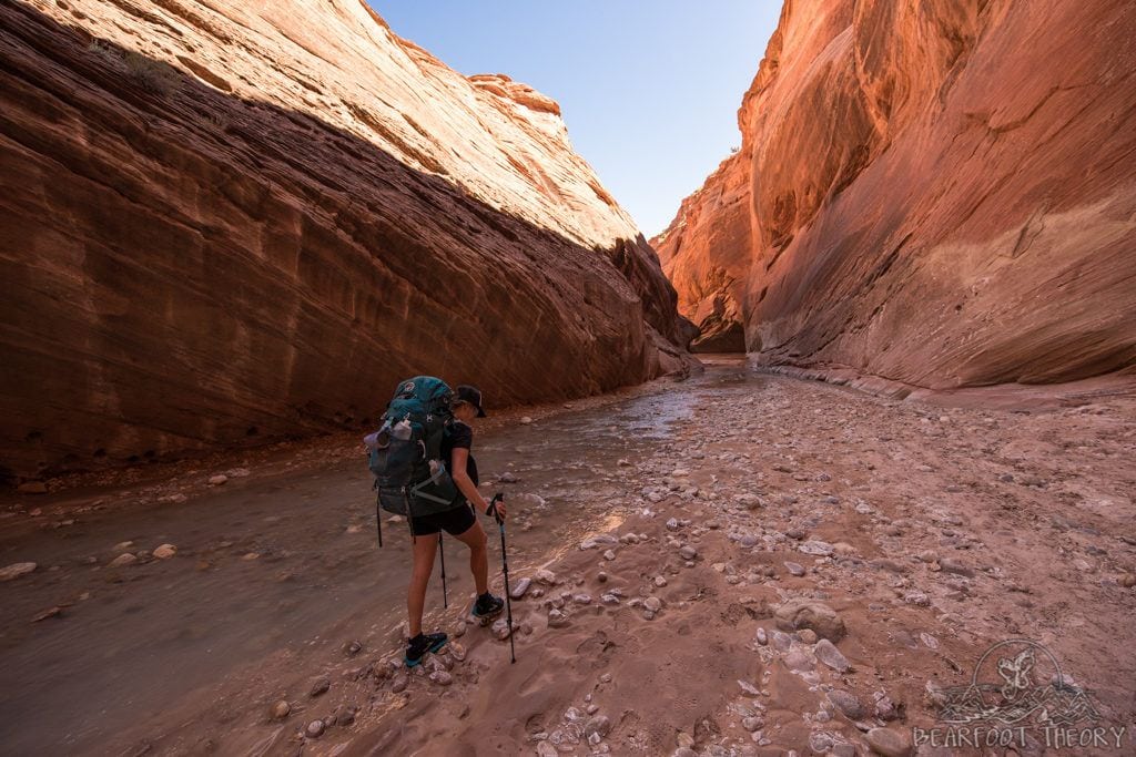
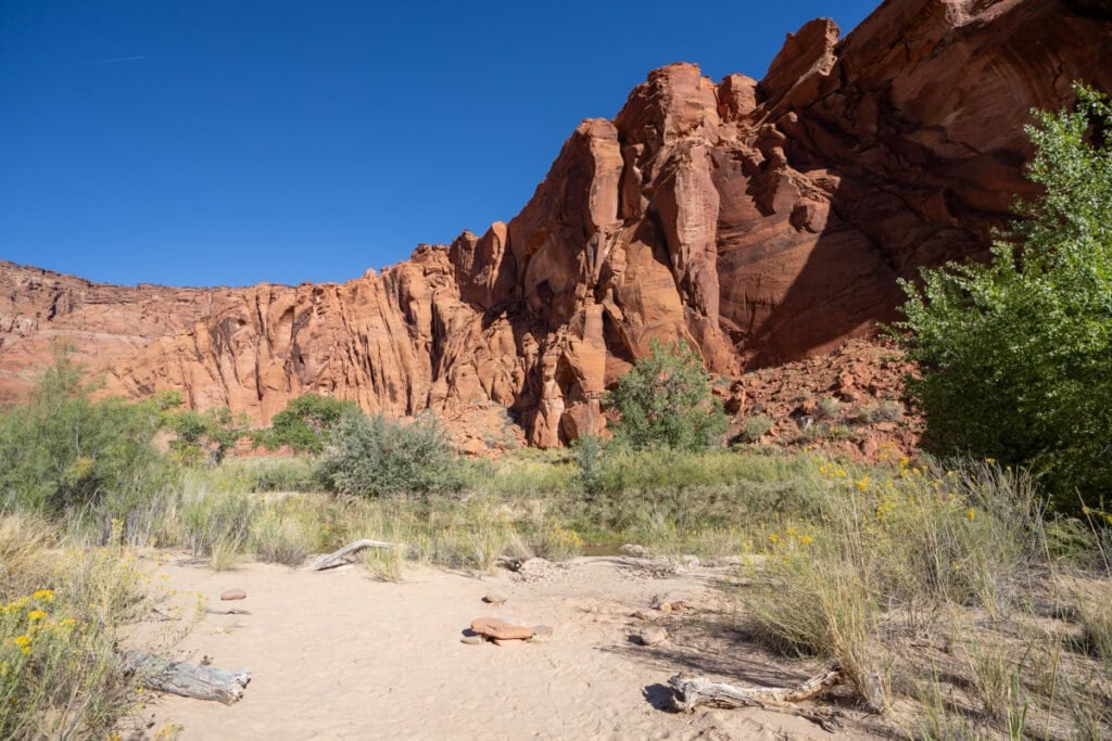
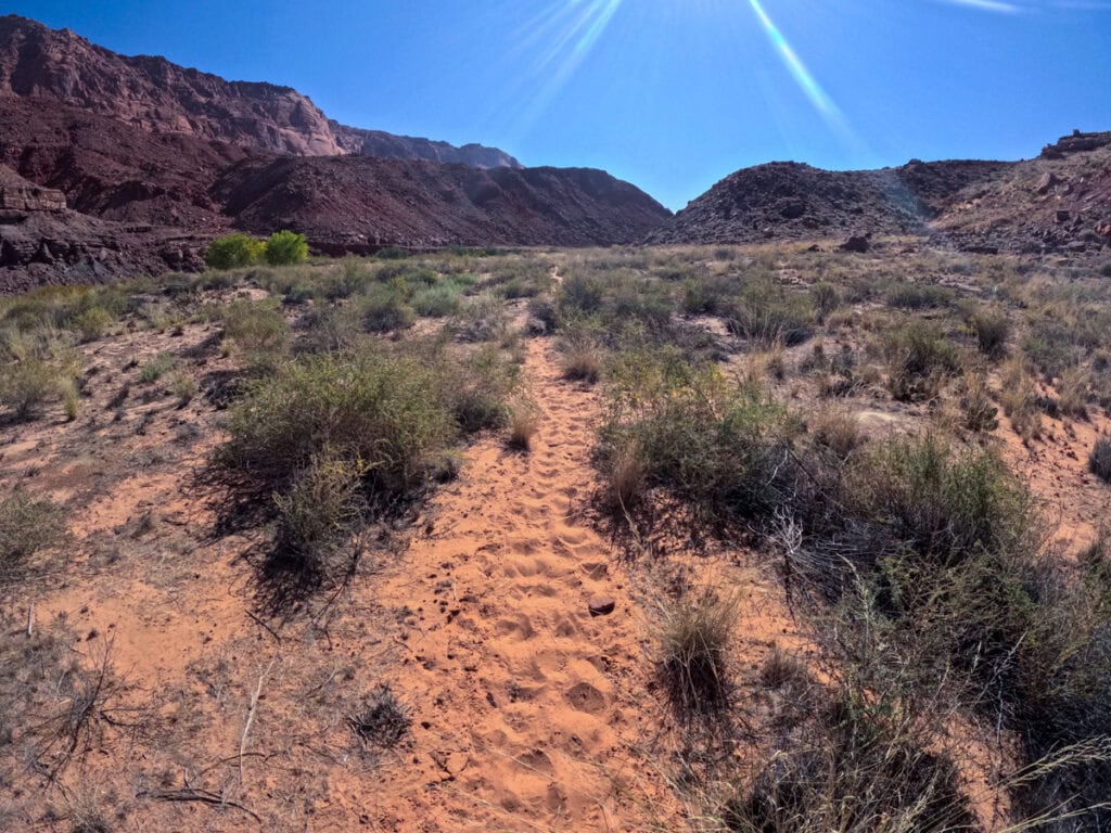
From the White House Trailhead, the canyon walls start out short and wide and slowly narrow as you continue hiking down the river. The first part of the hike can be quite hot as there is little shade so if you are hiking in the warmer months, make sure to get an early start.
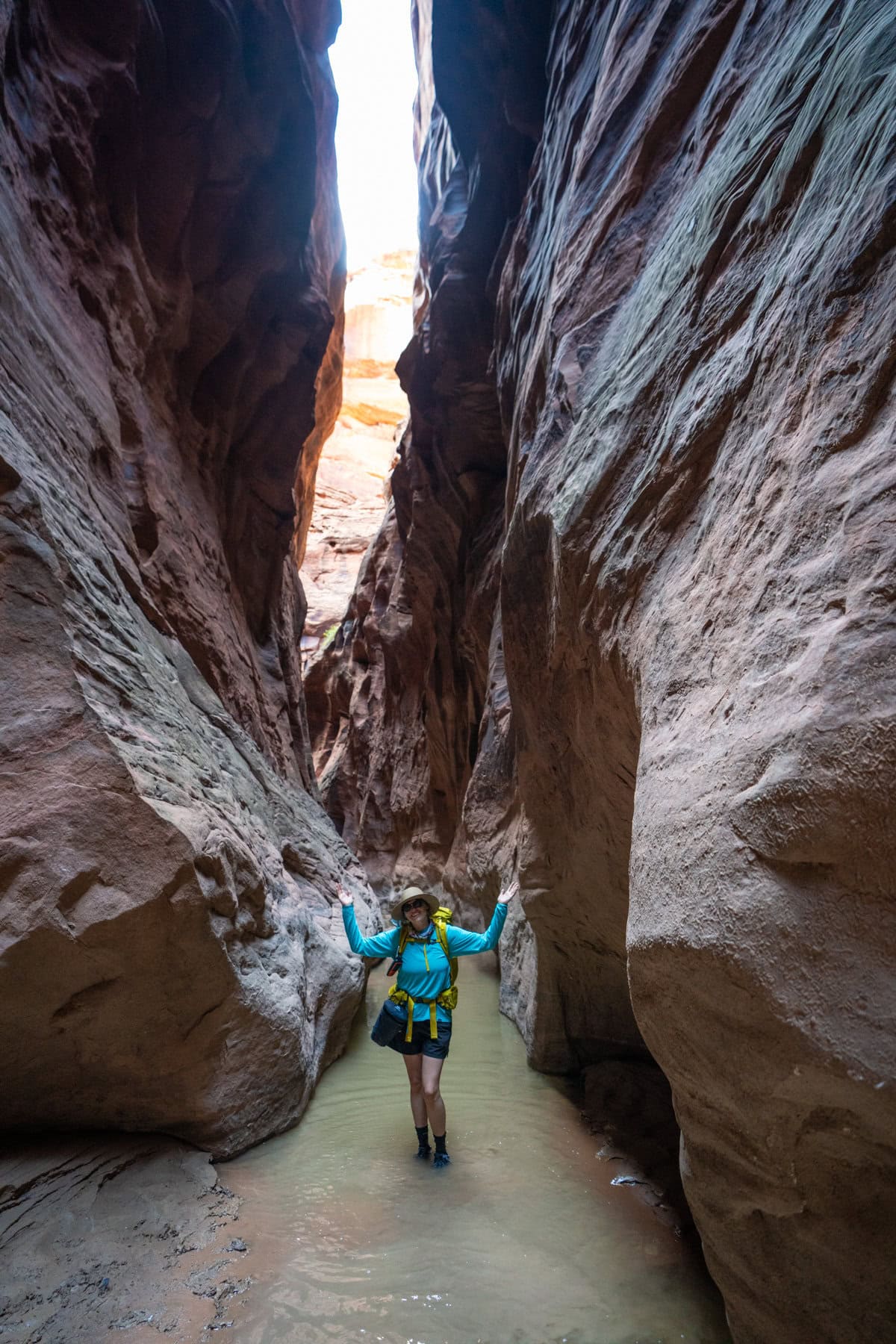
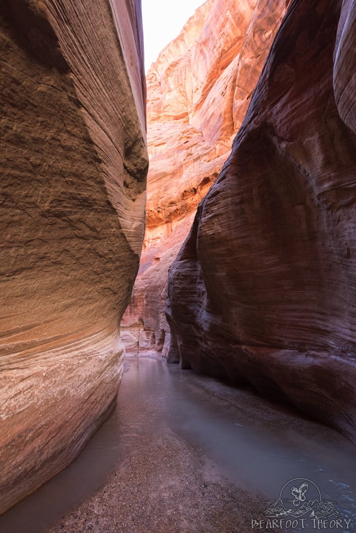
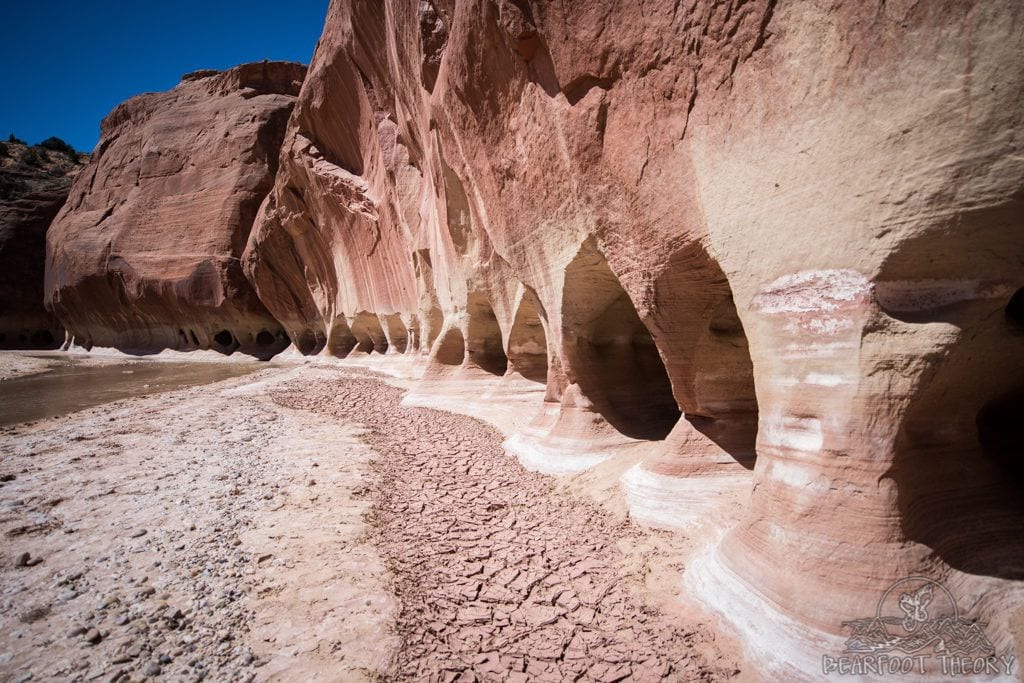
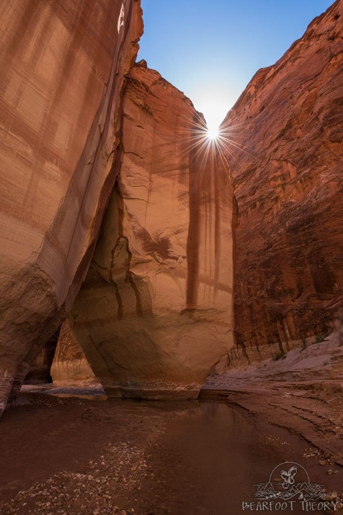
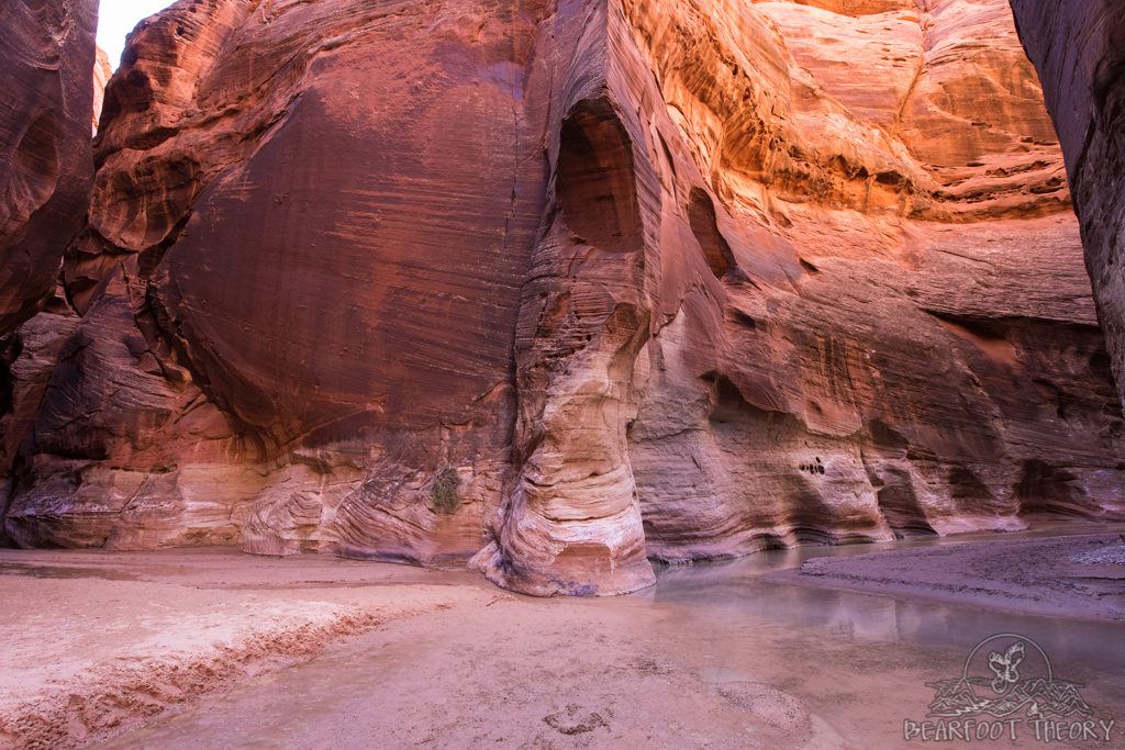
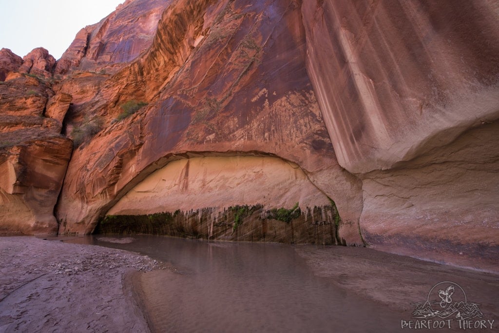
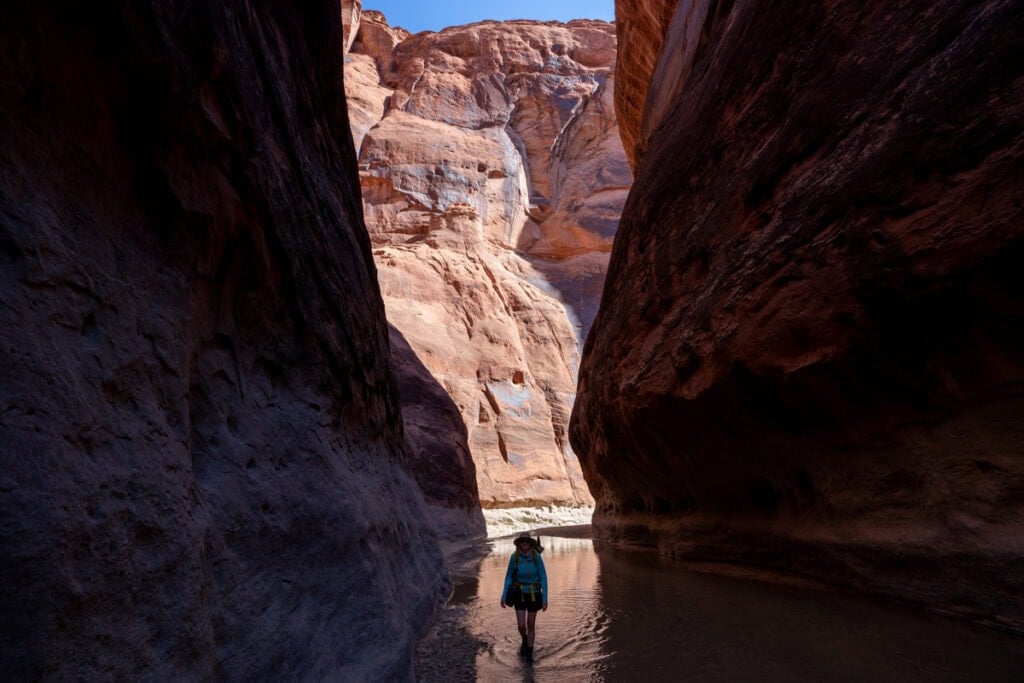
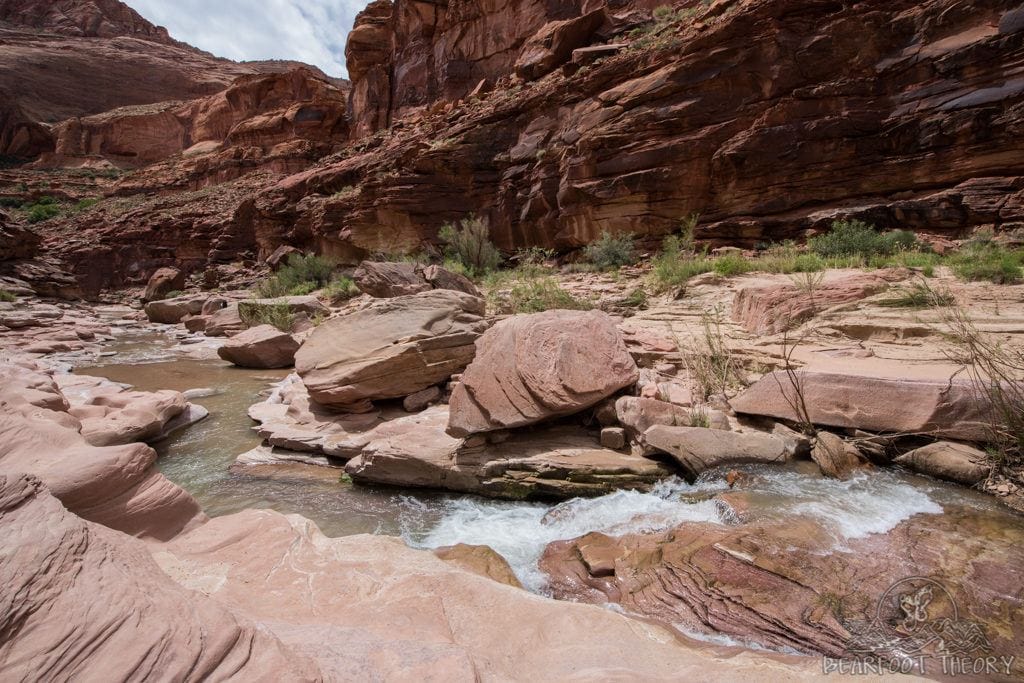
Around mile 4, you reach the entrance to the Paria Narrows. The towering sandstone walls in this section reach up to 800 feet high and at some points, the walls are a mere 6 feet apart. In this section it is cooler and shadier, and some places in the Narrows, the water can become waist deep following rainfall.
During my first trip, the water was never more than knee deep in the Paria Narrows. On my second trip however, the Narrows were bone dry. We didn’t find any water until right before the confluence.
Keep in mind it is hard for the rangers to predict current water levels, so you should be mentally and physically prepared for either scenario.
At mile 6.7, you reach Slide Rock Arch – an enormous boulder that once fell into the canyon and has formed a short tunnel. If you catch it at the right time in the afternoon, the sun beams down creating some great photo opportunities.
Around mile 7, you reach the confluence of Buckskin Gulch and the Paria River. Buckskin is very narrow with deeper water and has a lot more obstacles than the Paria Narrows. If you have time, you can hike a little ways up Buckskin Gulch. We spent 20 minutes walking up Buckskin until the water started to too deep. This is worth doing if you are crunched on time.
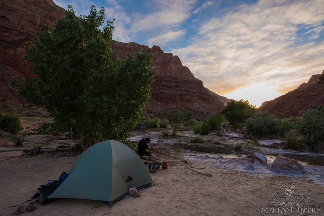
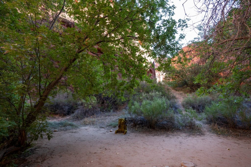
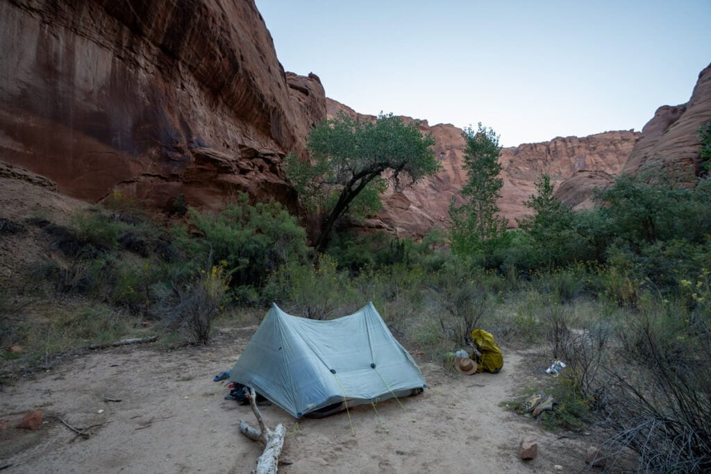
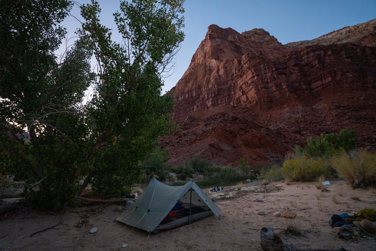
We kept hiking for another hour or so and camped right across from First Spring. There was a lovely place to sit next to the river and soak your feet, and our campsite was pretty private.
Day 2
Day 2 felt very long for us. An hour after leaving camp, we reached Big Spring at mile 12 – the first reliable freshwater spring. As mentioned above, most people prefer to get their drinking water straight from these springs rather than filtering from the river, but it’s always a good idea to have a backup water filtration method in case you miss a spring or it’s not flowing while you’re there.
At Mile 13, the canyon chokes up again, with a very similar feel to the Narrows section.
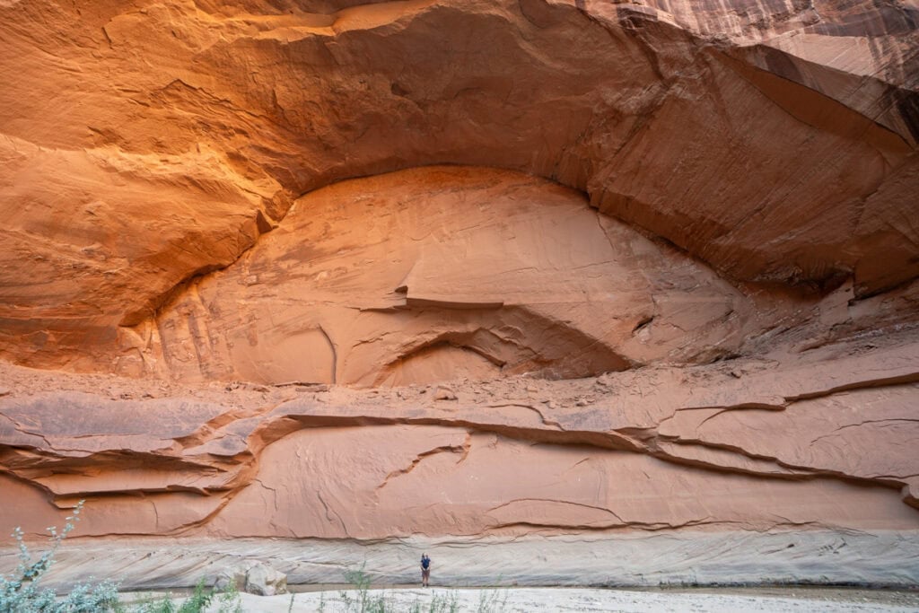
Around mile 15, there are a series of cave-like amphitheaters that rise 650 feet above the riverbed. This was my favorite part of day 2. There are tons of beaches to stop and relax on, so make sure to take your time and enjoy it.
Once we reached Judd Canyon, we started to look for campsites. We couldn’t find the first site that was marked on the map around mile 18 that the ranger provided, so we kept going. At mile 19, we saw a faint trail up from the river on the left side that led to a flat campsite. We were tired, so we stopped, even though the campsite wasn’t that great. It was far from the river which made going pee a pain (unlike most trails, here you’re actually supposed to pee in the river).
If you have more steam, I suggest continuing past here to the junction with Wrather Canyon. There is a nice site near the mouth of Wrather Canyon with better views and water access. There is also an optional 25-minute side trail up Wrather Canyon that leads to Wrather Arch. We didn’t do this, but I’ve heard it’s quite impressive. No camping is allowed up Wrather Canyon.
Day 3
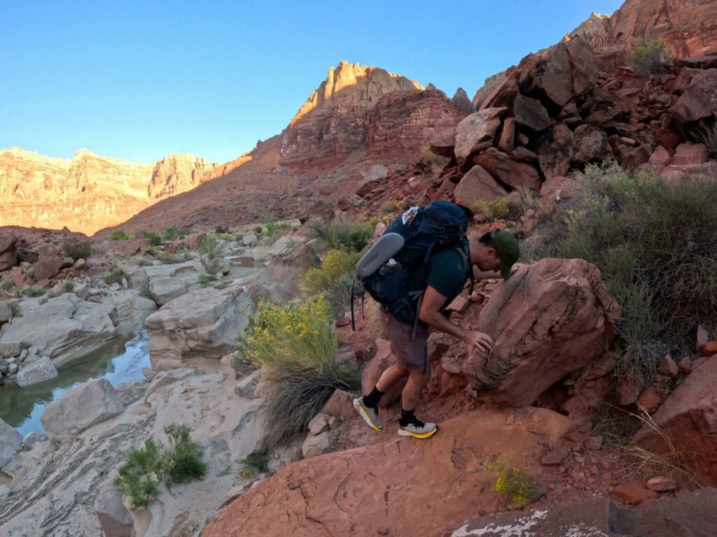
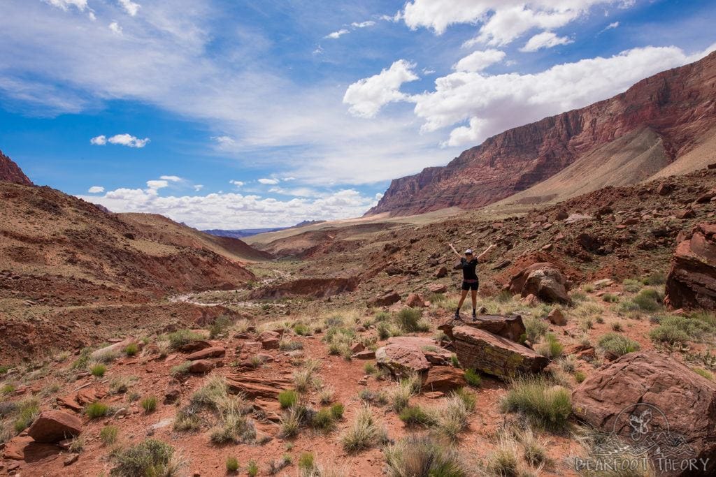
On Day 3 the terrain began to change – the canyon broadened, but the river features got more interesting with rocky obstacles, deep holes, and small cascades. It was really neat to watch the canyon slowly transform over the course of the trip.
I found this day to be the most challenging. The pools in the river were deeper, which meant we had to scramble over rocks and boulders along the river’s banks. There was also less shade, which made it pretty exhausting.
Many people choose to camp at the last reliable spring at mile 25, but that leaves 13.5 miles for the final day. That didn’t sound too appealing to us, so we filled up at the spring and kept going.
On both of my trips, we camped at the last good spot on the river, around mile 28. There’s an awesome spot on a high bank on the right side of the river with a perfect sunset view.
Day 4
The final day the landscape takes on more of a desert feel. The trail is hotter, drier, and sandier and with the canyon broadening, sun exposure can be intense so be sure to pack sun protection. That said, the views on the descent to Lee’s Ferry were gorgeous, and the variety in the scenery kept things interesting.
When we departed camp, there is an obvious trail that goes up and over the bench. It goes away from the river and looked like a shortcut, so we decided to follow it. We didn’t realize that this trail would take us far away from the water, not meeting back up with the river for 1.5 miles.
There were two sketchy sections. One where the trail was very narrow and exposed and a second steep rocky section. It wasn’t anything impassible, but these sections got my heart pumping. I’m not sure what it would have been like had we stayed in the river bed, so I can’t compare your options.
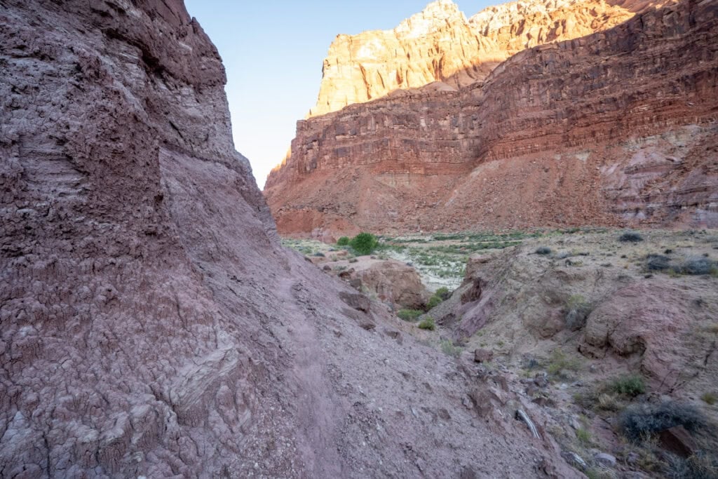
Eventually the trail met the river again. While the trail does cross the river a few times over the last several miles, most of your time is spent out of the water following a trail that crosses the river benches. It’s suprisingly slow going because the trail was often hard to track. Eventually, you come to an old ranch, indicating that you are close to the trail’s end at Lee’s Ferry.
Gear for Hiking Paria Canyon
Start with this backpacking checklist and desert hiking clothes guide to pack for Paria Canyon. In addition to a map and your normal backpacking essentials, there are a few extra gear considerations for canyon hiking.
Hiking Shoes and Socks
The Paria River is cold and full of pebbles so I would not recommend water sandals for this hike. Instead, you’ll want to wear tennis shoes or a pair of lightweight, non-waterproof hiking shoes with a closed-toe and closed-heel. Waterproof hiking shoes will fill up with water while non-waterproof ones will allow water to go in and out. I wore my Oboz Katabatic (non-waterproof version) and fond them to be a great option for this hike.
Instead of regular socks, I highly recommend pairing your shoes with some 0.5 mm neoprene socks. These will prevent the sand and rocks from rubbing your skin and will help prevent blisters.
Dry Bags
On my trip, the water was never more than knee-deep, but the river can be waist-deep after periods of heavy rain. In order to keep your essentials dry, you might consider packing your sleeping bag, clothes, and electronics inside some lightweight dry bags. Or for a cheaper solution, you could line the inside of your pack with a garbage bag and then pack all of your gear inside of that.
Trekking Poles
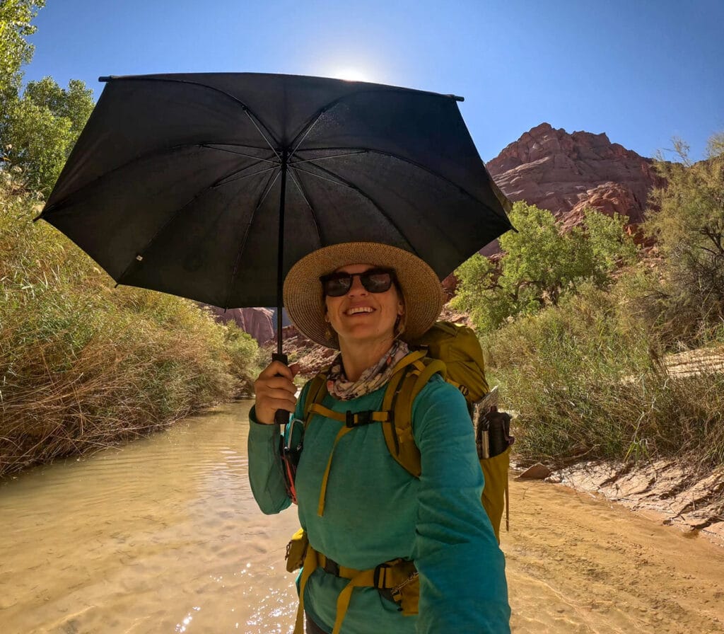
I actually didn’t use my trekking poles much on this hike because I was using my hands to hold my sun umbrella instead. The trail is mostly flat, and there were sections I liked having my hands free. However, they can help with stability during the deeper river crossings, and I also use a tarp-style tent called the Zpacks that requires trekking poles to set up. If you do bring trekking poles, bring ones that collapse so you can throw them in your pack if you aren’t using them.
Sun Umbrella
This was the winning piece of gear on my most recent Paria Canyon hike. Even in late September, it was nearly 100 degrees and sunny the entire time. This Six Moons Designs sun umbrella is lightweight and reduces the temperature you feel by at least 10 degrees. It also reduces the amount of of sunscreen you need to reapply during the day.
Water Filtration System and Bottles
Water Filtration
I brought the Versa Flow Lightweight water filter on my most recent trip because I heard it was very good at handling water with a lot of sediment in it. You can also backflush it easily if the slow fIows due to clogging. It performed very well and is much lighter than the Playtpus GravityWorks filter that I’ve been using for the lat decade.
I paired it with the CNOC Outdoors 2 liter water container. The wide opening made it very easy to fill from the river or springs, and it conveniently attaches to the Versa Flow filter. Then you either squeeze the water through the filter or you can hang it up and let gravity do the work.
Water Purification
There are a couple of options for purification, and it’s always good to bring these as a backup. The cheapest, lightest, and easiest are purification tablets.
Another (more expensive) option is the SteriPen. Just swirl the tip of the pen around in your water bottle for a minute, and it kills any viruses that might be present. The only thing about the SteriPen is it works best with wide-mouth water bottles, like a Nalgene, and it also runs on a rechargeable battery. This means you need to charge it up before you leave the house or bring along a battery pack or small solar panel to charge it in the field.
Water Bottles/Reservoirs
If you’re planning on filling up in the springs, I would recommend carrying a 3L hydration reservoir, as well as a few extra lightweight water bottles. Having the capacity to carry extra water will provide you more flexibility in where you can camp.
Shuttle Info
Because this is a one-way hike, you will need to do a car shuttle so you aren’t stranded when you reach the end. If you have two cars, that makes it very easy.
If you have to shuttle cars, you should drop off one car at Lee’s Ferry the day before your hike. Then you can drive to White House where there is a first-serve campground with a pit toilet, picnic tables, and fire rings. that night. Camping here means you can get an early start the next morning.
If you don’t want to camp, there are a lot of hotels in Page, which is about 25 minutes from the White House Trailhead.
If you’re parking a car at White House, they will give you a parking tag when you pick up your permit at the Contact Station. Make sure to leave this on the dashboard of your car.
Drinking water and trash disposal are available at the Paria Contact Station at the northern end of the campground access road – I recommend filling up your water here before starting the trail.
If you don’t have two cars, there are several companies you can hire to shuttle you. We used Grand Staircase Discovery Tours which was $200 total. They met us at Lee’s Ferry at 7:30 am the morning of our hike. We gathered all of our gear, dropped our off car, and then they drove us up to the White House trailhead. This was great because our car was there waiting when we finished the hike.
There are other companies, but some of them charge per person, so you’ll want to compare pricing before you book.
Leave No Trace
Here are a couple of things to keep in mind for Leaving No Trace and reducing your environmental impact in Paria Canyon.
Frequently Asked Questions
Techincally yes. Dogs are allowed in Paria Canyon. It costs $5 per dog per day, and you are required to pack out their poop. However from a practical standpoint, I don’t think this is a very dog-friendly trail, and I personally wouldn’t bring my dogs. You’ll want to filter the water for your dogs so they don’t get sick. There are also lots of cactus and pokey things that could hurt their paws. Finally if the water is deep, it could create challenges for them.
You can day hike through the Paria Narrows without an advanced permit. However, from the White House Trailhead to the confluence and back is 14 miles round trip, with more than half of that in a dry river bed in the full sun. If you are doing a day hike, I suggest doing Wire Pass to Buckskin Gulch instead and saving Paria Canyon for a backpacking trip.
Most people hike from White House to Lee’s Ferry. In this direction, the trail gently slopes downhill and you are hiking with the flow of the river. The most convenient place to pick up your permit is also the Paria Contact Station which is right next to the White House Trailhead. However, there is no reason you can’t hike from Lee’s Ferry to White House instead if that is more convenient.
Backpacking Paria Canyon was my favorite desert trip to date, and with the colorful scenery and lack of crowds, Paria Canyon will not disappoint!
Have you backpacked the Paria Canyon in Utah or plan to?
Let us know in the comments!
More Utah Adventures
Amazing guide. Thank you for creating and sharing. I love your night photos of your tent under the stars! This looks like a must do hike.
Thanks Virginia! Glad you enjoyed it and appreciate the compliment about my night photos! Paria is definitely one to add to you list if you are traveling through the area. Thanks again! Kristen
Awesome! Thanks for putting this together. Maybe I missed it but how did you store your food overnight?
Hi Brad, I’d recommend carrying your food in an Ursack which is a bag that will keep critters (squirrels, mice, chipmunks, etc) out of your food.
really enjoyed your trip! Loved the petroglyphs on day 3! A-maz-ing!
Thanks Kelly! If you have any questions about Paria Canyon, just let me know! -Kristen
What books/map guides did you use for the trip?
Hey Celeste – The only map we had was the one I put in the blog post which was provided by the BLM office when we picked up our permit. The trail is very easy to navigate…the only thing you really need to watch out for is the fresh water springs. Before the trip, I also used this Utah hiking book which I really like: http://amzn.to/1f9LfGf
Inspired to trek this in summer 2016! Question though: what temp-rated sleeping bag did you use for the trip? Could one get away with a 3 season bag or will a 40 + bag be that much more comfortable?
Hey Alex – For Paria in the summer, it’s going to be hot. I think a three season bag would be ok though…probably not worth investing in a 40 degree bag just for this trip. You can always strip down, unzip, etc. I used this bag on the trip, but it was in April: https://bearfoottheory.com/product/rei-joule-sleeping-bag/
Hope that’s helpful!
I really enjoyed your blog post on hiking the Paria. I’ve hiked it twice, both times starting at Wire Pass and through the Buckskin. It’s beautiful either way but honestly, you missed the best parts! Buckskin is simply amazing and Wrather Arch is not to be missed. I did the entire 46 miles in 4 days but as you mentioned, it’s slow going even though it’s all downhill. Part of the hike is slippery boulders and there is the ever present quicksand. I averaged just over 1 mph! Next time I’ll take 5 days, 4 nights so I can “smell the roses” a little more.
One of your commenters asked about maps. I strongly suggest reading Kelsey’s book on the Paria. He’s written multiple books on the area and is the expert.
Hey Robert – I’ve heard amazing things about Buckskin…I would have loved to do it. And Wrather Arch too. I have a strong feeing I’ll be going back there at some point for round 2…so I’m definitely planning on working these things into my next trip. And thanks for the tips about the map/book! Appreciate the support and if there are ever any topics you’d like to see covered on my blog, feel free to get in touch!
I have to agree with Robert. I hiked Wire Pass to Big Spring this past summer and Buckskin Gulch was by far the most amazing part. The logs jammed across the slot 20 feet above your head make for some really incredible photos. I have also done Antelope Canyon and I think Buckskin takes the cake for best Slot Canyon. It receives a tiny fraction the number of visitors and the cesspools provide some memorable moments. Definitely try and get back to do this one Kristen! Otherwise, I must say this post was very helpful in terms of resources before my hike. I loved the map you provide and the information regarding water. We brought over a gallon per person for a 3 day hike and this was not quite enough.
Thanks Jake! I’m definitely planning on getting back there this spring. Thanks for the motivation.
The Buckskin has no potable water so we carried 5-6 liters each. Then walking from shower spring to Lee’s Ferry was no problem because we had sufficient water. We did try filtering once with clogging success. Even in the hot summer, the deep canyon stays relatively cool. The hike to White House and Lee’s Ferry gets hot though. A 3 season bag would be fine from April-Oct. I visited Coyote Butte and White Pocket last February and the nights were below freezing because our water froze.
Kristen, I am looking at doing this trip in December but it would be a solo trip and I don’t want to spend $100+ on a shuttle back to my car. Do you think it would be possible to do a round trip similar to what you did? Camp 1 and Camp 2 and then back to White House trailhead or something similar?
You could do that, but you’d be missing out on some of the scenery. And the first 4 or so miles from White House are pretty uneventful.
Hi Kristen. I am in love with your website and instagram! My boyfriend and I hiked Paria in July and your guide was an incredible source of information during our planning stages. Keep up the great work! Would you believe I left my NRS socks at home in Dallas? That was pretty awful, as anticipated. The day after our hike we kayaked 7.5 miles upstream on the Colorado River using LF as our input. We stopped occasionally to explore, fish, and floated back downstream in no time. If you have the time/energy to spare, it was the greatest kayak trip we’ve ever done. The original plan was to go further upstream to Horseshoe Bend where we’d make camp but no. Your arms will be beyond exhausted. Even in hot July the water is about 50 degrees and clearer than you’d ever imagine. Such a cool thing to see the giant boulders and huge schools of fish many feet beneath you. We rented our kayaks for $45/hour from a small outfitter in Marble Canyon.
Your writing has also inspired one of my next adventures for late 2016 – the John Muir Trail. I have never been much of an outdoor adventurer and Paria was my first thru hike. I’m hooked! In May 2016, I am walking the Frances route of the Camino de Santiago de Compostela – a 550 mile trek through Spain. Looking forward to the JMT later next year. Thank you for documenting your travels and writing to inspire!
Hey Shae –
That kayaking sounds amazing. I’m definitely going to check that out next time I’m in the area. And I’m so so so pumped to hear about your plans to hike the JMT. You are going to have an amazing experience and I can’t wait to hear about it. Please come back and share it all with me. Cheers and happy holidays! Kristen
Kristen, I can’t thank you enough for your information on the Paria Canyon hike. I’ve searched for as much information as I can since this is a dangerous (Buckskin Gulch portion) and somewhat difficult hike. I had lots of questions in my mind since I have friends that have completed the hike from Wire Pass to Lee’s Ferry. Your blog answered all my questions and even more. You made me feel much more confident that our group hike in May will be successful. Our group is getting extremely excited about visiting such a spectacular place. It brought a smile to my face to see you are also from Utah. Keep up the great work.
P.S. I’ve already signed up for your Barefoot Theory emails.
Hey Dallas! Thanks so much for the kind words. You are going to have an amazing time in Paria…you’ll have to come back and tell me about it! Cheers, Kristen
Thanks for tips Kristen. We are hiking the Wave in July and looking for additional hikes. Blog extremely helpful!
Kristen – thanks for the great compilation of information. My daughter and I are planning to apply for a permit to hike for four weekdays in late October. It seems like the pressure for permits would be waning by then, and probability ought to be better. What has been your experience? Thanks. Paul
I got my permit when it became available in the lottery. I think the trail is becoming more popular, but I think you shouldn’t have a problem in October. Just make sure you apply when the lottery opens.
Hey Kristen,
Your posts are always so informative! Thank you for being so thorough! I’m doing Wire Pass-Lee’s Ferry end of June and was curious what you would recommend for tent/sleeping bag and even clothing? The temps look like they are in the 70s-80s but I have no idea how to think about temps inside the canyon? Is it much cooler? Also, did you bring any bug spray type thing?
It would be really useful if you can write about the boring details about what to have in your first aid kid, carry a knife etc. 🙂
Thanks again!
I would bring a tent in case it rains. For a sleeping bag, you probably don’t need anything to heavy as it should be pretty warm. It is cooler in the canyon, but averages in the end of June should still be comfortable. There were no bugs when I did it in April, but June may be different.
Check out this page for some of my favorite gear:
https://bearfoottheory.com/gear/
Thank you for your informative article. I’m thinking of doing the hike from Wire Pass to Lee’s Ferry the wk of July 4th. I’m somewhat concerned about the risk of flash floods and high temps that late than, as well as water. I was also told that the river itself may by essentially dry, at least until rains come. Do you have any thoughts on hiking at that time?
I didn’t do Wire Pass, but flash flood season really gets going later in July. The best bet is to look at the forecast and call the rangers station to get current conditions prior to your trip.
Hi—My wife, Megan, Ollie the Adventure dog and myself just got back from this hike about a week ago. I used your blog to convince my wife that this was the hike for us before we left and we had a great time. If anyone is considering doing this hike and is reading this message, I have two pieces of advice. 1. Do it, this is one of the best multi-day trips I have been on in North America, and 2. After the big fall storms of 2016, the section of canyon between miles 25-28 is a mess. It took us about 3 hours to navigate all the flood debris in the canyon. At mile 28 I highly recommend taking the high water route. Its no where near as pretty or interesting hiking as the canyon floor, but you will save yourself hours of misery otherwise.
Awesome. Glad you enjoyed it and thanks for the tip about the high water route.
Hi
Great guide! My family and I are doing the hike in mid march over 4 nights. I have a few questions.
1. How were your feet at the end of the hike? I heard that your feet and shoes are destroyed after.
2. I have the platypus gravity filter. Did you use any prefilter and/or Alum to help the silt settle?
3. I am hoping to camp just below the confluence of the Paria River and Buckskin Gulch. Did you carry water the first day or filter from the Paria? The map does not show a spring.
Thanks
Eric
Hey Eric,
1) Feet were ok. I wore tennis shoes and neoprene socks. Just make sure you have something dry to change into at night (socks/sandals, etc)
2) We lucked out and the water was really clear. You might want to bring a bandana or something else to filter the silt out first. We also had a steripen and that worked great for the springs.
3) I believe we carried water from the trailhead.
Have fun!
Bill, How did the dog do on the hike? I am most curious about the depth of water, quicksand, and the rocky section around mile 27. We would LOVE to bring our adventure dog with us.
A water filtration system is a nice suggestion. Using purification tablets is simple way to meet this need, as you shared.
Such a great read! You mention that most of the trail is flat? Is there an elevation gain? My friend had an extra permit and asked me to join her in two weeks! Just wondering how physically fit I need to be before I go.
You are gradually descending throughout the hike. With a decent level of physical fitness you should be fine. Have fun out there!
Hi! Do you know what CFS the Paria was running at when you went down in April? How about night temps in April in the canyon? Were you chilly at night?
Hey Sarah – unfortunately i don’t know what the CFS was. Night temps were pretty cold but we lucked out with the weather. Best bet is to check the weather before you go and pack accordingly since April can be unpredictable.
Great guide and very nice photos! Very interested in the hike, but hesitate that if Thanksgiving will be a good time to do it. We will be needing some water wading pants I assume? I know it’s by nature hard to predict the water level, but do you by chance have any info of that during late Nov? Like average or so..
Thanks for your time!
Hi – question about doing the short day hike in Buckskin. Is there a lot of water-wading through cesspools for this hike? We are not planning on doing the giant version of this hike. Just the short version. I know there is a little scrambling involved but how much water are we talking? Enough to rent water boots? Thanks! Kathryn
Whether there is water all depends on the timing of the last rain. There was no water in Buckskin when I went there, but I’ve seen photos of people wading through knee and waist deep. I wouldn’t wear water boots. Boots are only waterproof until the water goes in over the top. I would wear tennis shoes instead with neoprene socks that will dry out quickly.
I’m planning a Utah/Arizona road trip for the end of June and your blog posts are so helpful! How do you think the heat would be for this trip at the end of June/beginning of July? Do you have other recommendations for day hikes/overnights while already in this area? Thanks!!!
Hi Rowan, it’ll be pretty warm by then but you can always start early in the morning for hike late in the afternoon & into the sunset to beat the heat. It definitely will be feasible just make sure you have plenty of water. Have you checked out our Ultimate Utah National Park Road Trip Itinerary? https://bearfoottheory.com/utah-national-parks/?
Hi Kristen,
After reading your blog posts I have planned a Paria Canyon trip for this June. I am scheduling a van pick up since we only have one car, and am wondering- doing the trek in 4 days, 3 nights as you did, about how long did it take you to hike out the last day? I am trying to guesstimate when the van should pick us up. Thank you!
thanks for the great info. looking forward to a Sept. trip. What did you do with securing your food? Were vermin a problem?
Great, great summary. Thanks so much. And great blog site, too. I will be doing my first canyon trip in Paria and Buckskin this October. I have my permit and seem to be gaining good information. I’ve set up a shuttle. I’m just wondering about car safety at Lee’s Ferry. I want to assume all will be well.
don’t worry about car safety. we’ve left vehicles (with plenty of stuff in them) at that parking area as well as the nearby campground and also at the airstrip parking for periods longer than a week with no problems.
marble canyon lodge is right up the road from lees ferry and was perfect place to decompress and reflect on the hike on the final night.
know your equipment,
don’t over pack.
i’d suggest two forms of water filtration/purification.
water socks that kirsten mentioned were perfect….. no blisters, no prune skin
after the confluence, we only saw two other parties of two for the next thirty miles.
it was great.
planned to post more photos and comments about our trip but haven’t got around to it yet.
but there are a few here…. http://outtakesfromanescapeartist.blogspot.com/
be safe
have fun
elliott
Hey! Great guide for the Paria. I just finished a trip through there and would love it if you would add something to your list for me. Wide Baskets on your hiking poles. In the event you encounter quick sand the wider basket will be a huge help to keep you above the muck longer. Thanks for writing about this trip. There really arn’t that many resources out there.
I was thinking of doing Buckskin Gulch/Paria Canyon after the Phish shows in Vegas at the end of the month. Should I be concerned about doing them solo or is that I’ll-advised? Thank you!
Hi, random question: are there trees at the first campground (from Whitehouse to the confluence)? The reason I ask is because I am bringing my dog, and usually I affix his leash to a tree at night time.
Great review of the Canyon!
Thanks!
Hey! Thanks for all the information here! I would like to add a bit of info on logistics based on my good experience. For a shuttle, I highly recommend Steve Dodson at Paria Outpost (www.paria.com). He’ll want to meet by 3 pm at Lee’s Ferry the day prior to your hike. You’ll leave your car there and he’ll drive you up to White House. We got our permits in Kanab on our way to Lee’s Ferry.
In addition, if you want the most in-depth local information on the hike or anything else about the area, these are the folks you want to talk to! Very friendly and very affordable.
Hello Kristen. Greetings from Spain. I have been looking for information about the vast areas explored by Spaniards throughout the sixteenth and seventeenth centuries in the North American territories, and indeed most of the names that you still use there to designate the topographic accidents are of Spanish origin. (Los Angeles, Mesa, Mosquito, Paria, Colorado, etc etc). Many of these places were discovered by exploration groups that radiated their steps from Santa Fe, and most of these incredible places have recognized the commanding officer who discovered it and also many times gave name. However, I find no bibliography that explains the origin of the Paria Canyon (which is a Spanish word meaning low social class or unfortunate). Taking advantage of your commendable love for that region, I would like to ask you if you know what explorer gave name to that area and why its name ?. Thank you so much. Ignacio
Kristen,
THANK YOU for your incredible write-up for this hiking trip you did through the Paria Canyon. What an adventure! You shared amazing photos! I can’t believe you captured that many stars in your photos, either! What kind of camera did you use? I really appreciate the depth of information you shared because I was trying to figure out if my husband and I wanted to do this hike. We recently walked through the Narrows, as well as Kanarra Falls (have you gone there? If not, definitely check it out because in the slot canyon there are two pretty waterfalls as your destinations! ) After reading your article, I now know that we will pass on this trip since it would take 4 days and my husband works full-time on the road. Thanks for sharing your adventures. It really helps those of us that want to follow in your footsteps. So thanks for taking the step yourself to do this kind of writing. Keep up the adventures and the writing!
–Maryellen
What an amazing synopsis of this incredible hike. I did it years ago, and am now a Scoutmaster. I’m looking to take my scouts on this one. Can’t wait. We will use your blog here as a primary reference. Thanks again!
Glad to hear it Mark! What an incredible opportunity for kids. Thanks for sharing your love of the outdoors with your scouts!
We are going to be driving through the Paria in July from Phoenix on our way to the Canadian Rockies. We hope to spend a night or two and explore the Paria. I have a couple questions. 1) There are only a handful of sites at White House Campground. Do you think we will get one if we arrive around 5pm? 2) We will have our 10 year old with us. Is there a short hike we can do? 3) will the temperature be good for camping?
Hi Weiru,
Sounds like an incredible trip you’re planning! Like you said, there are only a handful of sites at White House Campground so it would be best to arrive early in the morning if possible. But, you could get lucky and score a site. If you don’t get one there, check out https://freecampsites.net/#!Kanab,+ut to find nearby public land that you could camp. The temps will be very warm in the day time and comfortable at night. It will be fine for camping but stay hydrated – bring a lot of water and drink it because the scorching sun and heat can dehydrate you fast. Also, keep in mind that you’ll be in Utah during monsoon season so make sure you camp in high places, not down low in any canyons or arroyos. For good family hikes, check out Wire Pass Trail and the Nautilus Trail. Check out some of our favorite hikes in Utah: https://bearfoottheory.com/best-hikes-in-utah/ Have a great trip!
Looks incredible! Definitely adding to my list of places to go!
Thanks for this awesome guide! It’s very helpful. We’re hoping to do this hike in a few months when things are hopefully settled down. I’m thinking to start at Lees Ferry and end at Wire Pass trail head. Logistically, this makes more sense to me because you can pick up your permit and stay at one of the campgrounds the night before and the next day get shuttled to Lees Ferry and hike back to the car at Wire Pass. Do you know of any shuttles that will take you from Wire Pass to Lees Ferry? What’s your opinion about this route? I see most people doing it the other way but because we have to pick up our permits in person, it would be easier. Thanks in advance!
Question!! Newbie backpacker here! Should I buy a slightly bigger pack so my sleepbag can fit inside? I guess I’m concerned about it getting wet? Thank you! Great Blog
Hi Carl! Do you use a compression sack for your sleeping bag so that it stuffs down smaller? It is nice to have it inside the pack so that it doesn’t get wet, especially if it’s a down sleeping bag. You could also get a waterproof stuff sack if you want to strap it to the outside of your pack.
Thanks for the great intel. Just got my permit for April 10-13, 2021 and ordered some waterproof socks. Hoping it’s not too cold at that time.
Have fun!
Any thoughts on doing it in reverse? Starting from Lee’s Ferry and hiking up the Paria and then through Buckskin Gulch up to the Wire Pass trailhead. I ask because we are thinking of going that way so we get the less interesting part of the hike done first and have the best of it, the slot canyon, at the end.
We are interested in doing a day hike in September. What trail head would you recommend for and in and out? and secondly, where are the best places to stay?
Love your blog!
Wire Pass is a popular out-and-back day hike. You can also call the Paria Contact Station for more day hike ideas and places to stay in the area.
Did Paria almost 20 y ago and still relish the memories. We camped our first night out by going up Buckskin Gulch several hundred yds to where it opens up with a huge sand mound ideal for peaceful sleep. Surrounding walls were a raven populated echo chamber. Magical
Hi there! Thank you for all this info!
Just want to make people that are attempting this hike to be hyperaware of flash floods any time of the year. Check the watersheds and if there is ANY rain in a 100 mi radius 24 hours prior, do not go in!
We were incredibly lucky and escaped a 12ft water wall by so little. It took the river 14 hours to go back to hikeable levels and then another smaller wave came through as we were about to hike out of our safe spot. We were stranded for 24 hours and had to be airlifted out and our gear was left behind.
Bring a satellite phone with you! It’s money well spent! Do not leave camp without basic survival gear (we went to the spring as a day hike, but fortunately we had basic gear with us). Look for high ground at all times while hiking and make a mental escape route.
It’s a beautiful place for sure! Just be aware of the dangers.
Hi Emma – thanks for sharing your experience & wow, I’m so glad you made it out safely! That is a really scary situation but it sounds like you handled it well and were prepared with the right safety gear. We definitely recommend checking the weather and calling the ranger station to ensure a safe hike.
This is the best write-up for Paria Canyon I have read yet. Well done Kristen Bor.
We did it in 2014 Buckskin to LF in 5 days. The best guidebook for reference we found was “Hiking and Exploring the Paria River by Micheal R. Kelsey”. It is extremely detailed so that and talking with the rangers at the BLM office made it so safe.
We got dropped off by the shuttle person the night before and left early in the am. Having a tent was a must. The gnats at Buckskin campground would have eaten us alive without it. We mostly slept outside. Paria Canyon was not near as well known as it is now. When we went and told people about the trip no one knew it existed, maybe that is a good thing.
Kristen recommends NEOPRENE socks which are a must. I would add sock liners. They dry out easily overnight and really protect your feet that are going to be in water for a good portion of the time no matter when you go.
Back then there was a lottery at the closest BLM office for the Wave. They saved a few spots for visitors to apply for the day before. Luckily enough we got in. Try it if you have the time. You will never experience anything like it again in your lifetime.
Hiking Paria Canyon was the most amazing trip in so many ways, hearing a Raven echoing through the canyon, days of being alone in nature, Wrather Arch, sleeping under the stars, petroglyphs, and most of all the mind-blowing layers of geological formations.
Hi Jeannene, thanks for the kind words and your trip report/tips! You’re making us want to return to Paria Canyon again 🙂 It really is a special place!
There is a campsite in the Buckskin but it’s very small for only one tent about a quarter mile before Buckskin meets the Paria. It’s on top of a large little hill.
Thanks for the tip, Gary!
Hello Kristen. I am curious about the amount of water in Buckskin/Paria at the end of April. Is there a snowmelt/runoff through that area? I already have a permit, but given the crazy winter that Utah has had, I am curious. Thank you. Doug P.
Hi Doug, I’d recommend calling the local ranger station to get an accurate assessment of the water situation. Best of luck & enjoy your trip!