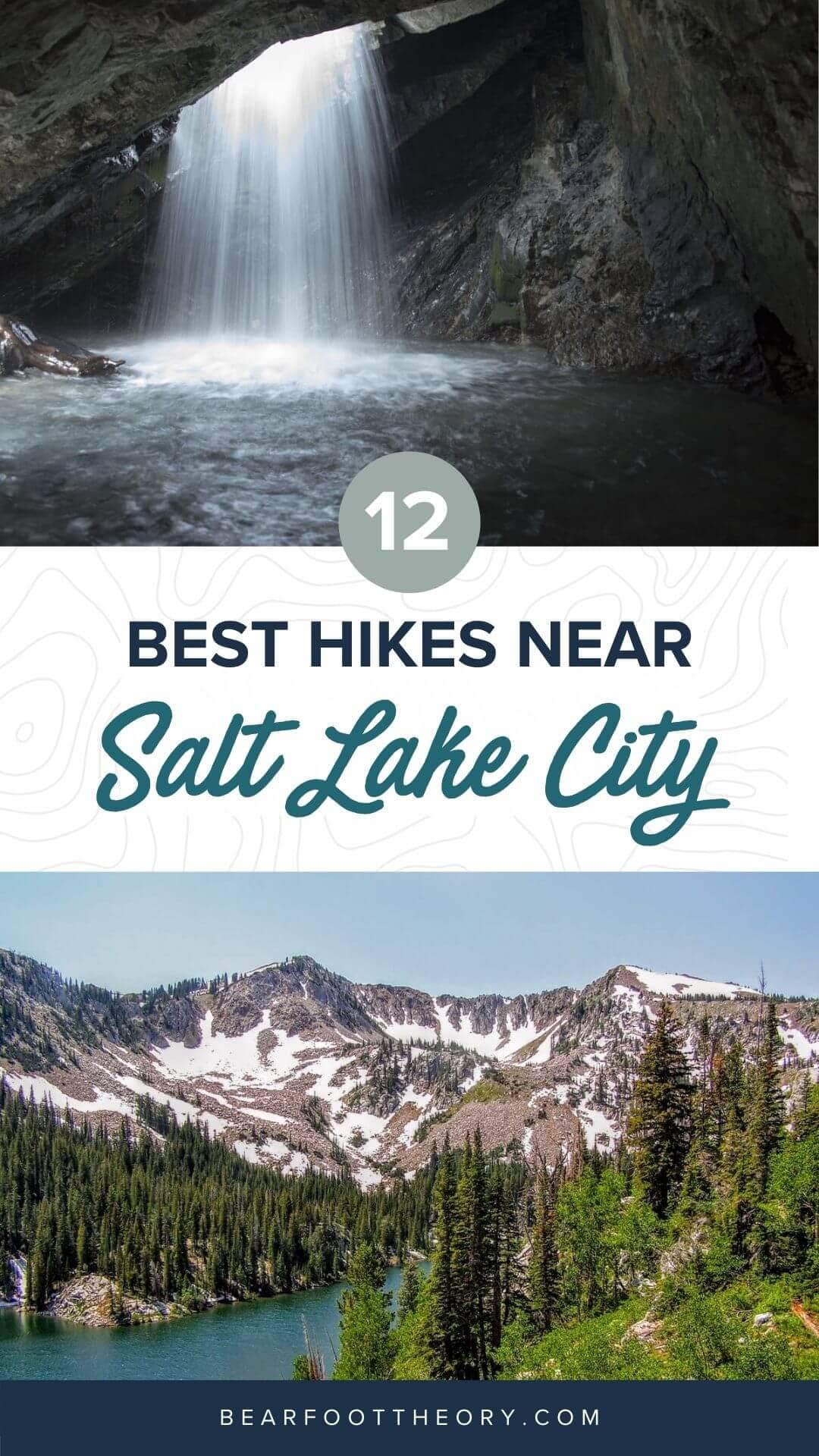
12 Best Hikes Near Salt Lake City
Learn about 12 of the best Salt Lake City hikes from alpine lakes to peaks to waterfalls including trail stats and trailhead info.
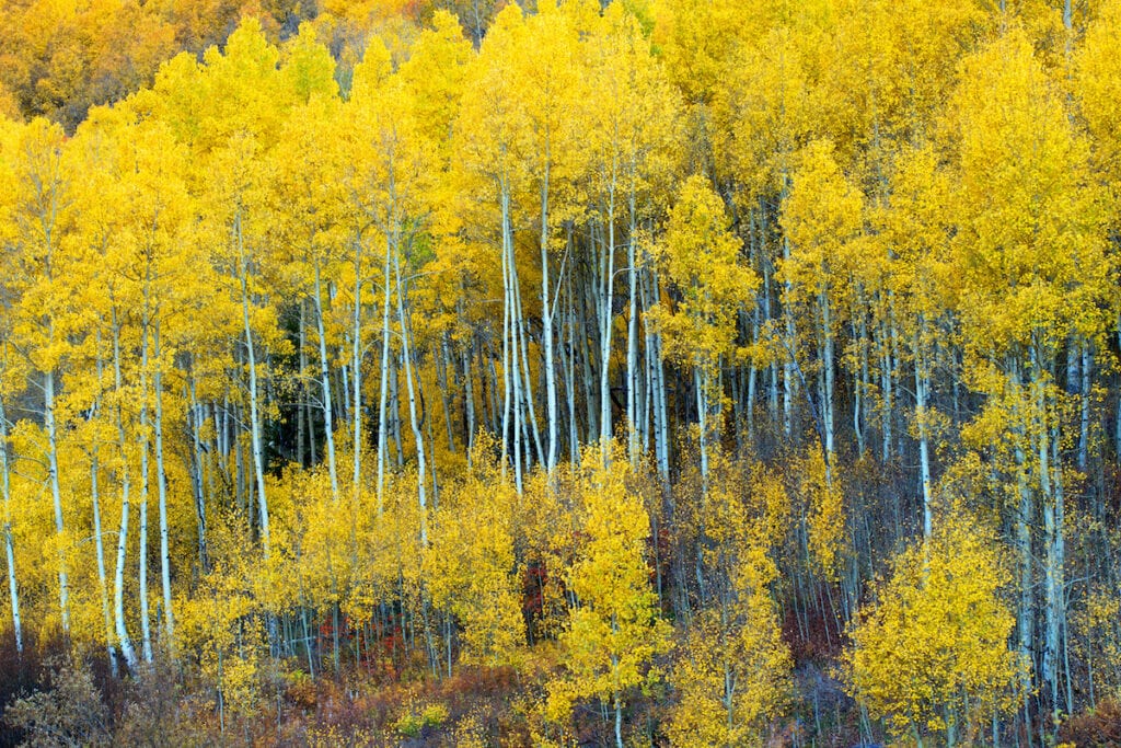
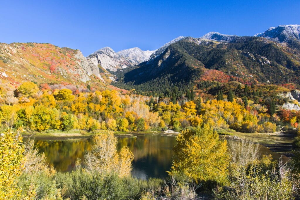
From alpine lakes to gorgeous waterfalls to epic peaks, there are endless hiking trails to explore near Salt Lake City. Located in the heart of the Wasatch Mountains, you’ll be treated to fields of alpine wildflowers in the heart of summer and bright yellow aspen trees in the fall.
While Utah is home to 5 National Parks and known for its red desert canyons, there is so much more to explore in the state. I’ve called Salt Lake City home for over 5 years and in this guide, I outline my favorite trails in the Salt Lake City area.
This post may contain affiliate links.
Looking to hit the trail? We’ve rounded up the best hikes in Salt Lake City so you can easily plan your next adventure.
As it goes in all of the destinations we share, please practice good trail etiquette and remember to Leave No Trace. This means packing out all of your garbage, being respectful to others on busy trails, and following the established rules.
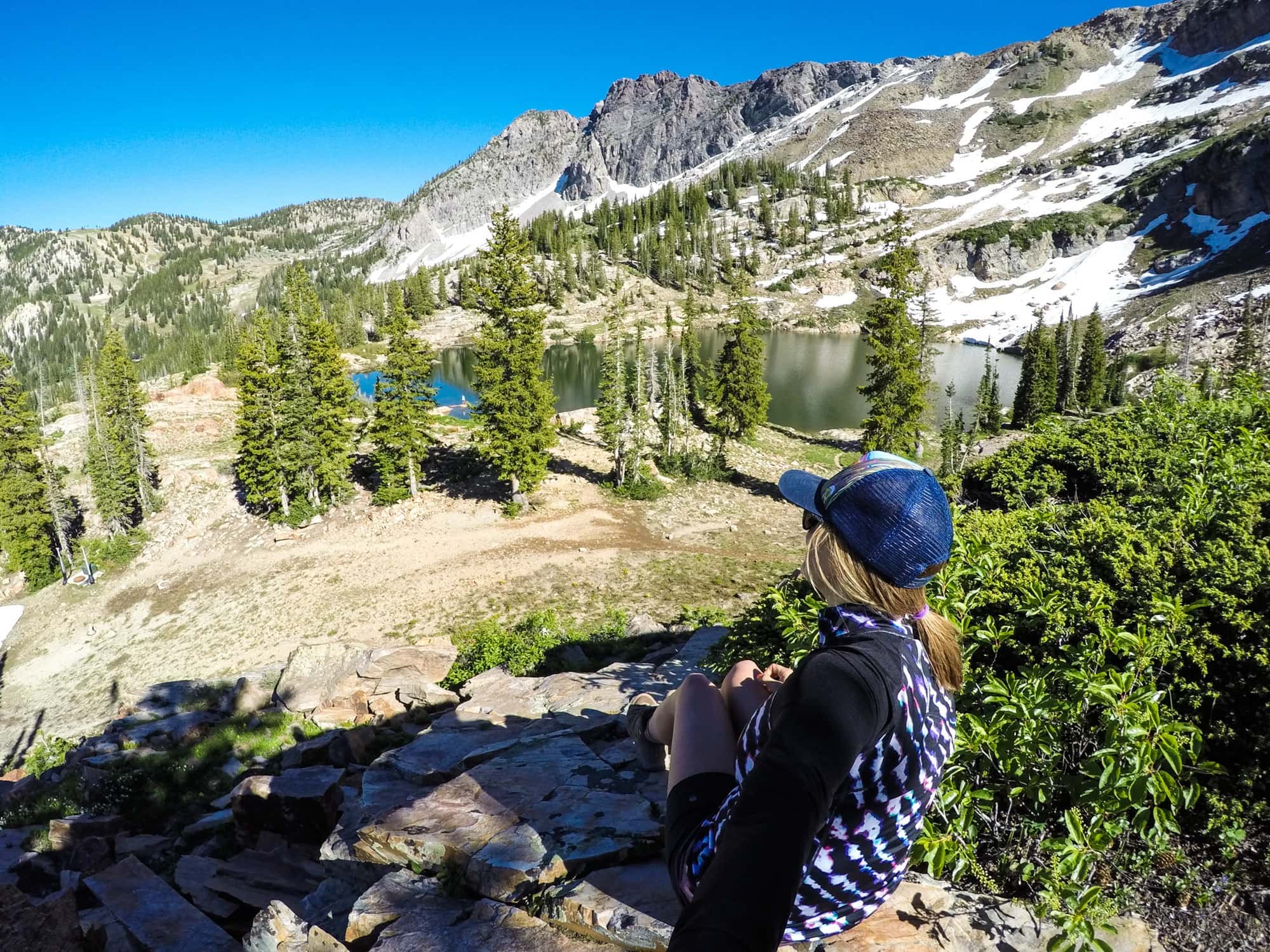
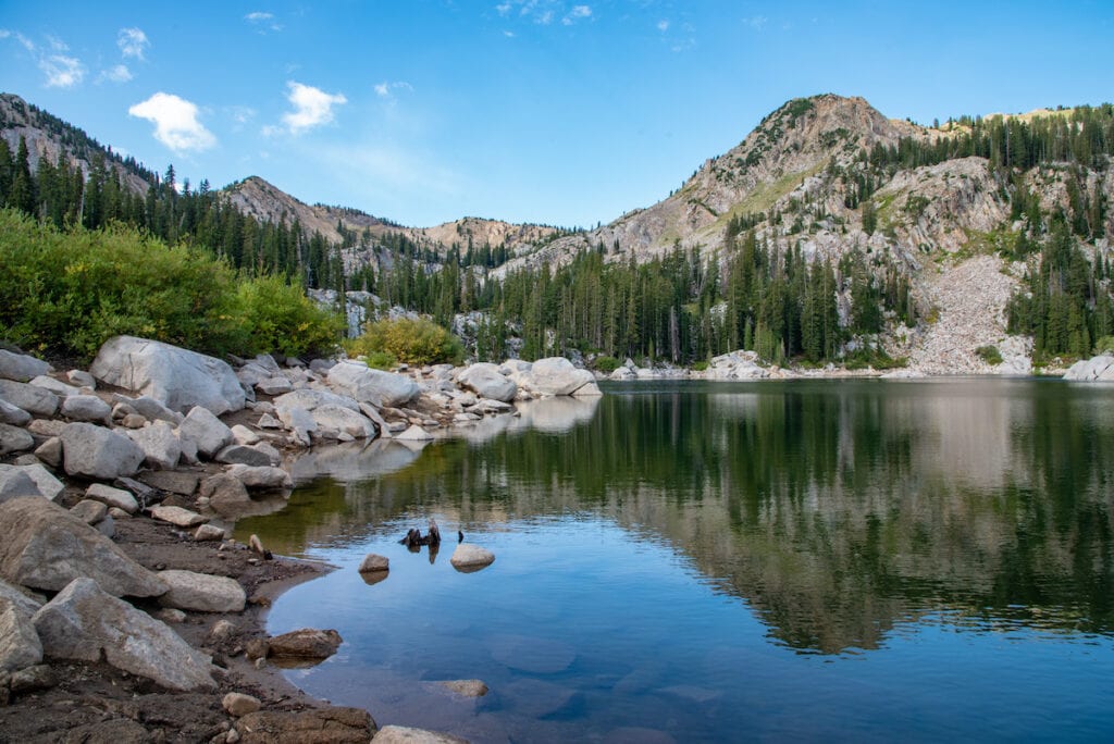
Best Lake Hikes Near Salt Lake City
When Salt Lake City summer temperatures hit 90 degrees, why not head to the mountains and cool down on the shores of these beautiful alpine lakes? These hikes can be done as day hikes or overnight backpacking trips. Please note that swimming is not allowed at any of these lakes because they feed the Salt Lake City watershed.
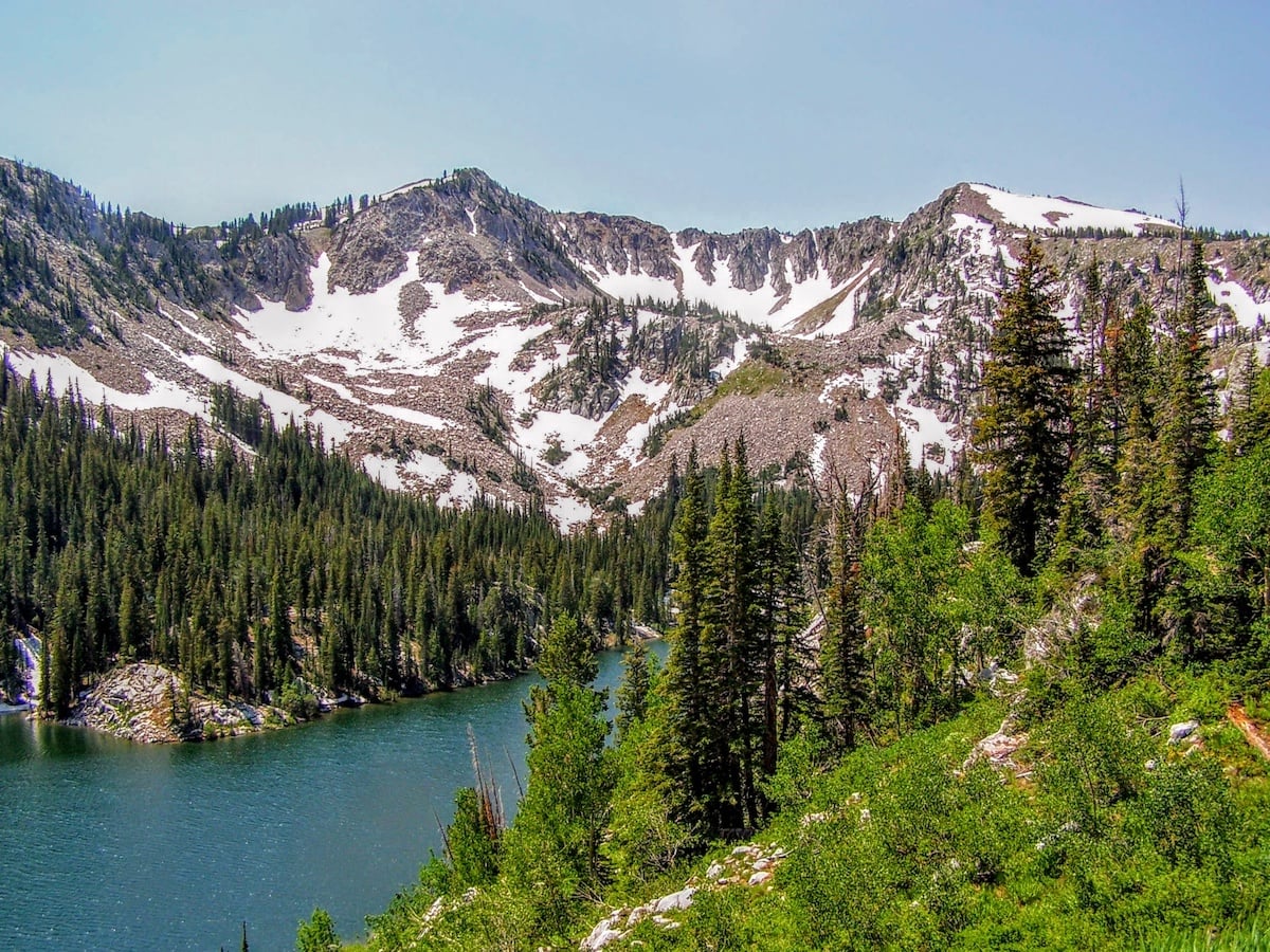
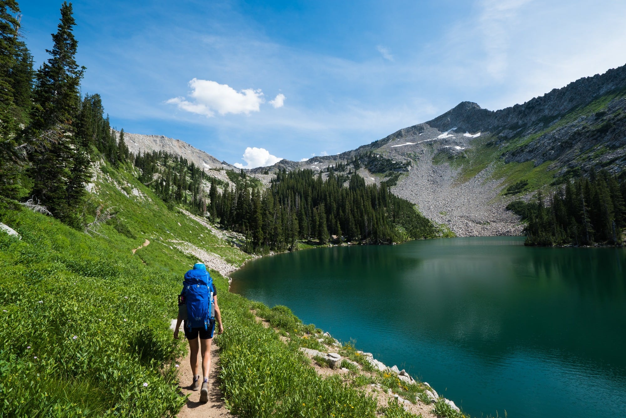
Red Pine Lake
- Distance: 6.8 miles roundtrip
- Elevation Gain: 2000 feet
- Time: 4 hours
- Difficulty: Hard
- Trailhead start: Red/White Pine Trailhead
- Dogs Allowed: No
The hike to Red Pine Lake begins at the White Pine Lake trailhead and starts by moving gently up through a grove of aspen trees. Once you are at Red Pine Lake, you can decide to continue upwards to Upper Red Pine Lake. To find Upper Red Pine Lake you’ll need to hike the stream that flows into Lower Red Pine Lake. There is not a maintained trail between the two but you’ll see a hiker-made trail that connects the two. For the full trail description and tips for overnight backpacking at Red Pine Lake, see my detailed Red Pine Lake Trail guide.
Interested in checking out even more? From the lower lake, it is about a 1.5-mile climb to the top of the Pfeifferhorn, a popular 11,326-foot summit, and Salt Lake City’s 3rd highest peak. You can read our guide to hiking to the Pfeifferhorn here.
Read next: Best Utah Backpacking Trips
White Pine Lake
- Distance: 10.7 miles roundtrip
- Elevation Gain: 2700 feet
- Time: 5 hours
- Difficulty: Hard
- Trailhead start: Red/White Pine Trailhead
- Dogs Allowed: No
The hike to White Pine Lake starts out on the same trail as Red Pine Lake. After crossing the first footbridge over Little Cottonwood Creek the trail forks. Go left here and climb up towards White Pine Canyon. After a mile when you come to the next junction, you’ll come to a stream. Do not cross that stream. Instead, head up to the left and continue on the old 4WD jeep road (which is no longer open to cars). This will climb up and is very easy to follow. Stay on this until you reach White Pine Lake, and enjoy the awesome views along the way!
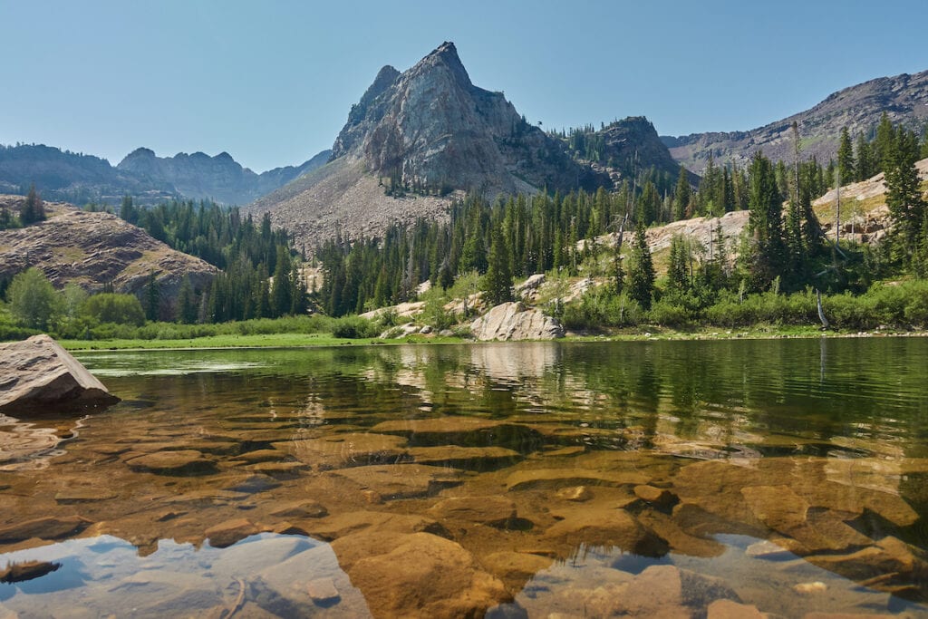
Lake Blanche
- Distance: 6.8 miles roundtrip
- Elevation Gain: 2800 feet
- Time: 3 hours
- Difficulty: Moderate/Hard
- Trailhead start: Lake Blanche Trailhead
- Dogs Allowed: No
Don’t miss this absolutely incredible alpine lake that sits under Sundial Peak. We love this hike due to its shaded start amidst mighty oak and aspen trees. The trail to Lake Blanche also offers incredible views of the Salt Lake Valley as you get higher up. The trail is easy to follow, except for one section where you cross a very short boulder field. When you get here look for cairns if you can’t find the trail. Once you are at Lake Blanche, If you’re up for exploring more you can also access Florence and Lillian Lakes on short, spur trails that lead to the right along the dam.
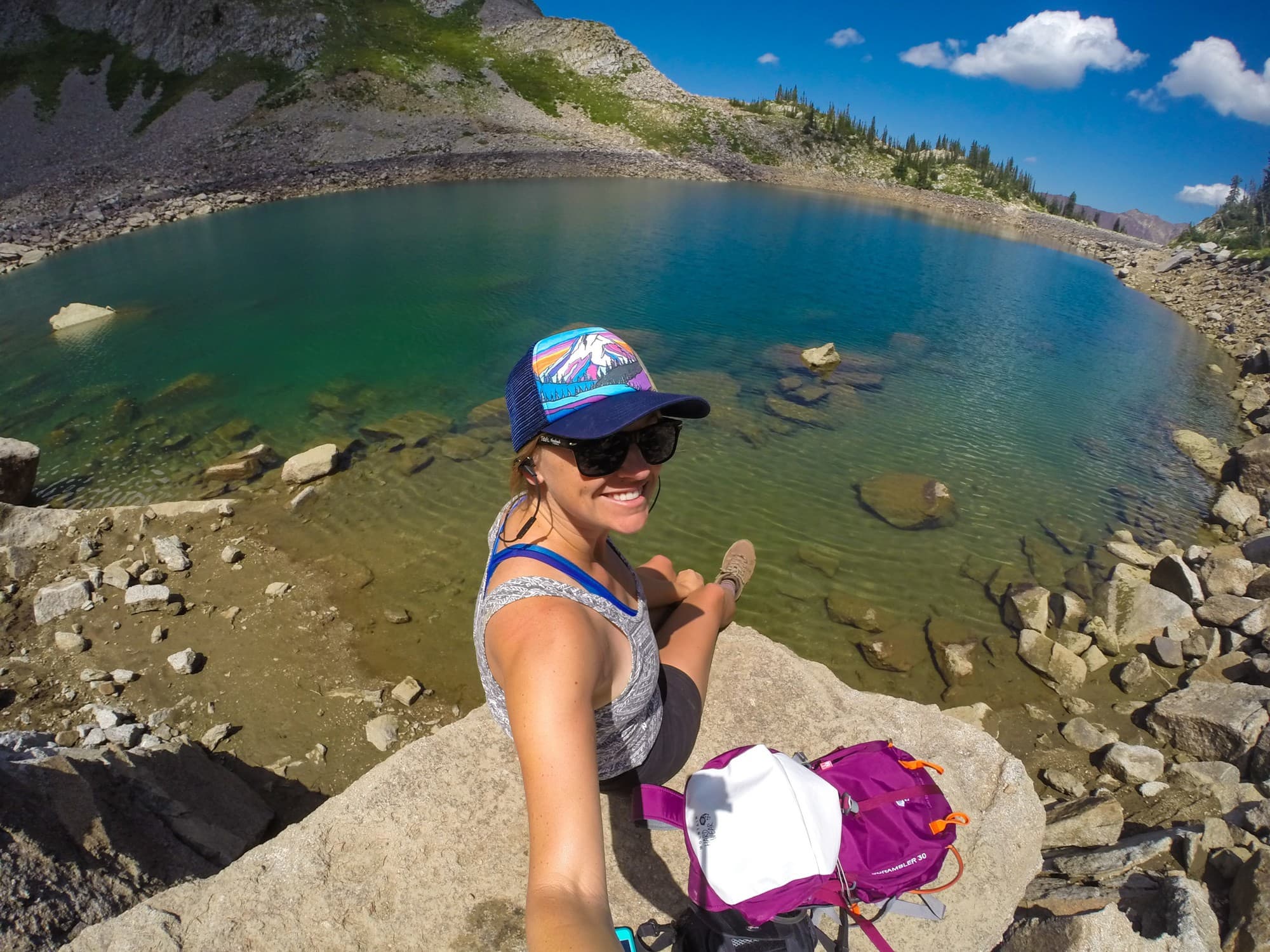
Cecret Lake
- Distance: 2 miles roundtrip
- Elevation Gain: 300 feet
- Time: 1 hour
- Difficulty: Easy
- Trailhead start: Cecret Lake Trailhead
- Dogs Allowed: No
Arguably a right of passage for all Salt Lake City residents, this Alta Ski Area hike is an easy way to kill an afternoon in the Wasatch Mountains. The trail to Cecret Lake is known for incredible wildflowers and the occasional moose sighting (I saw 3 when I went!). From the lake, you can also climb to the top of Sugarloaf Peak for an incredible sunset vista. Or alternatively, for a longer hike, you can also start at the Albion Meadows Trail at the lower parking lot.
Lake Mary, Martha, & Catherine
- Distance: 5.4 miles roundtrip
- Elevation Gain: 1200 feet
- Time: 3-4 Hours
- Difficulty: Easy/Moderate
- Trailhead start: Lake Mary Trailhead
- Dogs Allowed: No
Why hike to one lake when you could hike to three? Lake Mary is first, then Lake Martha (which is the smallest), and finally, Lake Catherine which is almost completely surrounded by mountain peaks–definitely worth going to the end. The further you go, the more solitude you’ll have, but if you don’t have time, even the quick hike to Lake Mary makes for a great afternoon.
And if three lakes aren’t enough for you, just to the south of Lake Catherine is Sunset Peak which you can access by a 0.6 mile trail that gains 708 feet. I went up there for sunset last summer, and the views were incredible.
Willow Lake
- Distance: 2.4 miles roundtrip
- Elevation Gain: 600 feet
- Time: 1 hour
- Difficulty: Easy
- Trailhead start: Willow Heights Trailhead
- Dogs Allowed: No
Willow Lake is one of the most family-friendly, easy hikes near Salt Lake City. Winding through a shady aspen forest, you will reach the picturesque lake in 3/4 of a mile – continue onward around the lake for an easy stroll. Willow Lake is especially gorgeous in the fall when all the leaves turn yellow!
There is no signage or large parking area, so it’s easy to miss the trailhead without GPS. Just past the end of an area with homes and businesses, the road bends to the left. Look for a 35-mph speed limit sign facing toward down-canyon traffic, which is located at the trail entrance. There is a small stone monument designating the Willow Heights conservation area — this is the beginning of the trail.
Bell Canyon to Lower Falls
- Distance: 4.6 miles roundtrip
- Elevation Gain: 1400 feet
- Time: 3-4 hours
- Difficulty: Moderate
- Trailhead start: Bell Canyon Granite Trailhead
- Dogs Allowed: No
Bell Canyon is a relatively short (but challenging!) hike in the Wasatch Mountains. Not only does this hike include a lake, but it also leads to a gorgeous cascading waterfall. Once you reach the Bell Canyon Lower Reservoir, you will continue up a steep, rocky path to reach the Lower Falls. This is a great place for a lunch break! Throughout this hike, you will have amazing views of the surrounding canyon and the city below. Be aware that rattlesnakes frequent this area, especially around dusk in the summer.
Save this post!
Enter your email & I'll send this post to your inbox! You'll also receive my weekly newsletter full of helpful advice for planning your adventures.
Best Waterfall Hikes Near Salt Lake City
Donut Falls
- Distance: 1.5 miles roundtrip
- Elevation Gain: 300 feet
- Time: 45 minutes
- Difficulty: Easy
- Trailhead start: End of FR019 (40.63956, -111.65127)
- Dogs Allowed: No
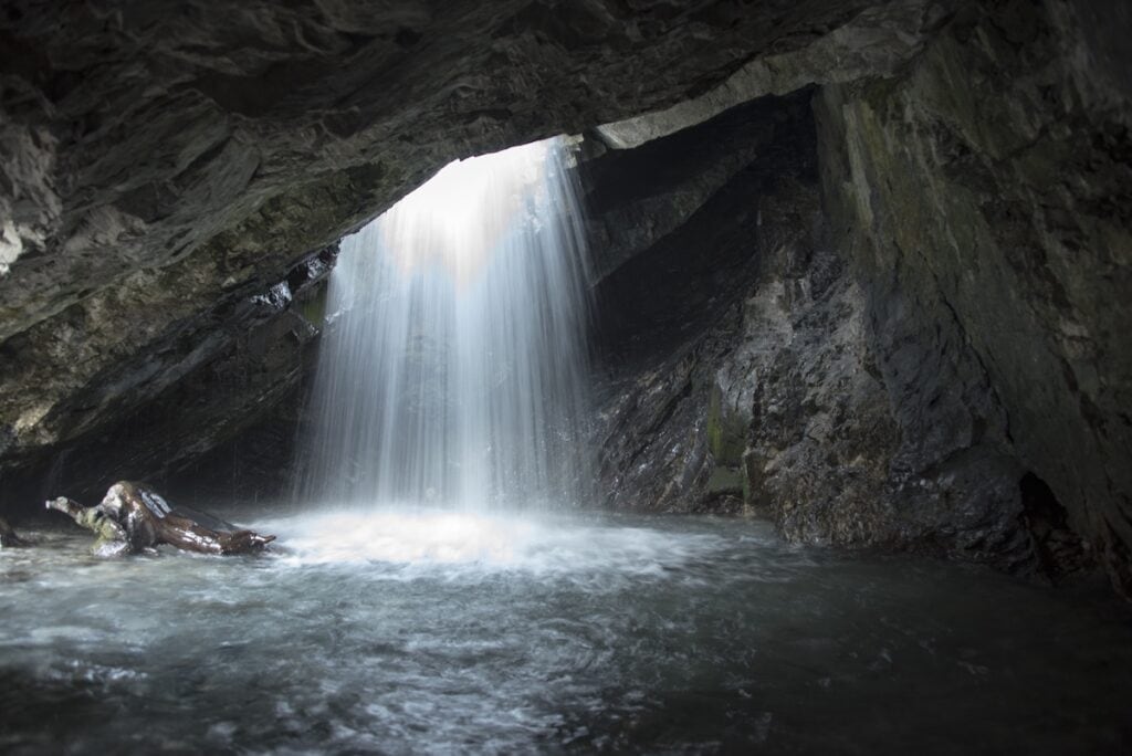
Donut Falls is a great easy hike near Salt Lake City – perfect for families or a leisurely stroll. There are tons of waterfall hikes in Utah – but only this one drops into a cave. Years of erosion caused a donut-shaped hole in the rock where water now cascades down – a very unique thing to see!
This hike is extremely popular, so get an early start to beat the crowds and find a parking spot.
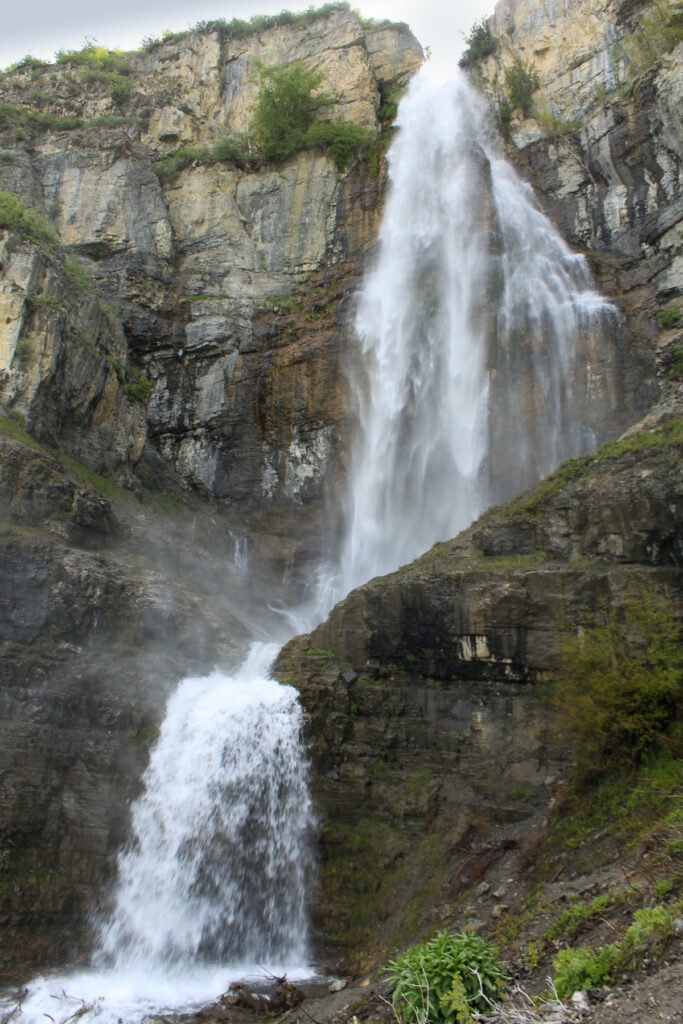
Stewart Falls
- Distance: 3.4 miles roundtrip
- Elevation Gain: 600 feet
- Time: 1.5-2 hours
- Difficulty: Moderate
- Trailhead start: Aspen Grove Parking Lot
- Dogs Allowed: Yes
Stewart Falls is a 200-foot two-tier cascading waterfall located about an hour south of downtown Salt Lake. As you hike through the forest, you’ll see the east side of Mt. Timpanogos. This hike is best during early summer when there is fresh snowmelt or during fall when the aspens turn bright yellow.
Parking at the Aspen Grove parking lot requires a $6 entry fee (as of September 2021, valid for 3 days), paid at a tollbooth on the Alpine Scenic Loop.
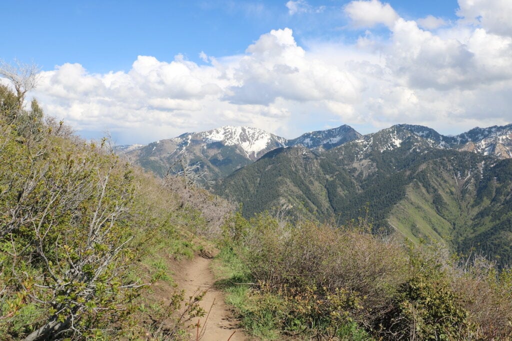
Best Peak Hikes Near Salt Lake City
Grandeur Peak East via Church Fork
- Distance: 5.9 miles roundtrip
- Elevation Gain: 2300 feet
- Time: 4 hours
- Difficulty: Hard
- Trailhead start: Grandeur Peak via Church Fork Trailhead Picnic Area
- Dogs Allowed: Yes – off-leash on odd-numbered days, on-leash on even-numbered days
With jaw-dropping views along the trail and at the summit, it’s no wonder this hike is called “Grandeur”. While this hike can be done at any time of day, we recommend you wake up and hit the trail at sunrise for gorgeous views and a mostly shaded trail. You’ll be watching the sunrise above the treeline!
You can access Grandeur Peak from the east (our recommendation here) or from the west, and although the west trail is slightly shorter in distance at 4.4 miles, you gain an additional 1000 feet in elevation, making it a much tougher climb.
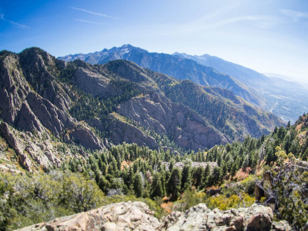
Mount Olympus
- Distance: 7.8 miles roundtrip
- Elevation Gain: 4100 feet
- Time: 6+ hours
- Difficulty: Hard
- Trailhead start: Mt. Olympus Trailhead
- Dogs Allowed: Yes
Mt. Olympus is a grueling trail that climbs over 4,000 feet and is best for experienced hikers. This is definitely a bucket list hike but it requires adequate physical and mental preparation. The last mile ascends 2000 feet and includes a lot of scrambling. Pack PLENTY of water as this trail is fully exposed and gets hot during the summer. Trekking poles are also highly recommended.
Those who decide to tackle Mt. Olympus will be rewarded with amazing views over Salt Lake City and the Wasatch Mountains – plus bragging rights.
Desolation Overlook
- Distance: 5.2 miles roundtrip
- Elevation Gain: 1300 feet
- Time: 2-3 hours
- Difficulty: Moderate
- Trailhead start: Thaynes Canyon Trailhead
- Dogs Allowed: Yes, on leash
This is one of our top picks for dog-friendly trails near Salt Lake City. Desolation Overlook weaves through beautiful Millcreek Canyon and during the summer season, expect to see abundant wildflowers. Unlike most other trails nearby, the trail leading to Desolation Overlook allows dogs on leash!
If you are looking for solitude, the Desolation Overlook has several off-shoot trails.

Have you hiked any of these trails or do you plan to? Let us know in the comments below!
These hikes look absolutely beautiful! Sometimes I wished I lived by Salt Lake City or at least on the West Coast! But for now, New England will do.
Kim
http://www.simplylovebirds.com
So many lakes, so many magnificent sunsets and views! Your articles spur my imagination to thinking I could be there, I wish I were there! Hiking in these beautiful areas would be a trip of a lifetime. Thanks so much for sharing your experiences! This surely puts the Salt Lake City area on my bucket list.
We’ve been road tripping the US for 11 months and are just getting to SLC! We will probably be here for a little under a week, look forward to checking out Lake Blanche and/or Cecret. Pfeifferhorn summit is on the top of our list, thanks for the helpful trekking details!
Hello,nice share.
Hi Kristen, thanks for making this website. It helped me find a great hike in the spare half-day I had while staying in Salt Lake City. (Hiked up to the lower waterfall at Bell Canyon.) Cheers! Keith.
Hi Keith, glad to hear it! That’s a great hike 🙂 Thanks for reaching out.
We are planning to camp at Wasatch Mountain State Park and Deer Creek State Park during the last week of September and the first week of October with our campervan. From the two state parks we plan on accessing and hiking several of the trails in the Wasatch front. Is the last week of September and first week of October a good time to experience the fall colors on trails in the Wasatch front?
Hi Darryl, it’s hard to predict exactly when fall colors will peak in Utah, but typically late-Sept to mid-Oct is a great time to be here for fall foliage. Enjoy your trip!
I am traveling to SLC for work next week and plan to take a day and hike around Secret Lake and Devil’s Castle. I’m pretty pumped!
Enjoy your hike!
I will spend 8 week in Salt Lake City , i arrive from Denmark mid september and stay to start november , looking forward to use you experience. Thanks a lot