Trail Guide: Climbing the Pfeifferhorn in Salt Lake City
Reap big rewards & wide open views by hiking to the summit of the Pfeifferhorn – one of the tallest peaks in Salt Lake City’s Wasatch Range.
I’ve never been much of a peak bagger. Something about it has always seemed intimidating. Maybe I felt like I wasn’t in good enough shape or maybe the idea of it just sounded dangerous. Either way, I let those sentiments get in my way.
But when I moved to Salt Lake City which is surrounded by big mountains, I thought it was about time to tackle some of these fears head-on.
Shortly after moving here, a friend of mine suggested that we climb the Pfeifferhorn, which is one of the tallest peaks in Utah’s Wasatch Range at 11,326 feet and one of the most popular peaks in the Salt Lake Region. Getting to the summit requires some scrambling and a steep final push, but no technical equipment is needed. You also pass by Red Pine Lake, a gorgeous alpine lake basin in Little Cottonwood Canyon. It sounded like a good and reasonable challenge for my first Utah summit, so I said let’s go for it!
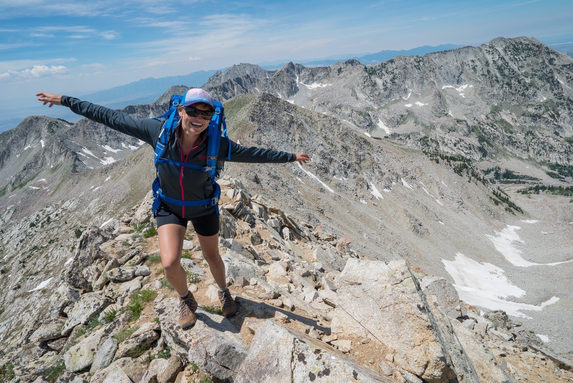
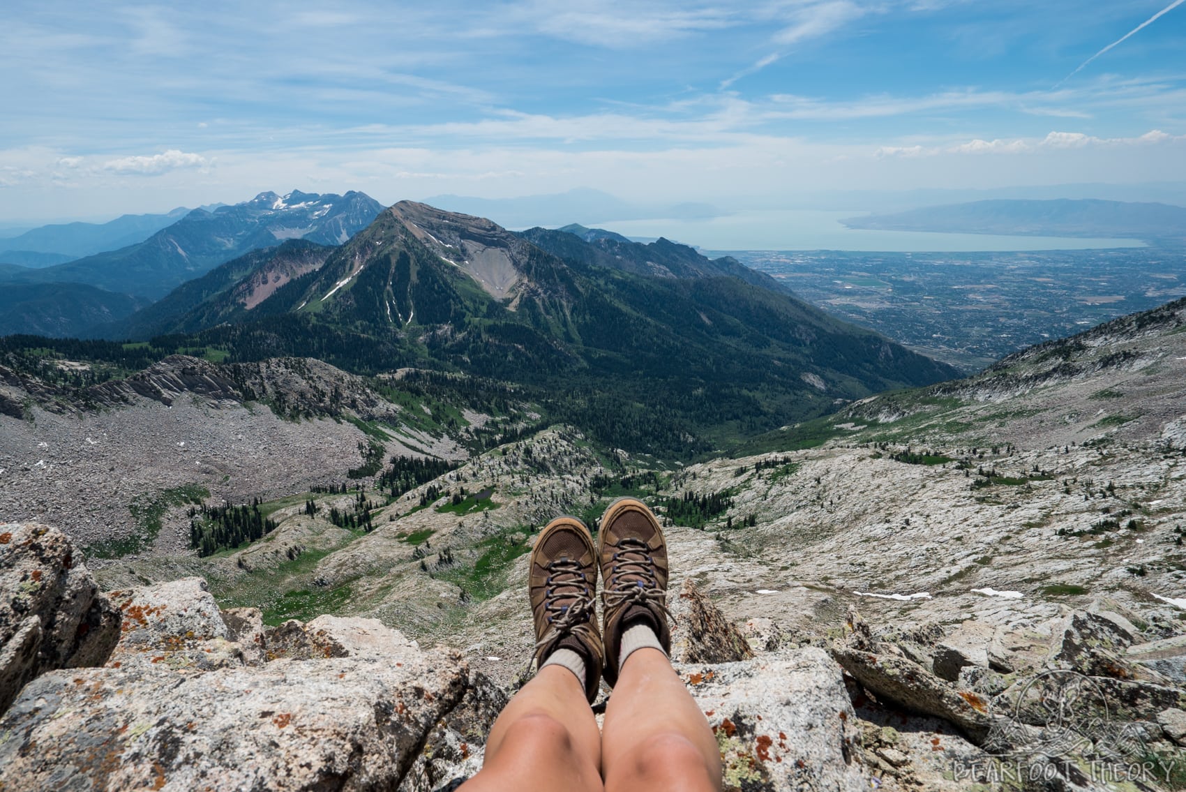
Now, fast forward to that moment when I reached the summit…. what an incredible feeling! Standing on my first Utah peak got me so excited about my new outdoor playground. Between the high altitude, the steep ascent, and a small amount of scrambling, the Pfeifferhorn provided a reasonable amount of mental and physical challenge with big rewards.
Whether you are in Salt Lake for vacation or you are a local who wants to start bagging some peaks, the Pfeifferhorn is quickly accessible with an amazing payoff, and if I can do it, you can too! In this post, I share all of the information you need to make it to the top.
This post may contain affiliate links.
Pfeifferhorn Trail Stats
Trail Basics
Getting to the trailhead
From Salt Lake City, take I-80 and merge onto I-215 S. Continue on I-215 S for 5 miles and take exit 6 onto 6200 S. Go left at the light and take 6200 S following signs to Alta Ski Area. After 4 miles, this road curves left up Little Cottonwood Canyon becoming Little Cottonwood Canyon road. Continue driving up the canyon for 5.5 miles.
Keep an eye out for signs on the right for the White Pine Lake Trailhead, and turn right into the large paved parking lot. If you get to Snowbird Ski Resort, you’ve gone too far.
Best time to hike Pfeifferhorn
The best time of year to summit Pfeifferhorn is June through October, depending on conditions. Some years, the snowpack will still be too deep in June while other years, the trail will be open.
There are some steep and narrow sections near the summit that could be very dangerous with ice and snow, so check the conditions before planning your hike.
Are dogs allowed?
Unfortunately, dogs are not allowed in Little Cottonwood Canyon where White Pine Trail is located. You’ll need to leave Fido at home.
Save this post!
Enter your email & I'll send this post to your inbox! You'll also receive my weekly newsletter full of helpful advice for planning your adventures.
Pfeifferhorn Trail Guide
White Pine Lake Trailhead to Red Pine Lakes
The hike to the summit of Pfeifferhorn begins at the White Pine Lake Trailhead. The trail starts with a gentle ascent up through a grove of aspen trees.
After about one mile, you reach a stream and a fork in the trail. The lower jeep trail goes up to White Pine Lake. Instead, you want to continue straight past the sign on Red Pine Trail.
About 400 feet after taking this junction, you will reach a bridge that crosses the stream. Beyond this, the trail is very easy to follow and continues rising up above the canyon and the Salt Lake Valley.
Gloria Falls: Just after the bridge crossing you’ll see a trail off to the left that leads to Gloria Falls. This is a nice detour if you have the time.
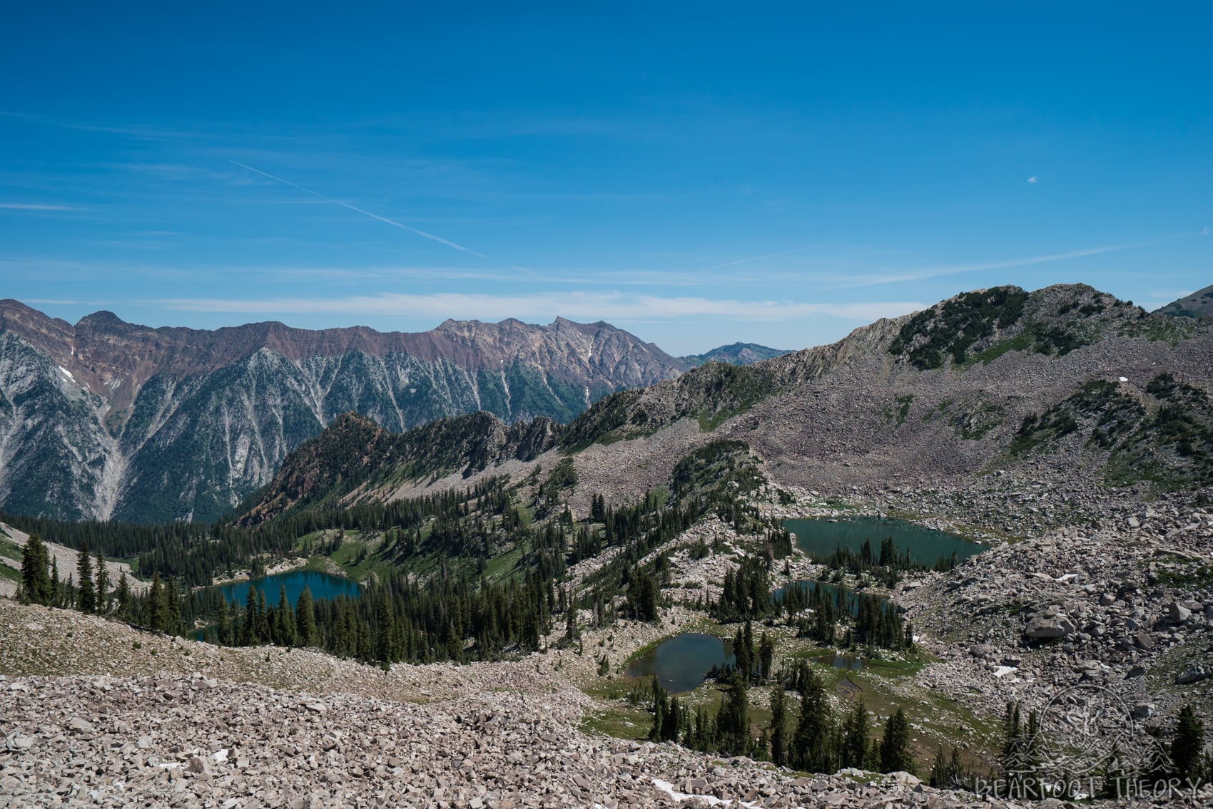
Depending on the load you are carrying, it should take about 2-3 hours to get to Red Pine Lake. Because these lakes provide water to Salt Lake City, no swimming or wading is allowed.
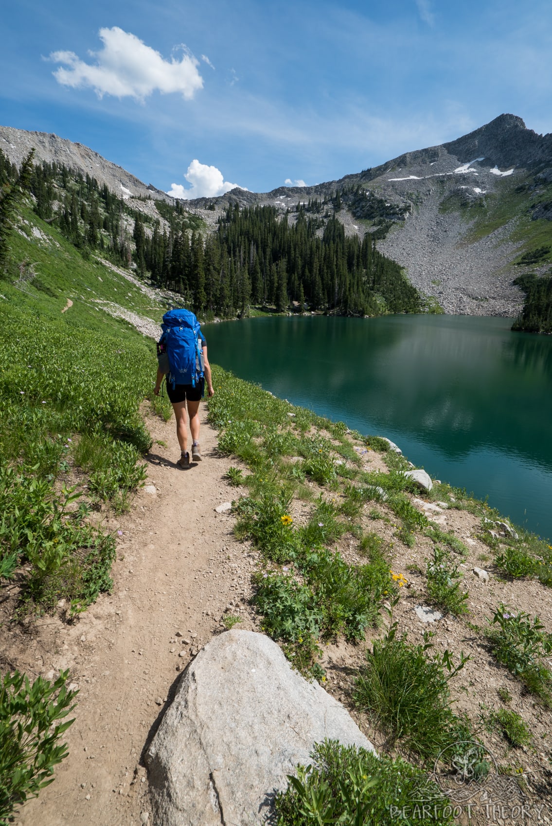
If you want to make an overnight trip out of your Pfeifferhorn summit, there are some really nice spots to camp around Red Pine Lake and Upper Red Pine Lake. You can have a nice relaxing night under the stars and then summit in the morning when your legs are fresh.
This is what we did and I highly recommend it if you have the time. Just be aware that this is a popular trail and can get very busy on the weekends. We opted to camp at Upper Red Pine Lake because it was a little quieter.
Quick tips for camping at Red Pine Lakes:
Read next: For more information about camping at Red Pine Lake, see my Red Pine Lake Backpacking Guide.
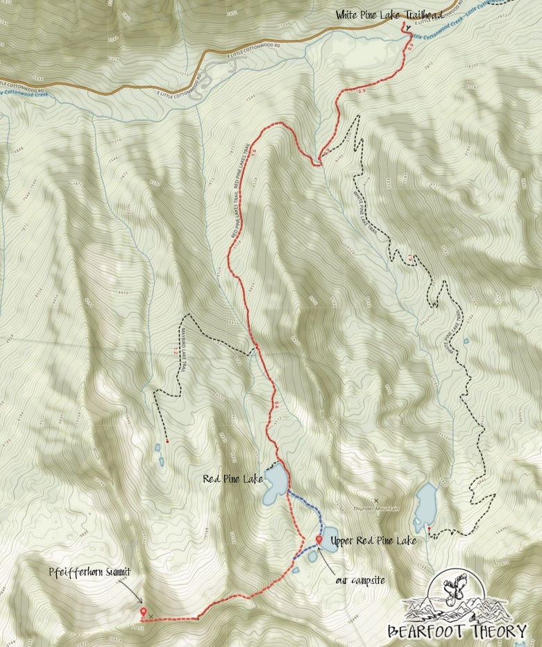
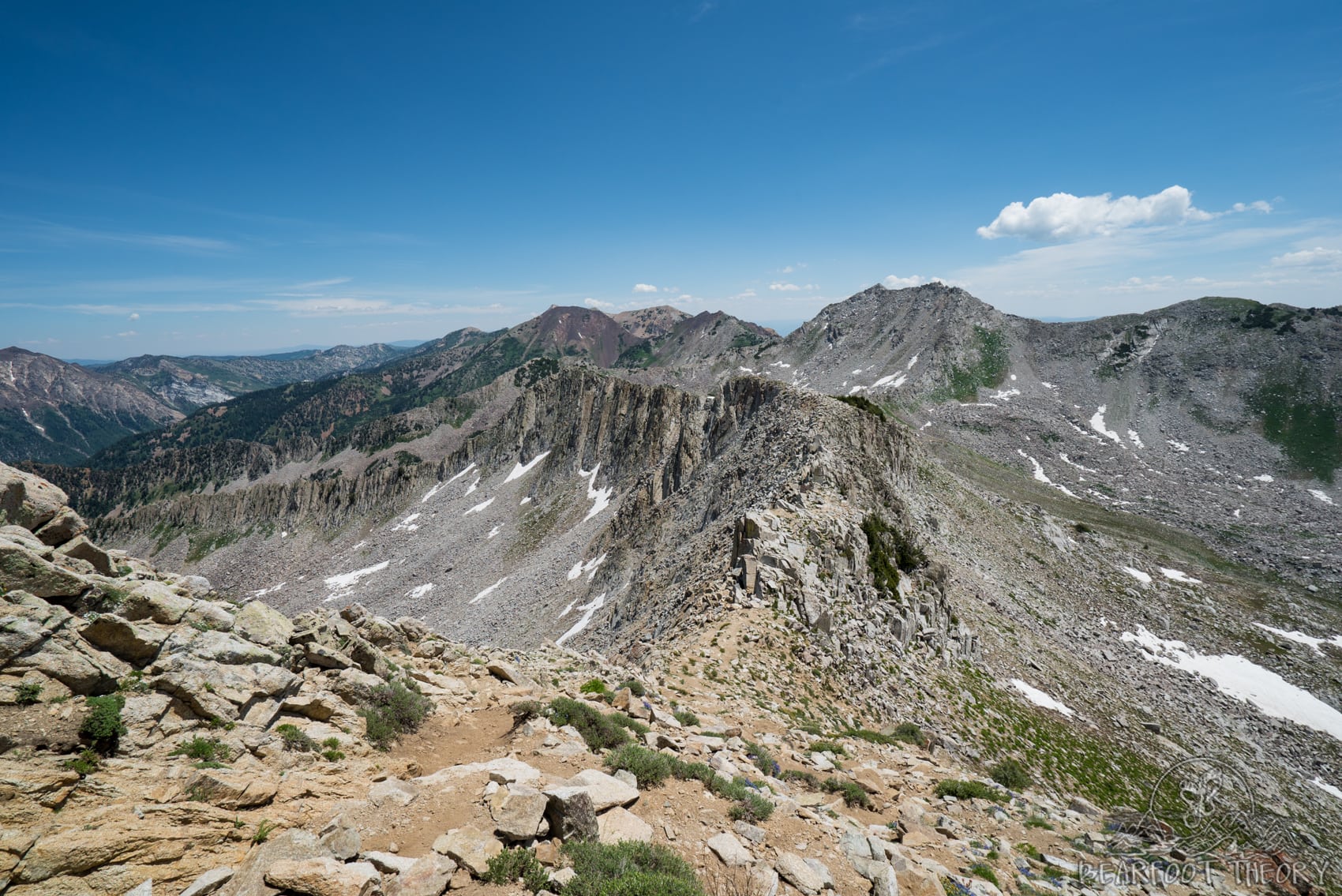
Red Pine Lake to the Pfeifferhorn Summit
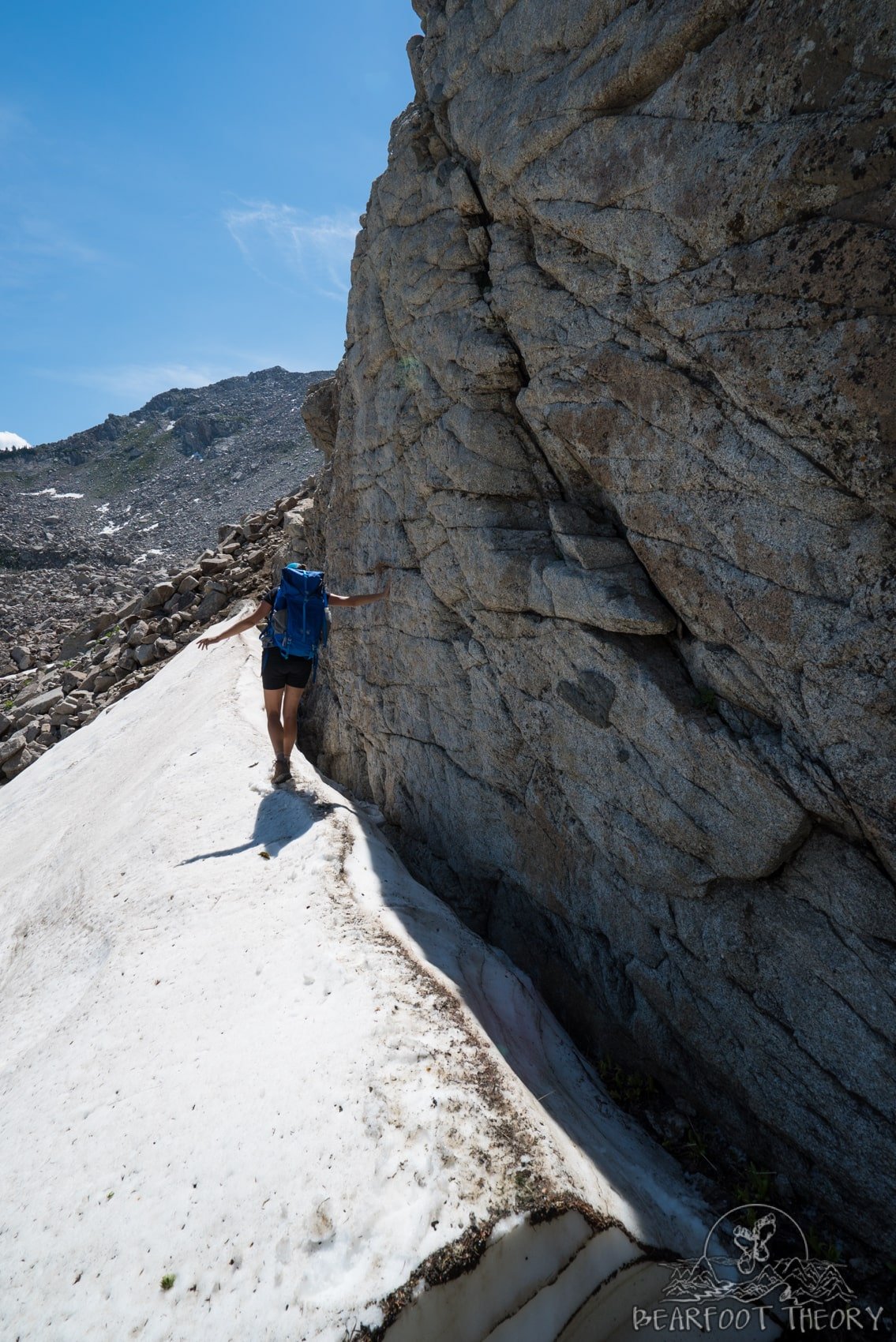
From Lower Red Pine Lake, the trail continues upwards from the southern edge of the lower basin. Once you come to the small pond, the trail continues a steep ascent towards the ridgeline. Before beginning this section, make sure you have enough water. Beyond these small ponds, there is no water available on the trail.
Because of where we camped at Upper Red Pine Lake, we had a little bit of trouble finding the trail up to the Pfeifferhorn. Rather than wander about, we just started walking up the boulder field towards the top of the ridge where we eventually met up with the Pfeifferhorn trail.
When we returned to our camp later in the day, we found the correct route which skirts the two small neighboring lakes on the north side (shown as the blue dotted line on the map above).
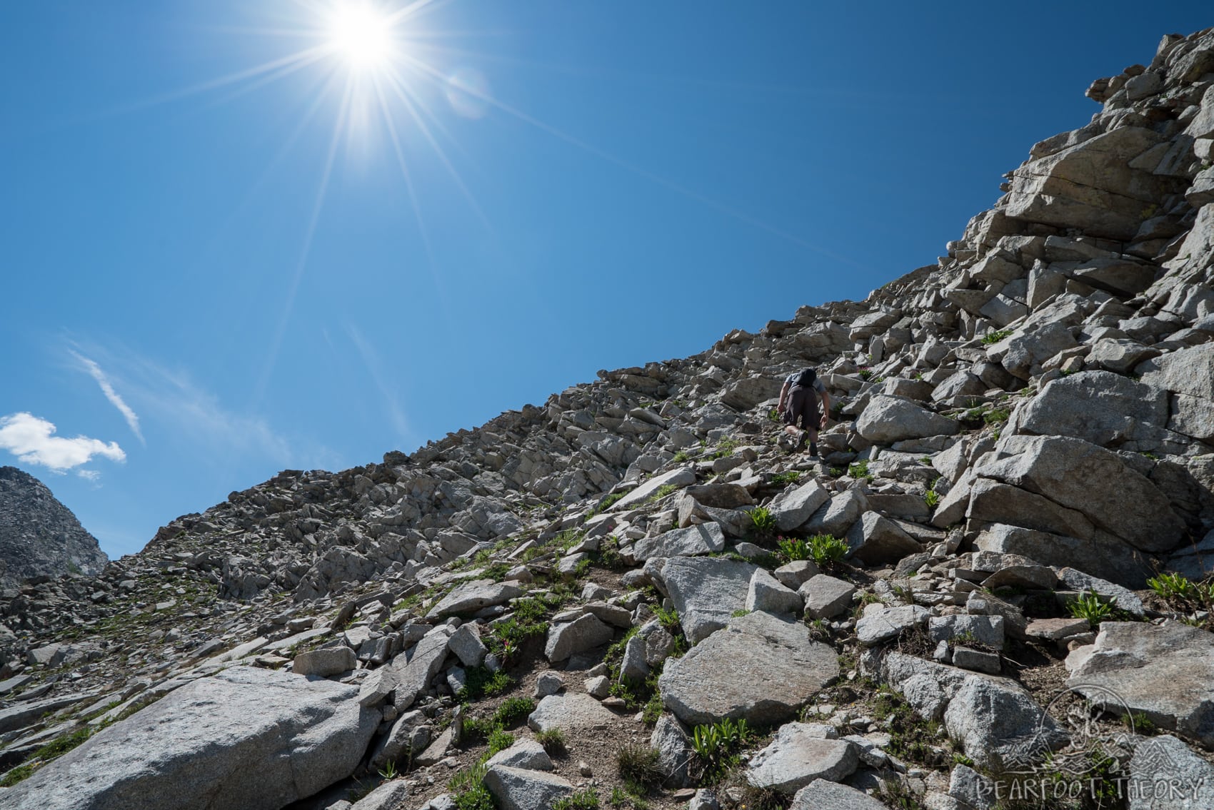
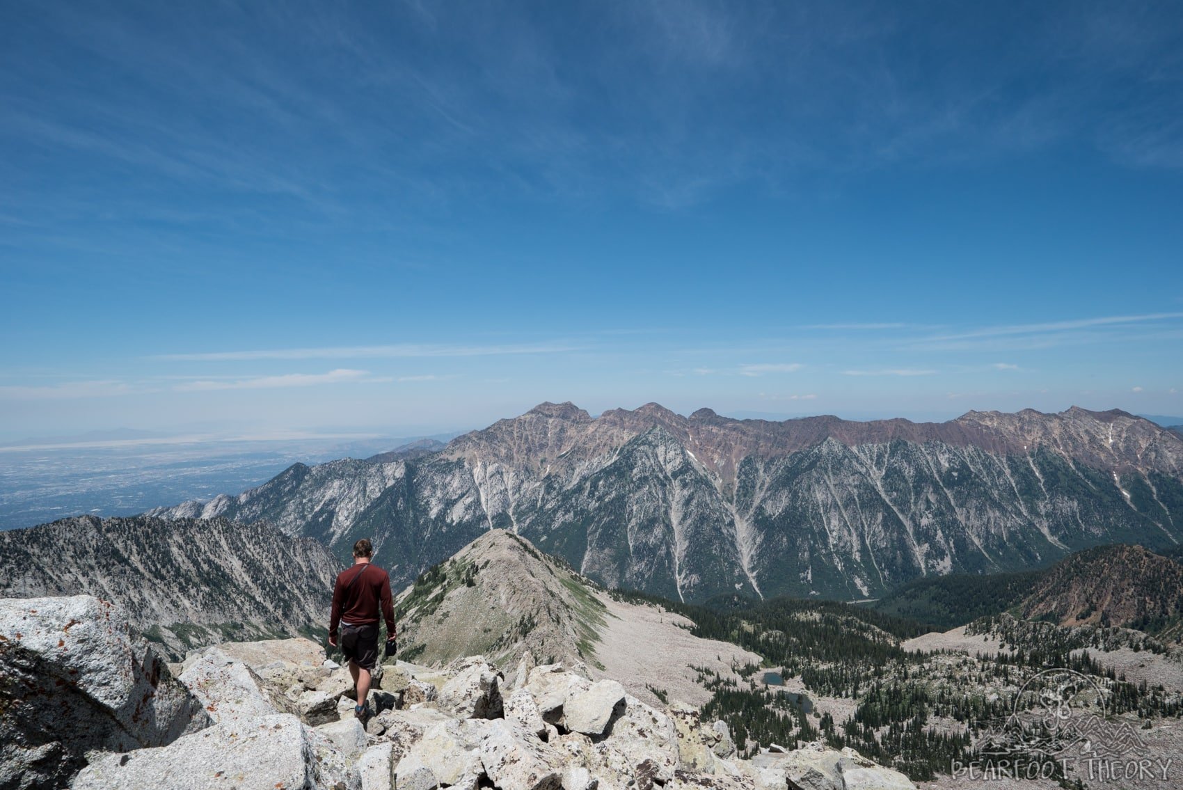
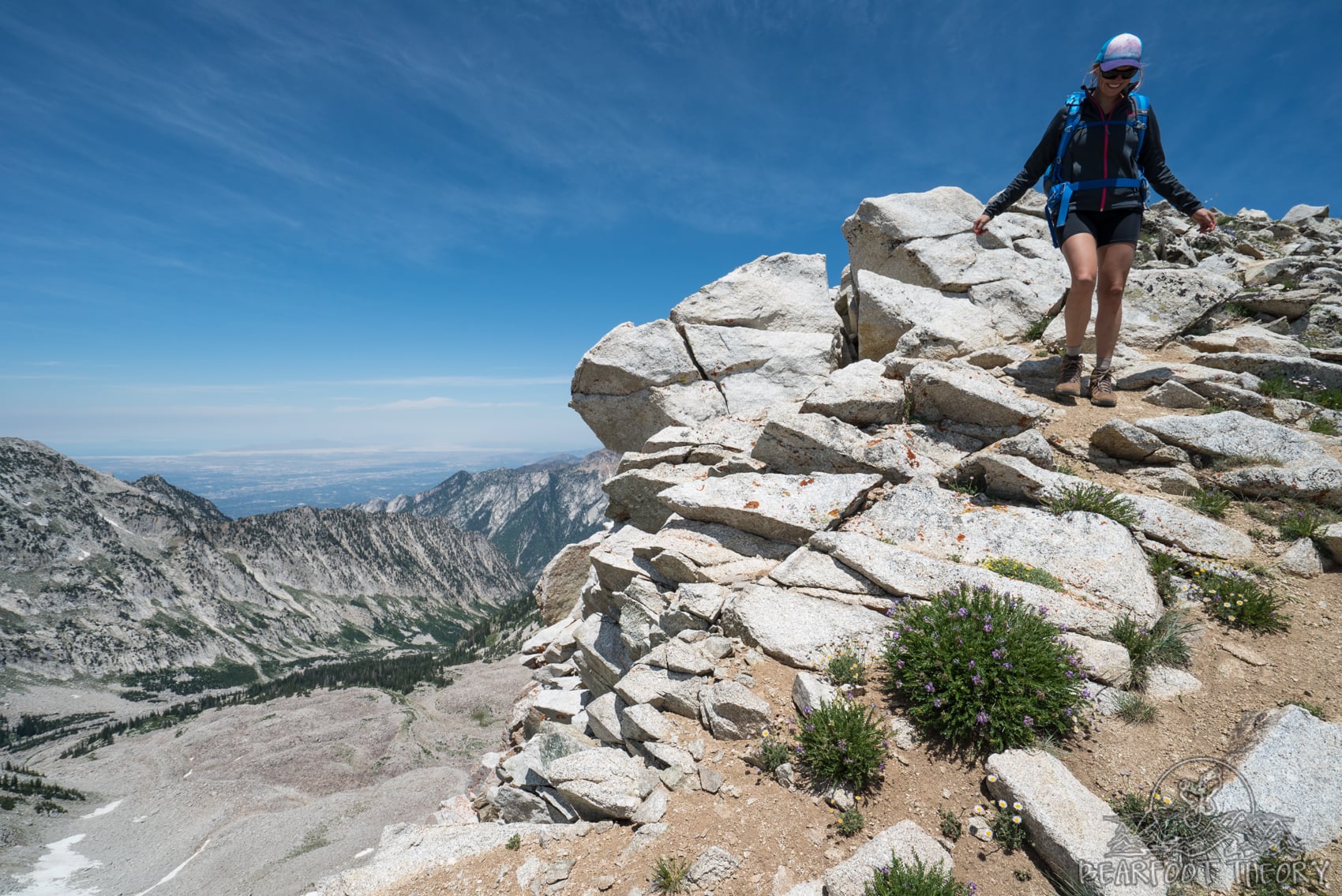
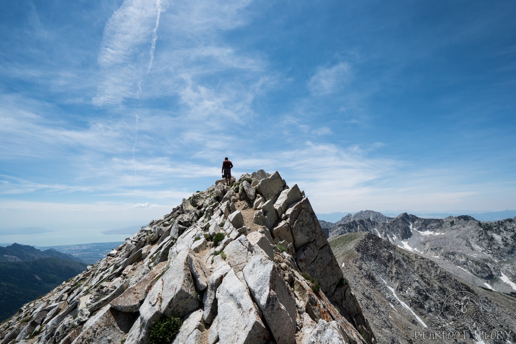
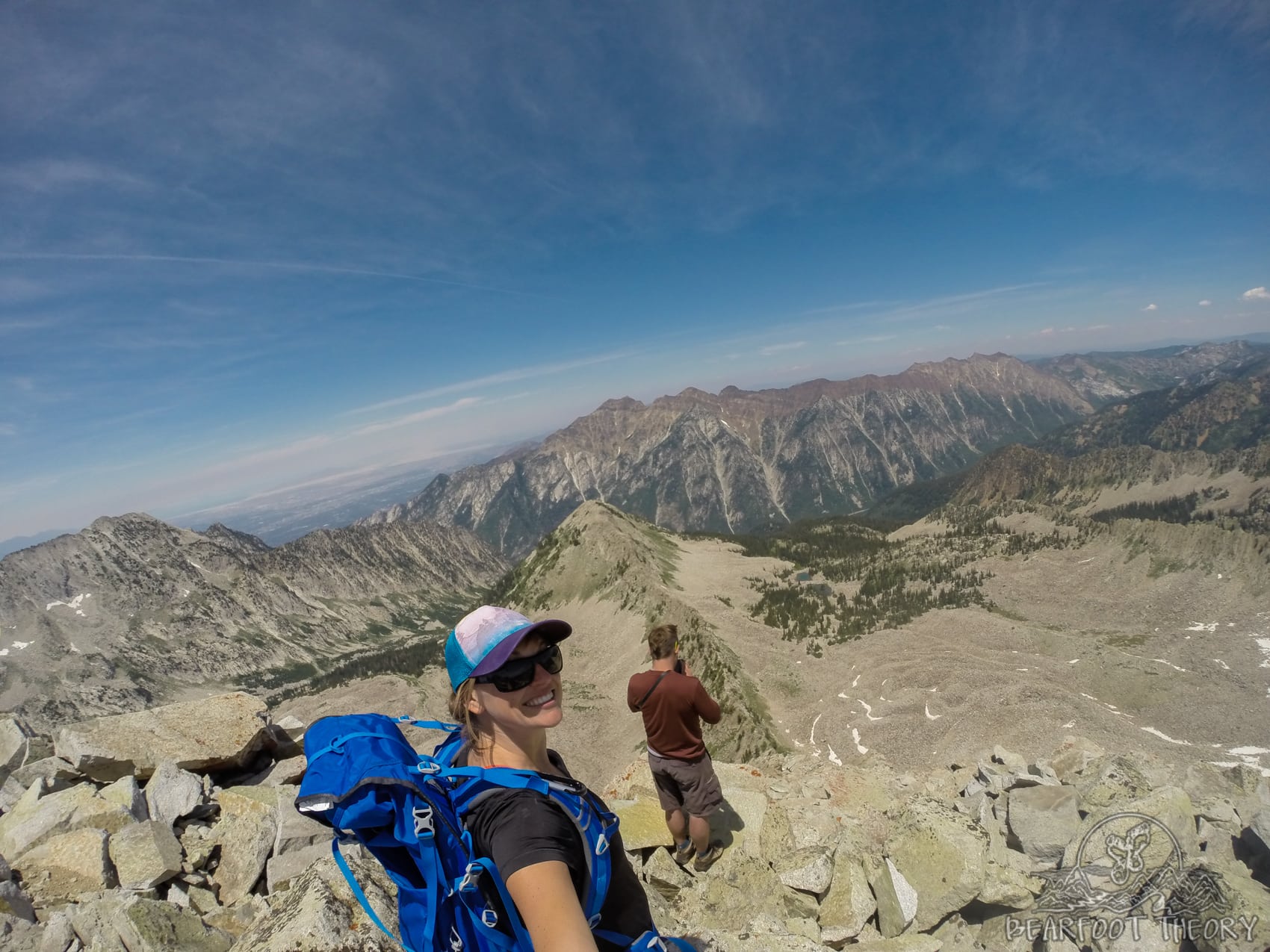
Once on the ridgeline, we made our way toward the base of the peak, scrambling over a short series of large granite boulders. This section is the most intimidating of the hike and definitely put my mental strength to the test due to the steep drop-offs on both sides of the ridge.
That said, I never felt like I was making any risky moves, and the granite has a ton of nooks and a lot of grip giving you plenty of places to hold on to. If you find yourself getting nervous, just slow down, take some deep breaths, and keep your mind calm.
However, if at any point, you start to feel too overwhelmed, there is nothing wrong with turning around. It’s much better to know your limits than to let your anxiety escalate to dangerous levels.
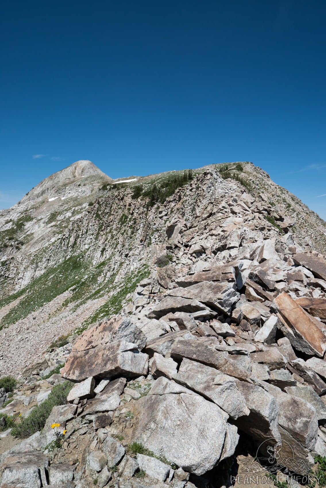
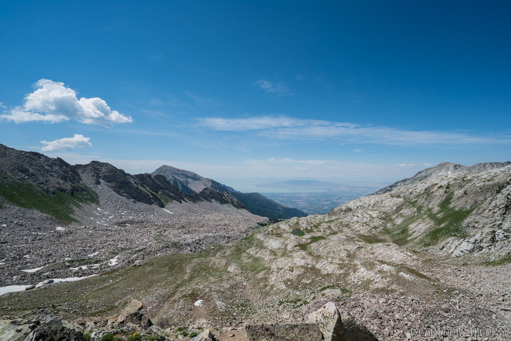
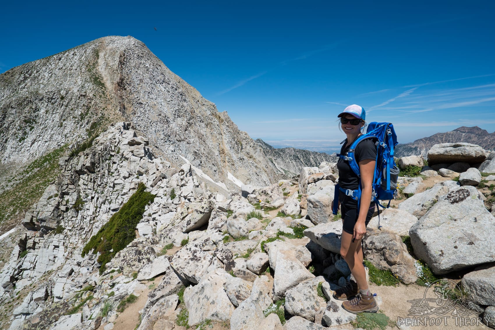
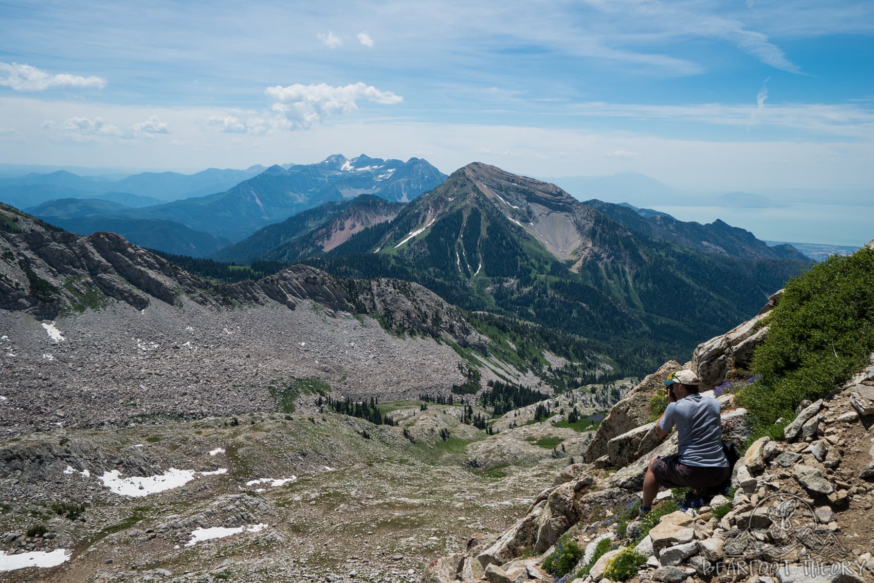
As we approached the base of Pfeifferhorn, I began to question how we were going to get to the top. From a distance, the faint trail up to the top looked almost vertical. But once you start the climb, you will see that the trail is way less daunting than it looks. On the way up, the views towards Mt. Timpanogos and the valley start to open up.
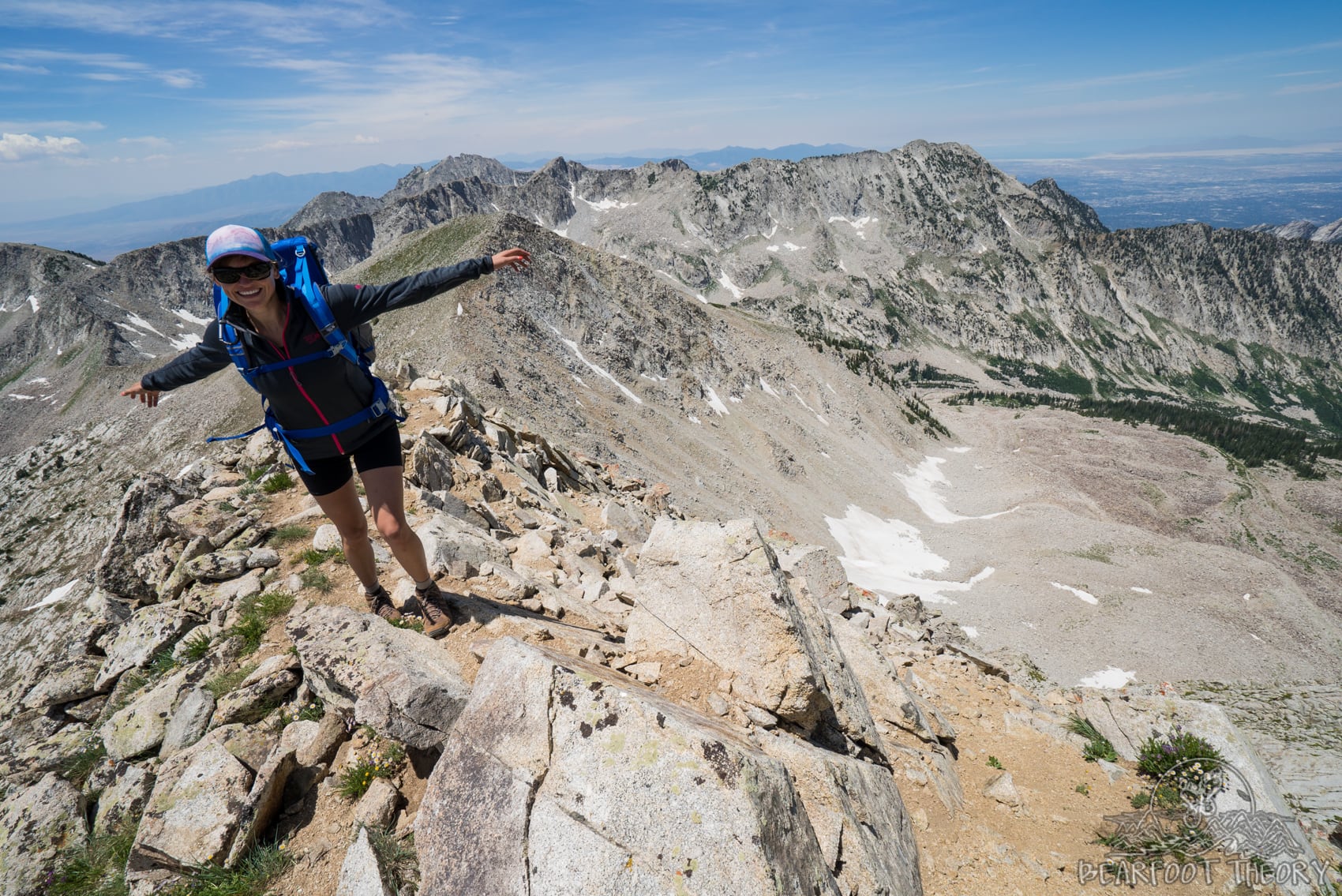
The climb was steep but short, and thirty minutes later, we were on the summit taking in that amazing panoramic perspective of the entire Wasatch Range.
In total, it took about 2 hours to get to the summit from Upper Red Pine Lake.
Press play on my Instagram video below to see a 15-second clip from the Pfeifferhorn Summit.
READ NEXT
Looking for more outdoor adventures in Utah? Check out these posts for inspiration:
Have you climbed the Pfeifferhorn? What was your experience like? What questions do you still have? What other peaks are your favorite in the Salt Lake City area? Leave a comment below!
I don’t know that I would have made it past that first lake you have pictured – it’s already calling me to jump in and spend the afternoon swimming!
Great write up. SLC seems to have so many recreation opportunities nearby!
There’s so much cool stuff to explore here. You should come out for a visit sometime! -Kristen
Great pics! Too bad dogs aren’t allowed – I think Choppy would love the hike!
Yes, it’s definitely a bummer for dog owners. The no-dog rule is due to the fact that the canyon is part of the watershed that provides Salt Lake’s drinking water.
This summit looks beautiful!! I did red pine in September and it was gorgeous!! We eyed Pfeifferhorn, but we weren’t prepared for the extra distance… then it hailed so we hurried down. I’ll have to try this next summer!! 🙂
Hey KJ! Thanks for checking out my Pfeifferhorn post. It is a super fun hike. A little bouldering, epic views, etc. Hope you’ll return next summer and come back and share you summit photos with me. Also just checked out your website. Some really tasting looking recipes on there. I’ve been looking for more vegetarian inspiration lately so I’m excited to browse around. -Kristen
We are hiking this tomorrow! Feeling a little intimidated, but I loved reading your step by step guide. I am hiking with my 15 year old son–practicing up for Machu Picchu in a few weeks!
That is awesome to hear Kim! Have fun in Peru as well!
Any animal encounters?
This looks awesome! Guess it’s another hike added to the bucket list. Thanks for the informative post!
Mdk