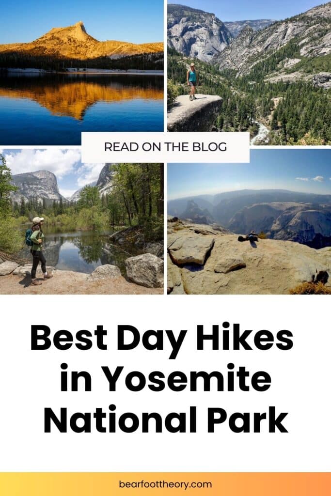
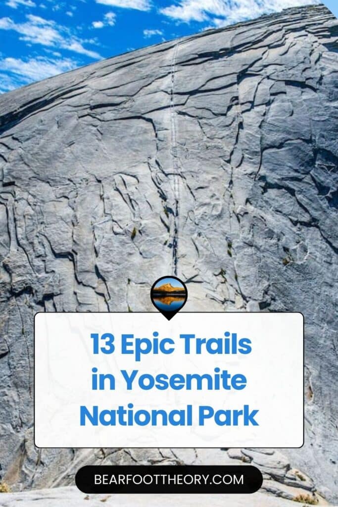
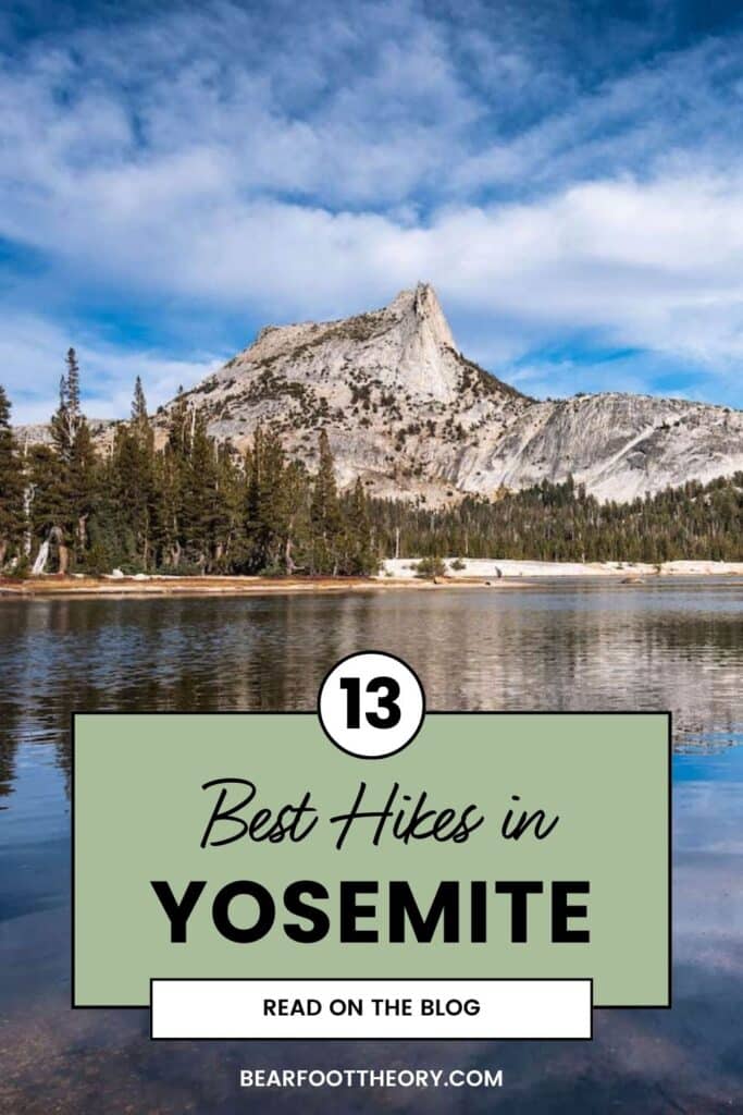
13 Best Day Hikes in Yosemite National Park
Yosemite National Park has no shortage of great hikes. But which are the best? Discover my top picks for epic views, gushing waterfalls, and wildflower-filled meadows.
The first time I visited Yosemite National Park, I was blown away by the incredible scenery. I knew from photos and friends that it was going to be beautiful, but I wasn’t quite prepared for how stunning it would be in person. The Valley – with its views of Half Dome and El Capitan – is magical!
My plan for my visit was to explore the best hikes in Yosemite National Park. From the iconic Mist Trail to the lesser-known – but no less scenic – hike out to Dewey Point, I had a list of trails I wanted to check off. In this post, I’ve rounded up my personal favorites from my trip that highlight all the best that Yosemite has to offer from gushing waterfalls to epic overlooks.
Important: Reservations are required to enter Yosemite National Park during some weeks and months out of the summer. You can learn more about how to get a reservation and other tips for visiting in my Yosemite National Park guide.
This post may contain affiliate links.
Yosemite National Park Layout
Before I dive into my favorite hikes, it’s important to get an understanding of how Yosemite is laid out. The Park covers nearly 1,200 square miles, which means preplanning your hikes is essential to maximize your time on trails instead of spending a ton of time in the car.
Yosemite can be broken down into the following sections:
- Yosemite Valley
- Glacier Point Road
- Mariposa Grove
- Tuolumne Meadows
- Crane Flat
- Hetch Hetchy
I based my visit and hikes around Yosemite Valley, Glacier Point Road, Mariposa Grove, and Tuolumne Meadows. Visit the National Park website to read more about hiking in Crane Flat and Hetch Hetchy.

Save this post!
Enter your email & I'll send this post to your inbox! You'll also receive my weekly newsletter full of helpful advice for planning your adventures.
Yosemite Valley Hikes
Yosemite Valley features the most popular hikes in the park. Most are accessible year-round and include Yosemite’s iconic viewpoints and waterfalls.
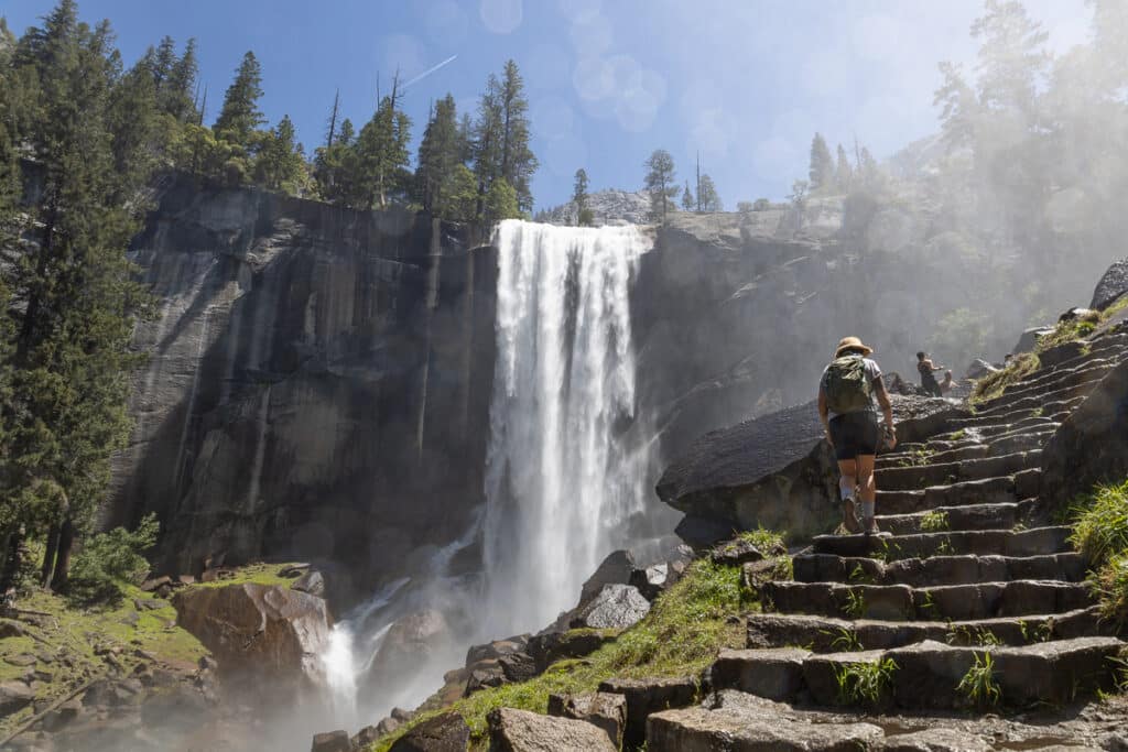
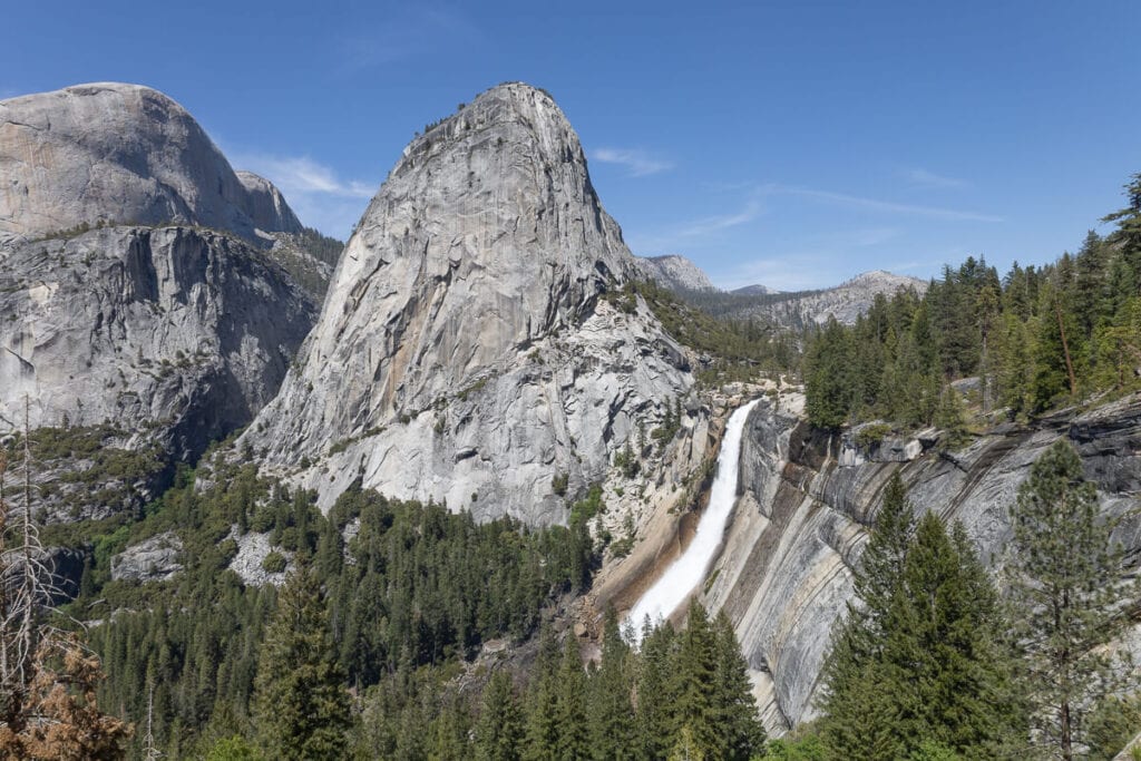
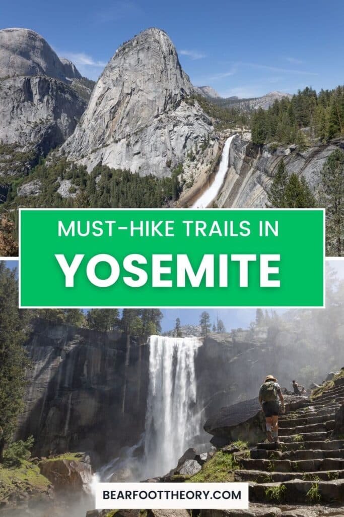
1. Mist Trail to Vernal Falls and Nevada Falls
Trail Basics
Trail Description
Mist Trail to Vernal and Nevada Falls is Yosemite’s most popular hike, but it shouldn’t be missed. I like to get away from the crowds as much as I can, but this hike was 100% worth the trail traffic!
The trail ascends steeply up the valley walls for about 1.5 miles until reaching Vernal Falls. It was here that I understood why the trail is called Mist Trail! When I visited in spring, I got drenched from the mist coming off of the falls. I was also lucky to see the Vernal Falls rainbow in the spray, which can typically be seen in spring and summer.
I found the hike from Vernal Falls to the top of Nevada Falls to be pretty challenging. It’s steep and there is a long set of stone steps that climb out of the valley.
Once I reached the top of Nevada Falls, I found a nice place to rest by the Merced River where I took in the Yosemite Valley views before starting my hike back down. You can go back the same way you came, but I recommend crossing the bridge over Nevada Falls and taking the John Muir Trail back down to the Valley. I found this descent to be more gradual than the stairs and it also provided a different view of Nevada Falls and the valley below.
Tips for hiking the Mist Trail
2. Upper Yosemite Falls Trail
Trail Basics
Trail Description
Did you know that Yosemite is home to one of the tallest waterfalls in the world? Yosemite Falls (which is actually made up of 3 separate waterfalls), cascades down 2,425 feet between Lower Yosemite Falls, middle cascades, and Upper Yosemite Falls.
I loved hiking this area because it’s the perfect “choose your own adventure”. You can stop at the lower falls for an easy hike, head to the bottom of Upper Yosemite Falls for a moderately strenuous uphill hike, or continue all the way up to the top of Upper Yosemite Falls for a very strenuous Stairmaster of a hike. I chose to hike all the way up!
I also added a quick detour to Yosemite Point. This added about 30 minutes and 300ft elevation gain to my hike, but it was well worth it. Yosemite Point was one of my favorite viewpoints in the park (it was also way less crowded than Upper Yosemite Falls).
Tips for hiking to Yosemite Falls

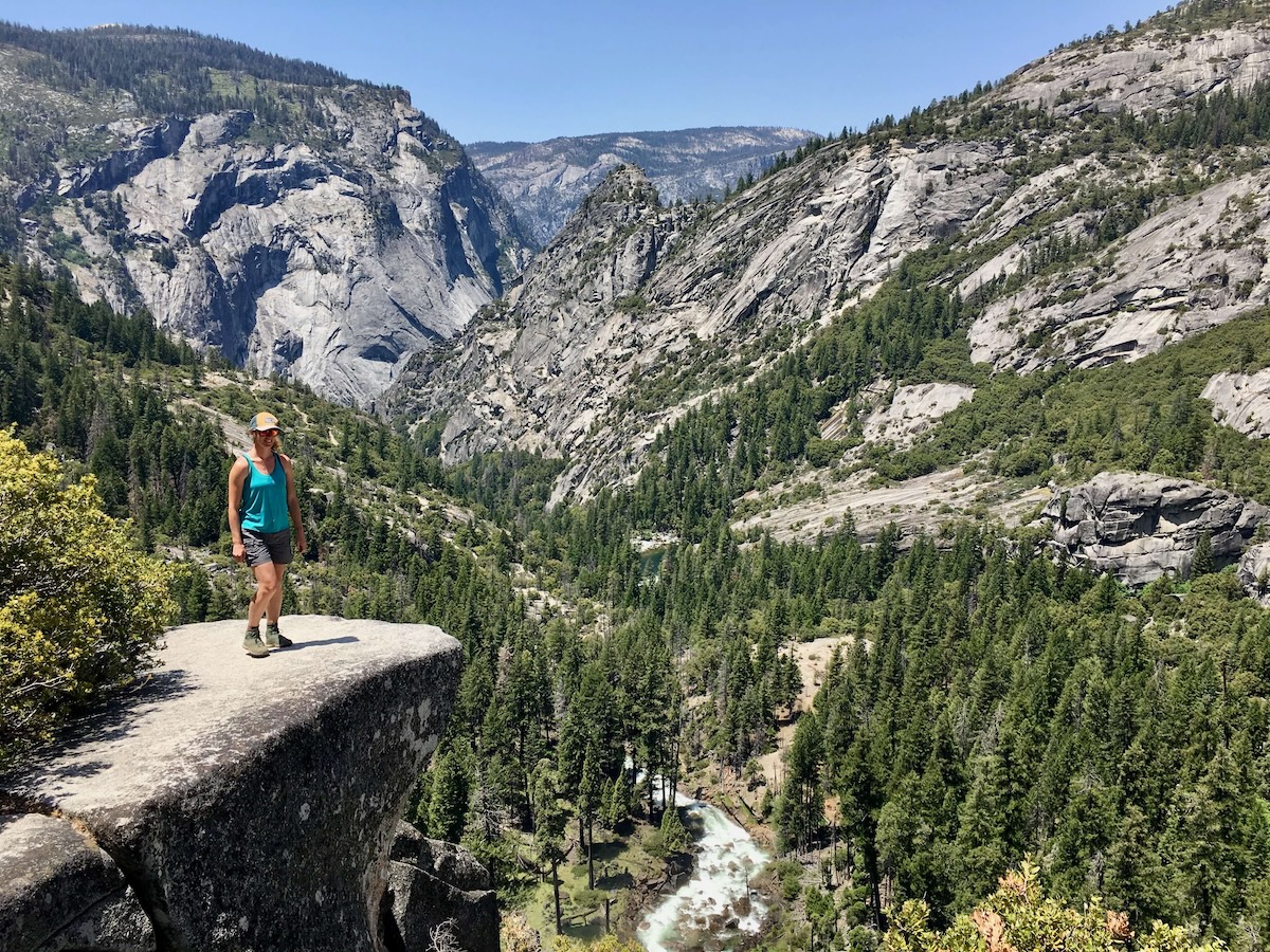
3. Mirror Lake Trail
Trail Basics
Trail Description
After a few days of challenging treks up the Valley walls, I wanted to do a nice, mellow hike. I chose Mirror Lake because it’s a beautiful, tranquil, mostly flat walk along Tenaya Creek.
Mirror Lake doesn’t have a lot of water in it most of the year, but in the spring and early summer, it’s often higher due to fresh snowmelt. When I hiked it in the spring, the water was calm and the lake reflected the beautiful surrounding canyons (hence the name).
I chose to do the full 4.4-mile loop, which follows Tenaya Creek past Mirror Lake, but you can make it shorter and just do an out-and-back to the lake shore. This is a great place to pack a picnic and relax on the rocks or beach by the water for the afternoon.

4. Half Dome
Trail Basics
Trail Description
The iconic Yosemite Half Dome hike is not for the faint of heart. Rising 5,000 feet above Yosemite Valley, it takes a minimum of 10-12 hours to complete. The last 400 feet require ascending up a steep rock face using cables. When I hiked Half Dome, I found this final section to be very challenging, both physically and mentally, but the reward was worth it! Standing at the top of Half Dome was an exhilarating feeling.
But climbing the rock face isn’t the only highlight of hiking Half Dome. On the hike there, I passed amazing views of Vernal Falls, Nevada Falls, Liberty Cap, and sweeping vistas of Yosemite Valley. Keep in mind, though, that the hike is 16.3 miles round-trip, so make sure you’re prepared for a long day on the trail.
Hiking Half Dome requires a permit. The pre-season lottery happens every year from March 1-March 31. You will receive confirmation by mid-April if you’ve been awarded a permit. If you are not successful in the preseason lottery, you can try for the in-season daily lottery.
Tips for hiking Half Dome

5. Four Mile Trail
Trail Basics
Trail Details
The Four Mile Trail was one of my favorite hikes in Yosemite. I’m not sure why it’s called “four mile” since the climb from the Valley floor to the top of Glacier Point and back is just under 10 miles round-trip. The steep switchbacks do end after 4 miles, though, so maybe that’s why!
With stunning views of El Capitan and Yosemite Falls on my way up and panoramic views of Half Dome and the Sierra Mountains at the summit, this was a very memorable hike. There is the option to tack on Union Point about two-thirds of the way up which offers an amazing view of Yosemite Valley.
I chose to hike back to Yosemite Valley by reversing my route, but you can also take the Panorama Trail down to the Happy Isles Trailhead. This loop is about 16.3 miles.
Glacier Point Road Hikes
Glacier Point Road is a seasonal road that ends at the spectacular Glacier Point. Starting your hikes from Glacier Point Road (vs. hiking from the valley floor) typically means less elevation gain, but still amazing views out over Yosemite Valley.
6. Sentinel Dome to Taft Point Loop
Trail Basics
Trail Description
This loop has spectacular views out over Yosemite Valley without the steep elevation gain of starting from the valley floor. I hiked the loop counterclockwise, first stopping at Sentinel Dome which is a large granite boulder that offers different vantage points of the valley. Then I continued on to Taft Point.
Rising 3,500 feet above the valley floor, Taft Point is totally exposed with sheer dropoffs and 360-degree views. If you are short on time, I recommend skipping Sentinel Dome and hiking to Taft Point as an out & back (2.3 miles roundtrip). It’s incredible!
7. Dewey Point via McGurkin Meadow Trail
Trail Basics
Trail Description
The Dewey Point via McGurkin Meadow Trail is a less popular hike in Yosemite National Park, but I thought it was spectacular. During summer there are tons of wildflowers in the area and the views from Dewey Point are some of the best in the park.
The trail has a mellow grade as it slowly climbs through McGurkin Meadow to meet up with Pohono Trail. From there, it’s a steady incline to Dewey Point where you’ll take in unique views of El Capitan, Cathedral Rocks, Half Dome, and the Yosemite high country.
Tuolumne Meadows Hikes
All of the hikes from Tuolomne Meadows start from Tioga Road, which is a seasonal road that typically opens in late May or early June and closes sometime in November. I visited in early spring and there was still some wet and/or snowy conditions on the trails.
Hiking in Tuolumne Meadows is one of Yosemite’s best-kept secrets because people never make it to this section of the park, they only stay in the Valley. If you are looking to escape the crowds, like I was, these are the best Yosemite hikes to do!
8. Clouds Rest
Trail Basics
Trail Description
Clouds Rest is a great alternative for those who didn’t win permits to hike Half Dome (or who are afraid of the cables on Half Dome). At nearly 14 miles, it is a strenuous hike with over 3,000 feet of elevation gain, but I think it’s well worth the effort. There are jaw-dropping views from the top and at 9,931 feet, you actually climb higher than Half Dome have have similar stunning views of the valley.
As you approach the top of Clouds Rest, you’ll be waking on a ridge that drops off steeply on both sides. It’s not technical in any way, and the ridge isn’t so narrow that if you trip, you’re going to fall off. However, if you have an extreme fear of heights, this trail will get your heart pumping. I also loved this hike because there were far fewer people on the trail likely due to the distance and elevation gain.
Clouds Rest can be done as a long day hike, which can be rewarded with a dip in chilly Tenaya Lake when you get back to your car. If you are looking for an epic Yosemite backpacking adventure, tack on Sunrise Lakes to make it an unforgettable 23-mile multi-day loop.

9. North Dome
Trail Basics
Trail Description
The hike to North Dome offers one of the best up-close views of Half Dome in the entire park. From the top of North Dome, you’re literally looking directly across Tenaya Canyon at Half Dome. And, since the trail starts on Tioga Road outside of Yosemite Valley, the crowds are typically much slimmer than the other day hikes in the Park. I had the trail almost entirely to myself!
This hike is a bit different than other Yosemite Trails. Here you are starting higher up and descending at you hike towards North Dome. Then you will be gaining elevation on the return, so make sure you save some snacks and water.
For the first 2 miles, the trail meanders through the forest and is fairly flat with a few ups and down. From there on, the trail opens up and eventually the trail turns to granite. Keep an eye out for trail markers known as cairns as you enjoy the amazing views all the way to North Dome.
Like many of the trails in Yosemite, the North Dome Trail doesn’t have a ton of shade once you get out of the forest, so make sure you take precautions to protect yourself from the sun which can be rather intense at this elevation.
10. Cathedral Lakes
Trail Basics
Trail Description
I love the Cathedral Lakes hike because it leads to two beautiful alpine lakes: Upper and Lower Cathedral Lakes. This trail is the most popular hike along Tioga Road, but I found it to be still much less crowded than other Yosemite hikes. Still, like the other popular hikes in Yosemite, I recommend getting an early start!
The elevation gain is steepest at the beginning of the trail when you’re in the forest, then it becomes gradual enough to not be super strenuous. Eventually, the trail emerges from the forest into a beautiful meadow with wide open views of the granite peaks.
At the fork in the trail, hang a right to go to the Lower Lake, which, in my opinion, is the nicer of the two Cathedral Lakes. I had to hop across a few rocks, but I think it’s worth skirting around the right shore for some epic views of Cathedral Peak. If you have time and energy left, you can hike to Upper Cathedral Lake, which will add another 1.8 miles.

11. Dog Lake to Lembart Dome
Trail Basics
Trail Description
I was looking for a short hike in Tuolumne Meadows after a few long and challenging hikes, and the Dog Lake to Lembart Dome trail was perfect. It’s a scenic 5-mile out-and-back trail that has panoramic views of Tuolumne Meadows and the surrounding high country.
The trail circumnavigates Dog Lake and there are lots of nice places to relax and have a picnic lunch. I chose to visit Lembart Dome on my way to the lake, but you can also visit it on the way back down. Note that Lembart Dome is extremely exposed, though, so be sure to check the weather to avoid being on top during a thunderstorm!
12. Mono Pass
Trail Basics
Trail Description
If you’re looking for alpine solitude in Yosemite National Park, add Mono Pass to your list of hikes. This trail climbs through tranquil meadows and flowing creeks to a max elevation of 10,600 feet at the top of the pass. From the top, you can take in gorgeous views of Bloody Canyon and Mono Lake – a very different type of landscape than anywhere else in Yosemite National Park. From the peak, you can hike a bit farther to Upper Sardine Lake for even more stellar vistas.
When I hiked this trail in the peak of summer it was still relatively empty and totally gorgeous with wildflowers, lakes, and mountain views. Note that this trail requires a few river crossings, where in early season you may not be able to avoid getting your feet wet. So you may want to bring hiking sandals to cross in.
Mariposa Grove Hikes
Did you know that you can see giant sequoia trees in Yosemite National Park? Most of the 500 sequoia trees in the park are located in Mariposa Grove, which is south of the Valley.
13. Mariposa Grove of Giant Sequoias Trail
Trail Basics
Trail Description
The Mariposa Grove of Giant Sequoias Trail weaves through quiet forest and passes giant sequoias including Grizzly Giant, The Bachelor and Three Graces, Faithful Couple, and the Clothespin Tree.
You can simply meander through the forest on the network of trails, or I recommend continuing on to Wawona Point. You are almost guaranteed to have the trail and viewpoint to yourself, which is a stark contrast from the popular viewpoints in the valley. I loved the solitude on my visit.
From Wawona Point, you can see the South Fork of the Merced River, Wawona Meadow, and across the valley to Wawona Dome.
Frequently Asked Questions
Yosemite Valley is generally open year round (unless there is a crazy snow event), but if you want to hike the best trails in Yosemite and to get into the high country, the best time to visit is in summer or early fall. At lower elevations, all of the snow generally melts by June and at higher elevations may persist into July. Bugs are usually the worst in late June and July. By August all of the snow is usually melted and the mosquitos are not as bad. In August and September there is a higher risk of wildfire and smoke. If there are no wildfires, my favorite time to visit is September. It’s less busy than the summer, easier to find campsites, and the temperatures are a little more mild for hiking.
No. Bear spray is not allowed in Yosemite. The only bears you might encounter in Yosemite are black bears that pose little risk to humans. If you encounter a black bear while hiking in Yosemite, keep your distance and if it approaches you, make lots of noise in an attempt to scare it off.
The only day hiking trail you need a permit for in Yosemite is Half Dome. All of the other trails do not require a permit.
I recommend wearing a hiking shoe or a hiking boot with decent tread that will provide adequate traction on the steeper sections. Many of the hikes in Yosemite are long, and you want something that is going to be supportive and comfortable throughout your hike. For recommendations, check out my post on the Best Hiking Boots for Women.
More Yosemite Planning Tips
Are you planning a trip to Yosemite National Park? What hikes in Yosemite are you looking forward to?