7 Best Hikes in Sedona For Amazing Red Rock Vistas
Discover the best hikes in Sedona. Find hidden gems, majestic red rock views, and essential tips for an unforgettable hiking experience.

Sedona has become a hot spot for outdoor lovers and adventure seekers. The stunning red rock landscape and endless miles of trails make it one of the top destinations in the West for hiking and exploring.
I’ve spent a lot of time in Sedona. As a mountain biker, it’s my favorite place to ride but I’ve also hiked many of the trails. I can confidently say that hiking in Sedona will not disappoint! Almost every trail that you choose will reward you with amazing views, unique rock formations, and a little bit of Sedona magic.
But if you’re looking for the cream of the crop, here I’ve rounded up the best hikes in Sedona that I would be happy to hike again and again.
Sedona Hiking Tips
This post may contain affiliate links.
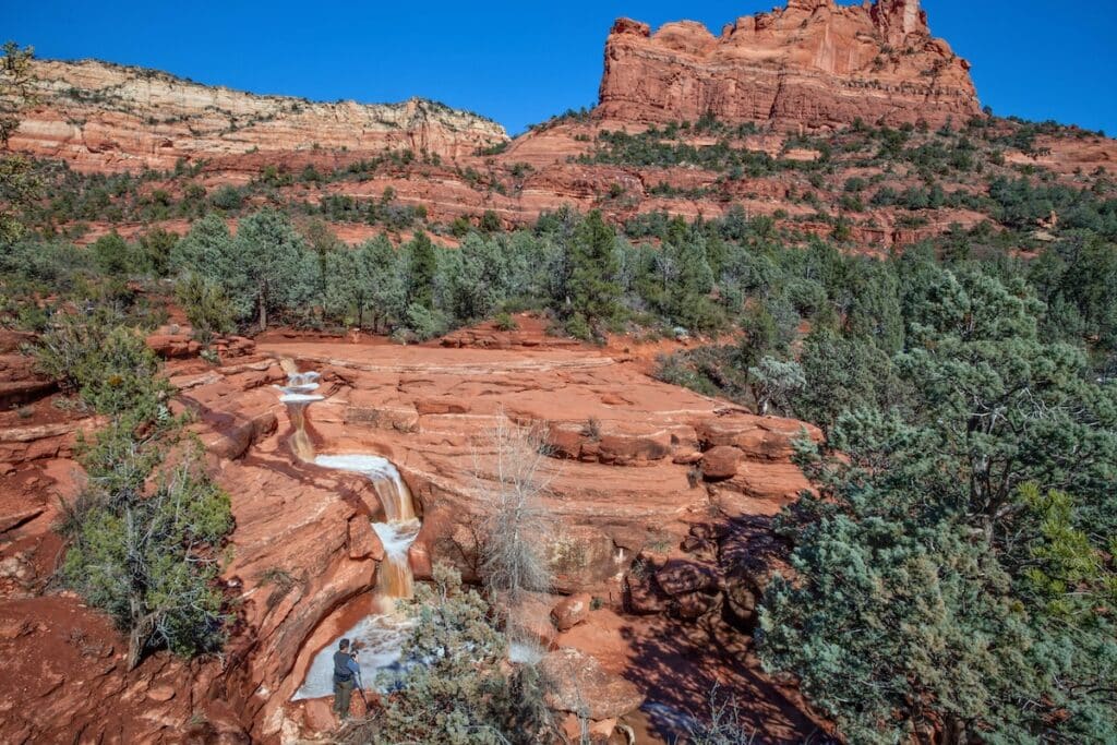
1. Seven Sacred Pools via Cibola Pass Trail
Trail Basics
If you’re looking for a great “bang for your buck” hike in Sedona, check out the Seven Sacred Pools via Cibola Pass Trail. It’s a relatively easy hike with less than 400 feet of elevation gain over 3 miles (roundtrip), but the views are incredible and the trail ends at the iconic Seven Sacred Pools.
These small pools were formed over thousands – if not millions – of years of erosion and today they’re often filled with water that reflects the surrounding red rock formations. It’s a great hike to do after a rain because the pools will be filled with water and you might even see them transform into a stunning waterfall!
Most people access Seven Sacred Pools via Soldiers Pass, but a quieter – and more scenic – approach is via Cibola Pass.
Save this post!
Enter your email & I'll send this post to your inbox! You'll also receive my weekly newsletter full of helpful advice for planning your adventures.
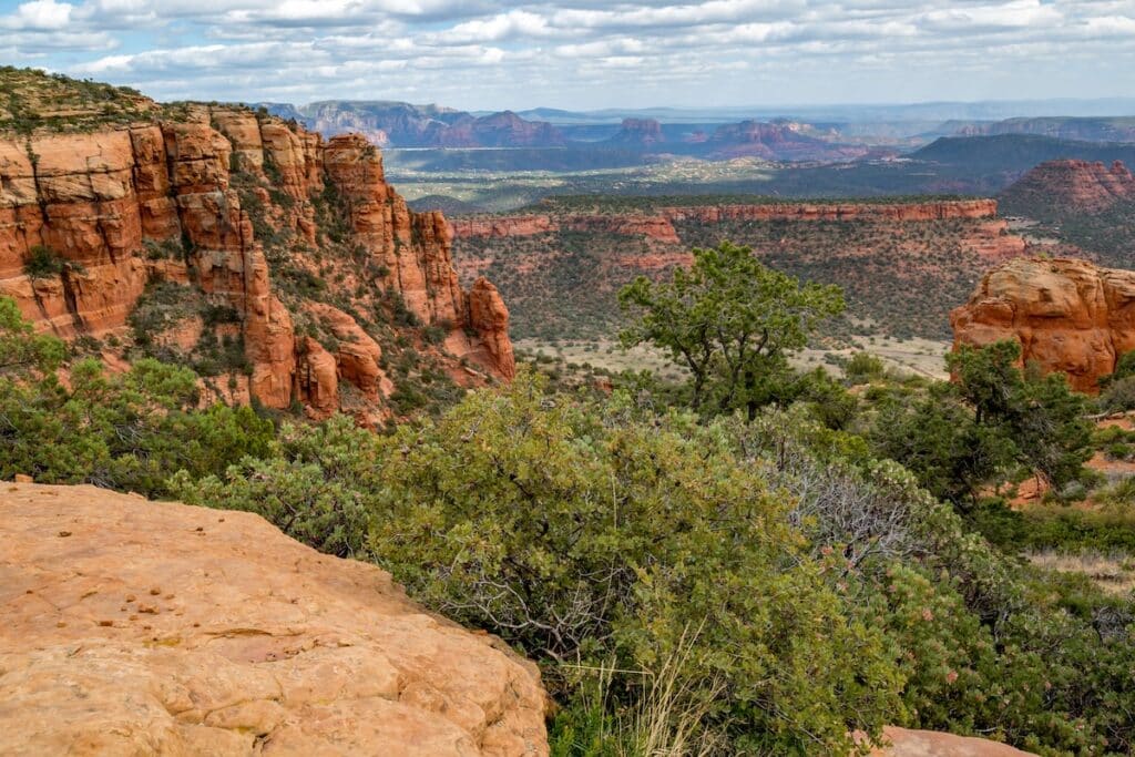
2. Bear Mountain
Trail Basics
Bear Mountain is one of the most iconic – and challenging – hikes in Sedona. The trail is super steep in places and very rocky with tricky footing and a bit of scrambling. But if you’re up for an adventure, Bear Mountain is a must-do.
Aside from a good workout, the views from the top are the reason to add this hike to your Sedona Itinerary. They’re amazing! You’ll be rewarded with panoramic vistas of the Verde Valley, the Mogollon Rim, and even the San Francisco Peaks in the distance.
As I mentioned above, this hike is tough. Be prepared with lots of water (a day pack with a hydration reservoir is a must), plenty of sun protection, and good hiking shoes.
Read More
Gear up for Sedona
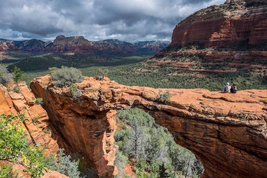
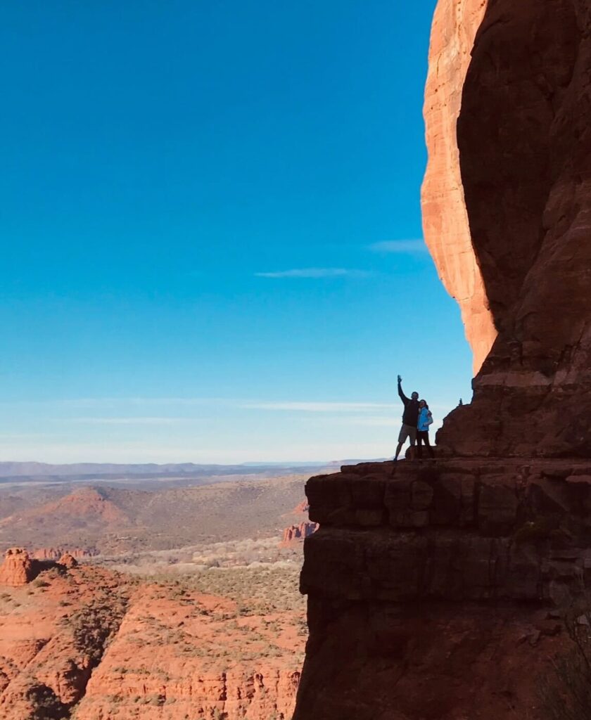
3. Devil’s Bridge Via Mescal Trailhead
Trail Basics
Devil’s Bridge is one of the most popular (and famous) hikes in Sedona, but for good reason. The trail culminates at a beautiful sandstone arch, which was created over millennia by the forces of erosion.
Devil’s Bridge overlooks the beautiful Verde Valley with tall red rock bluffs rising from the valley floor. You can even walk out onto the arch (at your own risk) if you’re not scared of heights!
There are several ways you can access the Devil’s Bridge Trail. My favorite is via Mescal Trailhead, but you can also park at Dry Creek Vista Trailhead.
4. Cathedral Rock Trail
Trail Basics
If you’re looking for the best views out over Sedona, a hike up Cathedral Rock Trail will deliver.
This short hike takes you up the red slickrock terraces of Cathedral Rock, gaining almost 800 feet of elevation in less than a mile. It’s short and steep, but I promise you, the views are worth it!
Since much of the trail is on rock slab, there is a bit of scrambling to get to the top. It’s a great choice for families with kids because they love climbing around on the rocks.

5. West Fork Trail
Trail Basics
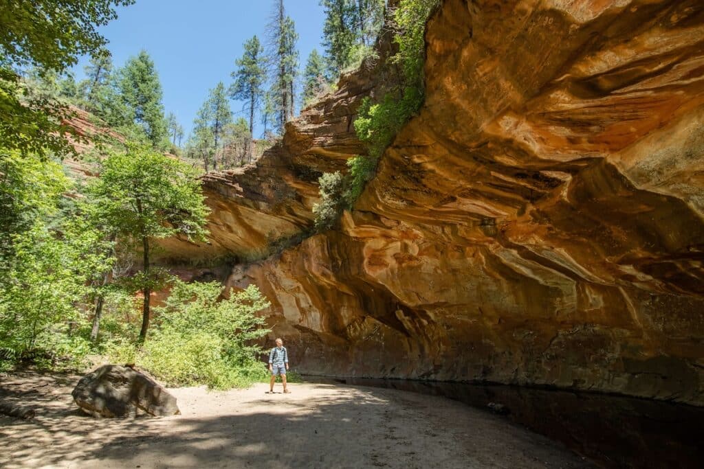
If you want to see a different side of Sedona, head up Oak Creek Canyon to the West Fork Trail.
This trail follows the West Fork of Oak Creek with sheer cliffs on either side, shallow river crossings, trees that provide shade, and great views the farther you hike.
It is a very popular hike though, especially on hot days, so try to get an early start. I recommend wearing hiking shoes that you don’t mind getting wet. A BFT Team favorite shoe for river hikes are Astral water shoes.
6. Wilson Mountain Trail
Trail Basics
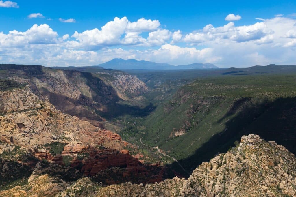
If you’re looking for an all-day hike that will take you up above Sedona for amazing views and less trail traffic, then head out to Wilson Mountain Trail.
Starting from Midgley Bridge, this trail steadily climbs up the rocky bluffs above Wilson Creek. It’s a sustained climb for about 4 miles on a narrow, rocky path and then you’re rewarded with incredible views out over Sedona.
Give yourself plenty of time to complete this hike and be sure to pack all your hiking essentials and at least 2-3 liters of water.
7. Boynton Canyon Trail & the Subway Cave
Trail Basics
Boynton Canyon Trail is located in West Sedona and is one of the best hikes in Sedona for a few reasons.
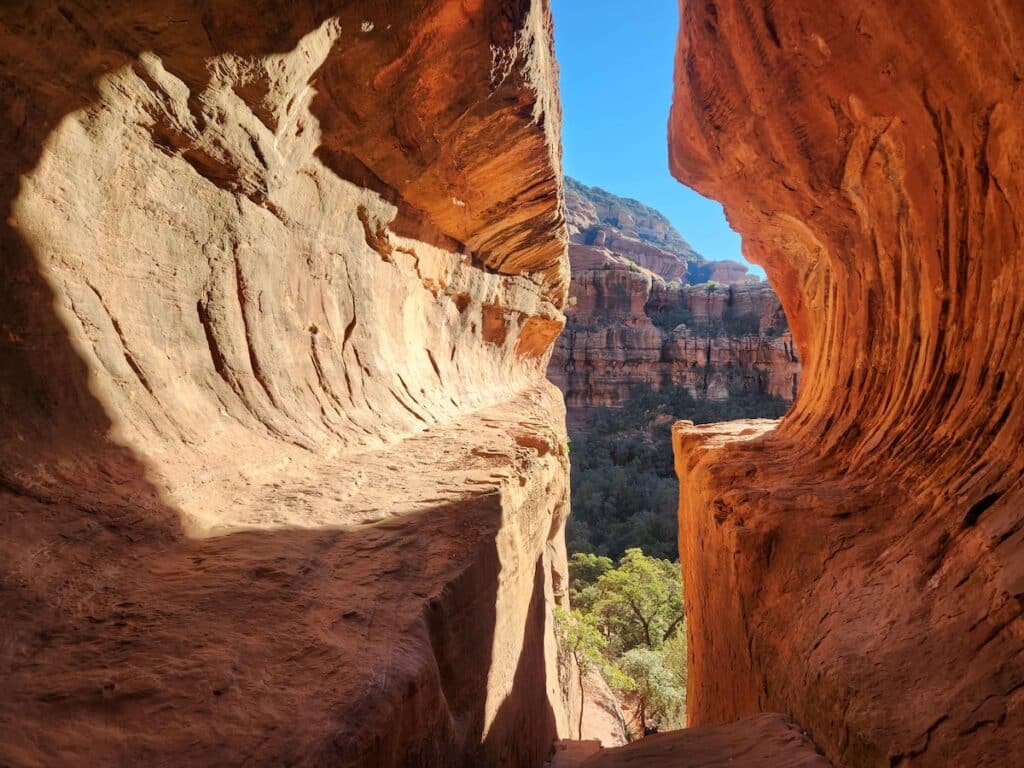
Many people hike this trail to access the Subway Cave, which is a super unique and beautiful rock formation that looks like a subway tunnel. There are also some Sinagua ruins in the area, make it a great hike for lots of interests.
The Boynton Canyon hike itself isn’t too challenging, but if you plan on visiting the Subway Cave, there is a bit of scrambling and exposure, so keep that in mind. It also gets really busy, for obvious reasons.
The trail to the cave isn’t marked, but the turnoff is at about mile 2 on the Boynton Canyon Trail. You’ll see a spur trail on the right.
READ NEXT
Planning a trip to Sedona? Use our Sedona guides to make the most of your visit!
- 4-Day Sedona Itinerary for Adventure Travelers
- Sedona Travel Guide: Camping, Dining, & Essential Tips
- Best Things to Do in Sedona
Save this post to Pinterest


What best hikes in Sedona have you done? Which one of these looks like the most fun? Leave a comment below!