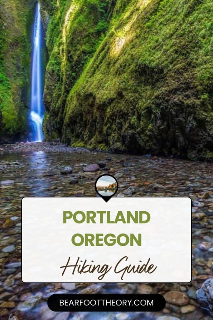
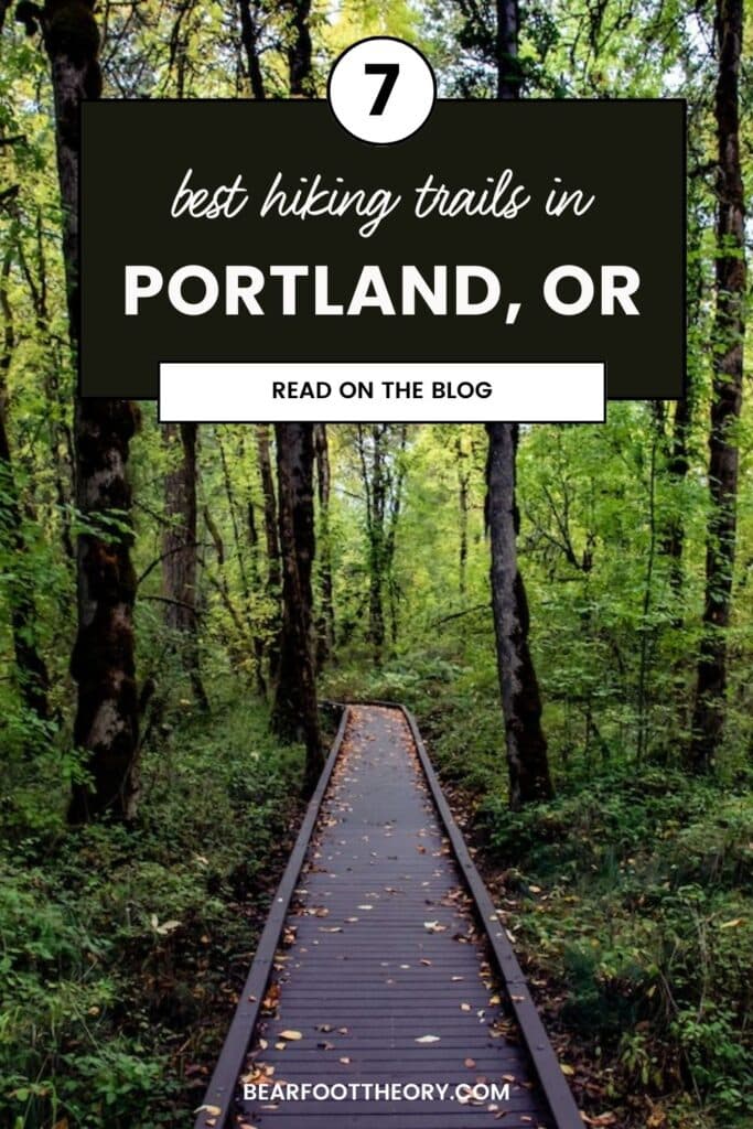
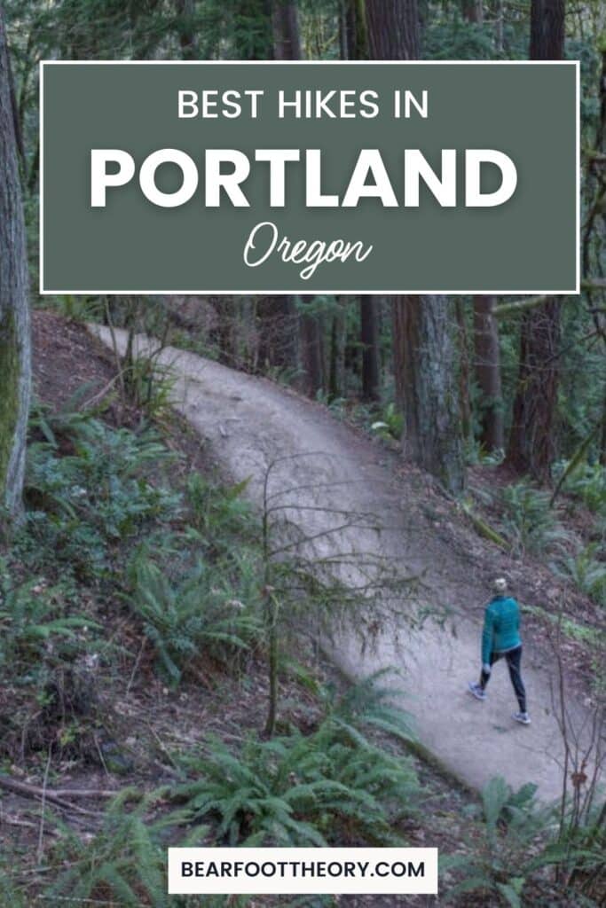
7 Best Hikes in Portland, Oregon
Discover the best hikes in Portland, Oregon to get away from the hustle and bustle of the city and enjoy the natural areas around town!
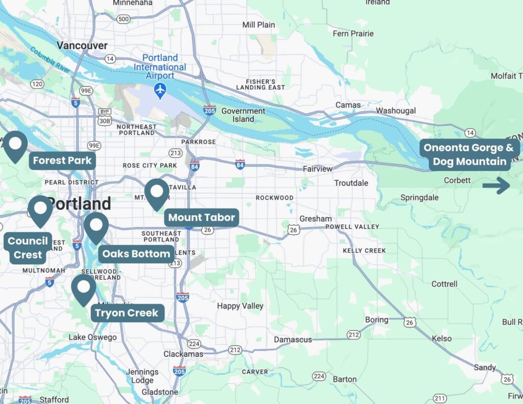
Nestled between two mountain ranges and the fertile Willamette River Valley, Portland, Oregon is home to a ton of great hiking trails. I’ve called Portland home for over 25 years and I know these trails like I know my own two feet. One of the things I love most about my city is that you can “get away from it all” without much fuss.
This heavily forested city boasts over 14 square miles of parkland and has easy access to even more great trails within a one-hour drive from the city center. From the Columbia River Gorge to lush forests, cinder cone volcanoes, and sweeping vistas of the entire city, hiking in Portland should be on every visitor’s to-do list.
In this guide, I outline my favorite Portland hikes, most of which are found within the city limits. At the end I include a couple that are a short drive from Portland if you’re looking to escape the city.
This post may contain affiliate links.
1. Tryon Creek Triple Bridge Loop
Trail Basics
Trail Description
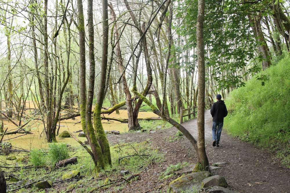
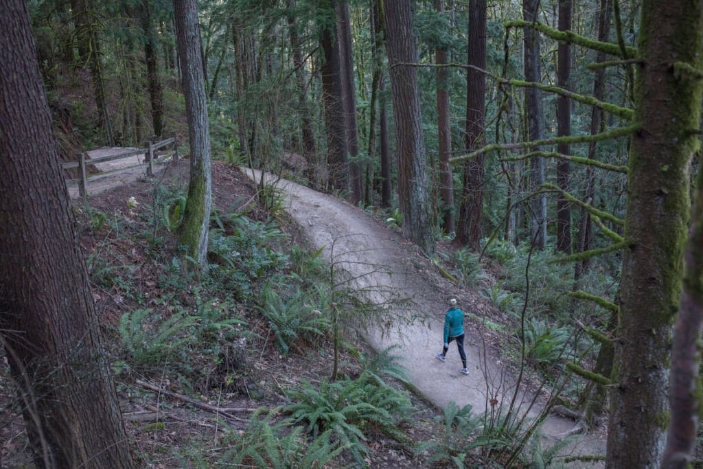
Tryon Creek State Natural Area is the only State Park within the Portland city limits. I love it for its lush canopy of thick vegetation and 100+-year-old trees. It’s truly a wooden wonderland in southwest Portland!
The park is home to over 8 miles of hiking trails that wind down to Tryon Creek where sometimes I’m lucky enough to spot a family of beavers working along the creek bed. I’ve also seen coyotes, red foxes, deer, skunks, and six types of salamander.
The Triple Bridge Loop is a popular route that features (you guessed it) three wooden bridges. If you want a longer hike, you can easily tack on a few more miles by heading deeper into the center of the park.
Tip: Tryon Creek State Park is shared with hikers, cyclists, and equestrians. Please bractice good trail etiquette and give the right of way to the horses and bikes.
Save this post!
Enter your email & I'll send this post to your inbox! You'll also receive my weekly newsletter full of helpful advice for planning your adventures.
2. Council Crest
Trail Basics
Trail Description
Get your quads working with this steady, gentle, and consistent climb up through the storied West Hills on Portland. This is my favorite hike for the best views out over the city. It’s also one I’ll take friends and family on when they’re visiting from out of town.
Most of the Council Crest trail is under a leafy canopy of Douglas fir, big leaf maple, and western hemlock trees, which are all native to Oregon. While the overlook at the end of the trail is accessible by car, the stunning vistas of Downtown Portland as well as Mt Hood, Mt. Rainier, and Mt St. Helen’s will be so much sweeter after a great hike!
3. Oaks Bottom Loop
Trail Basics
Trail Description
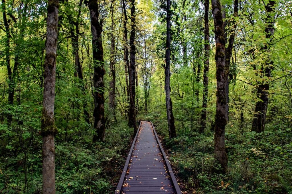
I love visiting Oaks Bottom Wildlife Refuge to watch the vast number of waterfowl and other birds make their homes here. It’s a beautiful park located in Southeast Portland along the Willamette River.
There are a few places you can start your hike, but I like to begin at the Sellwood Park trailhead. From there, I walk down the steep and often muddy embankment to Oaks Bottom. From Oak Bottom, I follow the easy and flat Bluff Trail, which passes through the centerpiece of the refuge – the Wapato Marsh. Here you can see all kinds of ducks, Great Blue Herons, nutria, and with some luck, the family of otters who have taken up residence.
There are lots of little spur trails in Oaks Bottom, so take your time and explore!
4. Wildwood Trail & Leif Erickson Loop
Trail Basics
Trail Description
Forest Park is one of the largest urban parks in the U.S. boasting over 5,200 acres of land and 80 miles of trails. It’s huge! I like to head here when I want to to a longer hike because there are so many different trail options.
One of my favorite routes in Forest Park is the Wildwood Trail & Leif Erickson Loop. It follows part of the 30-mile Wildwood trail before looping back on the the popular Leif Erickson trail.
In the spring, Forest Park sparkles with trillium, brightening the densely forested canopy of native wildlife. The trails are often muddy, so I recommend wearing quality footwear and using trekking poles during the heart of the rainy season (which, in Portland, seems to last about 9 months…).
Tip: The Leif Erickson trail is open to mountain bikers, so be sure to keep your dog on a leash and your kids close by. The riders can get going quite fast as they make their long descent.
5. Mount Tabor Loop Trail
Trail Basics
Trail Description
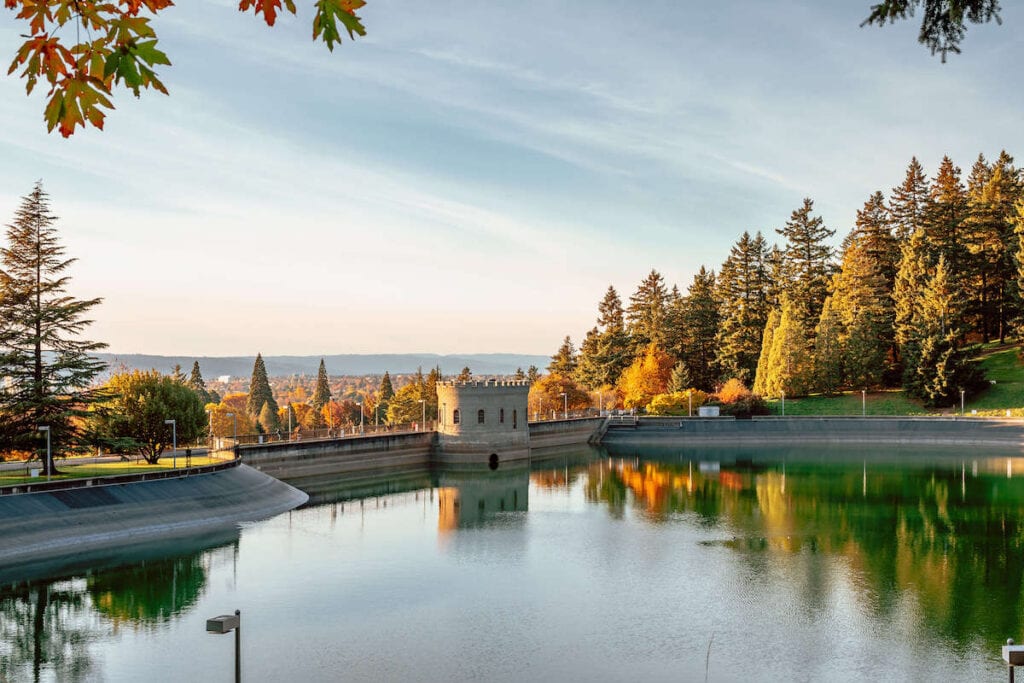
Portland’s Mt. Tabor rests atop a volcanic cinder cone. The park was established in 1909 and until recently, it housed reservoirs that supplied drinking water to Portland residents. I like to visit Mt. Tabor to see the historic open reservoirs and the spectacular views of Portland from the park’s summit. On a clear day, you can see the bridges that span across the Willamette River as well as downtown Portland and the West Hills.
The Mount Tabor Loop Trail is an easy walk around the park that is partially shared with cyclists. If you have a dog, there’s also an off-leash section located in the southeast section close to Warner Pacific University.
Fun fact: Each August, Mount Tabor is home to the Adult Soap Box Derby. Competitors race down the winding paved path in their elaborate “soap boxes”, hoping to avoid crashing on a turn affectionately called Dead Man’s Curve.
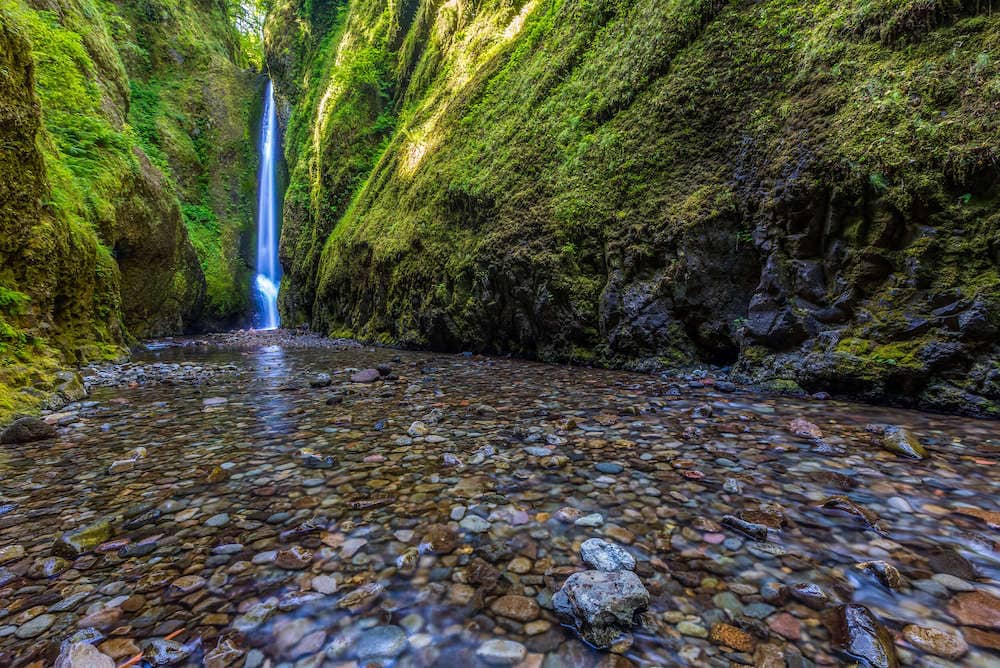
6. Oneonta Trail
Trail Basics
Trail Description
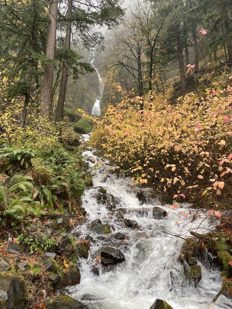
The Oneonta Trail is one of my family favorites. It’s about a 45-minute drive from downtown Portland, but worth it for the beautiful gorge landscape, swimming holes, and cascading waterfalls.
On a hot summer day, there is nothing better than wading waist-deep in the crystal-clear water and scrambling over downed logs. The trail passes by several waterfalls and you can choose to go as far into the gorge as you’d like before turning around.
Note: Parts of this hike are through the river, so make sure you wear shoes you don’t mind getting wet.
My preferred route for the Oneonta Trail is to make it a partial loop. Starting out on the steep uphill climb up the Oneonta Trail and then follow the trail to Triple Falls. You can choose to go even further, or return back down the trail and connect into the Horsetail Falls trail for the descent. This will spit you out about ¼ mile down the Columbia River Highway from the Oneonta Trailhead. From there, I just walk up the single-lane highway back to the parking lot.
7. Dog Mountain
Trail Basics
Trail Description
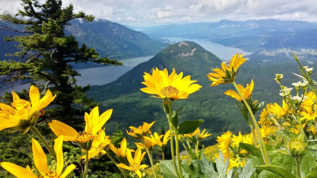
Dog Mountain is widely considered to be “the” best Portland area springtime hike. An explosion of wildflowers covers the mountainside and the trail takes full advantage of the spectacular scenery.
Located on the Washington State side of the Columbia River Gorge, the drive to the trailhead from Portland takes about an hour. I love this hike because as you climb up the mountain, better and better views of the mighty Columbia River come into view and you get a glimpse of the town of Hood River just a bit east of the trail.
Unlike many Portland hiking trails, most of the Dog Mountain hike is fully exposed. On a clear day, the trail can get hot so be sure to pack extra water and sturdy hiking shoes for the rugged uphill climb. The view from the summit of Dog Mountain, though, is worth every ounce of sweat and burn.
Tips: The Columbia River Natural Scenic Area charges a fee to enter, so be prepared to pay for parking. The spots also fill up quickly on spring weekends, so get an early start.
Tips for Hiking Around Portland, Oregon
Whatever hike or hikes you decide to do, here are a few of my tips to help you stay safe and make the most of your day on the trail in Portland:
Frequently Asked Questions
Portland is great for hiking all year round! That being said, if you plan on hiking during early spring, winter, and fall be prepared for wet weather because it rains a lot here. But rarely gets very cold – the temps stay pretty mild even during winter.
If you’re looking for good weather, summer is the best time to hike in Portland. June through September are typically the driest months.
My favorite seasons to hike are springtime because of the wildflowers and fall because of the changing foliage.
Good boots and rain gear are the essentials for hiking in Portland. The trails are often muddy and there’s always a chance of rain. I find that trekking poles also come in handy, especially on steeper terrain. And don’t forget your hiking essentials!
Since Portland is a large city and hiking is a popular activity for a lot of locals, the trails can get busy, especially on the weekends. I recommend getting an early start for the best chance of having some solitude in the woods.
More Pacific Northwest Adventures
Save this post to Pinterest


What are your favorite hikes in Portland? Did we miss any? Let us know in the comments!