My All-Time Favorite Trails in Mt. Rainier National Park
These are 6 hikes you shouldn’t miss on your trip to Mt. Rainier National Park.
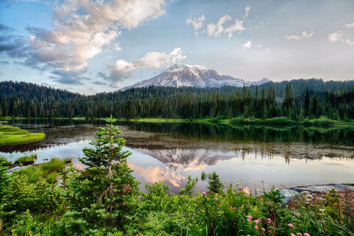
I’ve written 4 different books about Washington, and I’d say that Mount Rainier is a must-visit on a Washington road trip. Mt. Rainier National Park encompasses nearly 370 square miles and includes deep riparian valleys, lush old-growth forests, alpine meadows, and glaciated slopes.
With so many amazing hikes, it’s hard to pick favorites, but in this post, I’ve rounded up 6 of the best hikes in Mount Rainier National Park.
This post may contain affiliate links.
1. Comet Falls
These stair-step falls are my favorite waterfalls in Mt. Rainier National Park, and this trail is right up there as one of the best Mt Rainier hikes. What I love is that this trail is never really that crowded compared to some of the other stand out hikes in the park.
The top section of Comet Falls drops 300 feet as it crashes over black basalt cliffs. The waters gather at the bottom, roll across a heather step, then drops another 20 feet into a broad basin.
The trail starts with a steep climb away from the parking area (which is why this is considered moderate to challenging), quickly slicing into a dense old-growth forest. A short half-mile in, the trail pitch eases, and the forest opens up as the route angles north to climb along the eastern slope of the VanTrump Valley.
Note in mid-July, I’ve found lingering snowfields over sections of the trail where it crosses avalanche chutes. In this case, you have to be prepared to climb over downed trees and navigate other debris if local trail crews haven’t had a chance to clear the route yet.
Once you reach the waterfall basin at 1.8 miles that overly average trail suddenly seems exceptional. At about 2 miles, I suggest leaving the main trail and angling off onto a sidetrack on the left to access the plunge pool at the base falls. Enjoy the view before returning the way you came.
Save this post!
Enter your email & I'll send this post to your inbox! You'll also receive my weekly newsletter full of helpful advice for planning your adventures.
2. Skyline Trail
This 5-mile loop is one of the most popular trails in the Park, so don’t expect to be alone here. But in my opinion, the epic views of Mt. Rainier are worth sharing the trail with others.
This trail can get windy and there isn’t much protection from the elements, so be prepared with layers!
The route departs from the Paradise parking lot and leads past the doors of Paradise Lodge – a classic CCC timber-framed lodge. The path crosses the broad Edith Creek Basin and leads up through some of the country’s most glorious alpine wildflower meadows.
Within minutes after leaving the lodge, the trail crosses a sturdy bridge over the head of Myrtle Falls, a crashing cascade that drops into a deep gorge.
From the bridge, stay right as the route slices through a broad meadow before climbing steeply to the high crest of Mazama Ridge. As long as it’s a clear day, here you’ll experience unbeatable views of Mount Rainier’s glaciated summit as you trek upward along the ridgeline to Sluiskin Falls.
Here the trail gets a bit rocky, so I recommend sturdy hiking shoes. Trekking poles can also be helpful.
From Sluiskin Falls, the trail climbs a bit more before looping west and descending back into the Paradise Valley.
3. Mount Fremont Trail (via Sourdough Ridge Trail)
The Fremont Lookout tower no longer functions as a manned fire lookout, but the trek to and from the tower features unmatched panoramic views of The Mountain and the vast alpine meadows and glacier fields that grace her northern flanks.
On clear days, I’ve seen Glacier Peak, Mount Stuart, and even Mount Baker in the distance. The lookout’s location, unfortunately, offers somewhat limited views of Mount Rainier herself – something to consider if that’s your main goal.
The trail leaves the Sunrise Lodge parking lot on the Sourdough Ridge trail and, after a brief climb through the Sunrise Meadows, angles west past Frozen Lake and a series of trail junctions.
Despite the multiple trail options, I find staying on the route is easy as the open alpine meadows provide clear views of the Fremont Trail as it climbs north away from Frozen Lake along the flank of Fremont Mountain. The trail crests out of the ridge top at about 2.5 miles and leads to a gentle stroll along the rocky crest to the lookout tower. Pay attention to the meadows before the tower and you might see the resident mountain goat herd.
TIP: While the trailhead area is known as Sunrise – it is one of the first places in the park to receive the morning sun – Mount Fremont and the other area peaks are some of my favorite places to watch the sunset in Mt. Rainier National Park. If you plan to enjoy the sunset, make sure to pack a headlamp for your hike out in the twilight hours.
4. Glacier Basin
Your time is running out. Without radical changes in global practices, glaciers could disappear entirely in the lower 48 states, and the ice rivers on Mount Rainier are already in full retreat.
Fortunately, we can still see the mighty ice sheets, and even get up-close and personal with them. Seeing a glacier up close should be on everyone’s bucket list, and for that reason, I consider Glacier Basin is one of the best Mt Rainier hikes.
This trail leads up the upper reaches of the White River Valley, crawling through scraggly forest and craggy moraines – ridges of rock pushed aside by the moving glaciers. If you have the skill and the time, you can scramble up the bottom section of a climbers’ trail to reach the ice of Inter Glacier.
From the White River Campground, start up the trail as it follows the frigid churning waters of the White River upstream. The trail is an old road, once used by miners and then by tourists, until the late 1940s, making the lower section of the route fairly easy to traverse. The trail dips near the river periodically, and even on the hottest summer days, you can periodically feel a refreshingly cool breeze off the icy waters.
When the trail forks at the 1-mile mark, stay right to continue up the Inter Fork of the White River. This branch of the river is spawned by the melting waters of the Inter Glacier, the river of ice nestled in the rocky basin below the pointed crest of Steamboat Prow.
From the fork, the trail continues west, climbing along the river at the foot of Burroughs Mountain. At just over 3 miles, the official trail ends at Glacier Basin Camp (5,900 feet). From here, you can look upward at the rocky notch of St. Elmo Pass, through which flows the headwaters of the Inter Fork of White River.
Added Adventure: For more rugged adventures, follow the climbers track as it ascends from the camp through the rocky rubble of the Wedge. In just under a mile, you’ll gain 1,200 feet, crossing through St. Elmo Pass, to reach the foot of Inter Glacier. NOTE: This is a rough scramble route and deserves a great deal of respect and caution.
5. Spray Park
Myself, along with several local guides, photographers, and naturalists, have deemed Spray Park as Mount Rainier National Park’s best meadow hike. Be warned, this trail can get busy in peak summer, so get there early for parking and to beat the crowds.
The lower section of the trail provides access to a beautiful waterfall before climbing steeply through a gradual transition of ecosystems. The route runs through a high forest, a riparian valley, into subalpine meadow, and finally to alpine meadows. The truly adventurous can push on to the top of Mt. Pleasant where you’ll have 360 degree views.
But it’s the meadows, especially the transition zone from subalpine (starts just below timberline) to alpine (open fields above timberline) that really make Spray Park special. The trees fade away as the trail climbs, leaving a path through a world of sparkling blue ponds and emerald-green vegetation interrupted by splashes of color from a variety of wildflowers.
The path starts at the Mowich Lake Trailhead and climbs gradually through the forest for more than 1.7 miles to Spray Falls. Views of the falls require a brief quarter-mile side trip, but trust me, this is NOT to be missed. Spray Falls is a glorious cascade that provides a cooling spray on hot summer hikes.
After visiting the falls, continue up the Spray Park trail as it climbs south up the flank of Mount Rainier. A long series of switchbacks leads over Grant Creek and into the subalpine meadows below Hessong Rock (6380 feet).
6. Eunice Lake – Tolmie Peak Lookout
I love this unique route that offers a stop at a clear alpine lake AND a scenic vista from an old fire lookout station. Eunice Lake is a blue gem nestled among the meadows and a perfect place to cool off during a hot summer hike. And Tolmie Peak provides astoundingly clear 360-degree views of Mount Rainier and the Central Cascades, making it one of the top Mt Rainier hikes.
The trail meanders about 1.75 miles from the Mowich Lake trailhead to Ipsut Pass (5,100 feet) before traversing through stands of forest and broad meadows to the shores of Eunice Lake. From the lake, you can clearly see your destination overhead. The trail climbs steadily from the lake to the summit of Tolmie Peak and the old disused but still sturdy fire lookout cabin at the crest.
The lookout cabin was built in 1933 by the Civilian Conservation Corps, but the peak was named for an explorer who visited the area nearly 100 years earlier. According to the National Park Service records, Dr. William Tolmie left London to take up residence as the local physician for the Hudson Bay Company at Fort Vancouver on the Columbia River just north of Portland, Oregon. Tolmie saw the mountain as he sailed up the river and subsequently journeyed out on an expedition to the Mowich Lake area to collect medicinal herbs. He made the first recorded ascent of Hessong Rock.
Note that the road to the trailhead closes earlier than some of the other hikes in Mount Rainier. So your best bet is to do this hike in late summer or early fall.
Frequently Asked Questions
Permits are not required for day hiking in Mt. Rainier National Park. However, in 2024, a timed entry system was implemented for the Paradise and Sunrise Corridors during peak hours in order to better manage crowds. For info on the current timed entry system, visit the National Park website.
Dogs are not allowed on any trails within Mount Rainier National Park. For nearby dog-friendly trails, check out routes in the Gifford Pinchot National Forest to the south or Mount Baker-Snoqualmie National Forest to the north.
For most trails, the best time to hike is mid-July through mid-October. My favorite time is September and early October when the bugs have died off, crowds are thinner, and the leaves are starting to turn.
The Road to Paradise is kept open year-round, providing phenomenal winter recreation on the slopes of the volcano, but the park’s other roads are typically snowbound from November through late May. The Road to Sunrise may not be opened until the Fourth of July or later some years. Check the park website for road opening dates and current trail conditions.
Are you planning a trip to Mt. Rainier National Park or have you been before? Am I missing any of the best Mt Rainier hikes? Let me know in the comments below!
