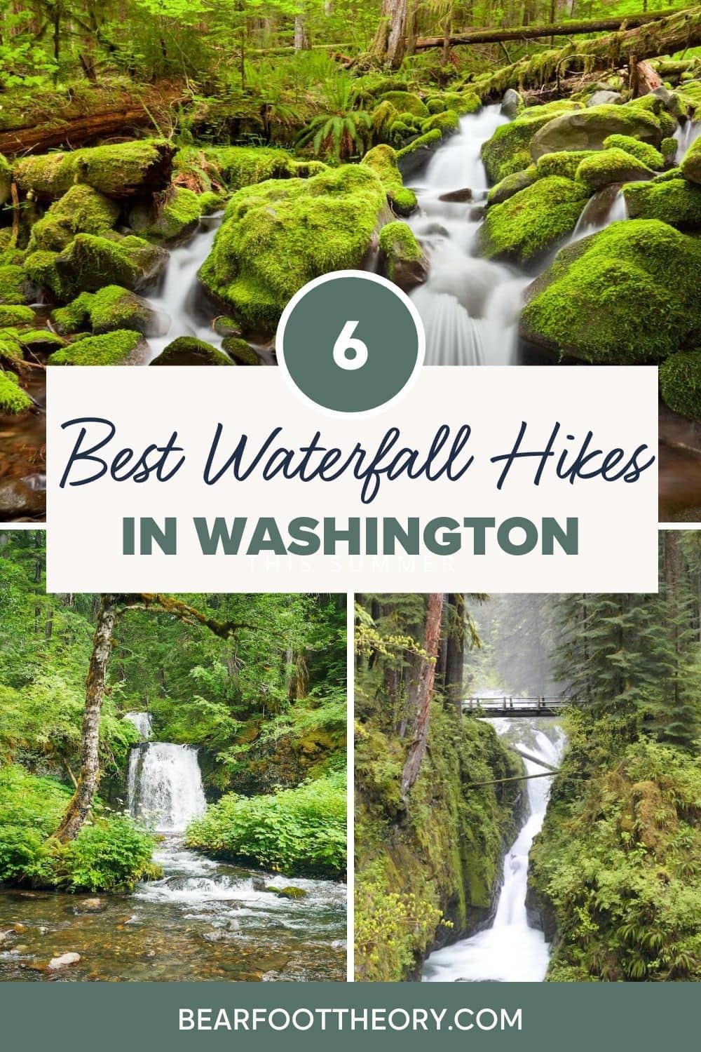
6 Best Waterfall Hikes in Washington
Discover 6 of the most scenic waterfall hikes in Washington State including how to get there and what to expect along the trail.

Everyone knows the Pacific Northwest’s reputation for rain, but the region also records some of the deepest annual snowpacks in the world. Mount Rainier and Mount Baker frequently trade the world record, with more than 1,000 inches of annual snowfall common on each mountain. Combine the rain with snowmelt and the results are lots of rivers and when rivers leave mountains, they often drop over waterfalls, making Washington one of the best states for waterfall hikes.
Many of the best waterfall hikes in Washington can be found along the west slope of the Cascades, or in the rainforests of the Olympic Peninsula. But even the dry desert country of eastern Washington offers some impressive waterfalls.
Here are 6 of our favorite waterfall hikes in Washington so you can easily plan your next PNW adventure.
Important Reminder: As it goes in all of the destinations we share, please practice good trail etiquette and remember to Leave No Trace. This means packing out all of your garbage (including toilet paper), being respectful to others on busy trails, and following the established rules.
Washington Waterfall Hikes – Mapped!
Find camping at sold out campgrounds
Try The Dyrt PRO free for 30 days
The Dyrt Alerts will help you get reservations at sold-out campgrounds across the US by sending you an alert when your desired dates become available.
• Select campgrounds and the dates you want to camp
• The Dyrt repeatedly scans for cancellations
• When your campsite becomes available you’ll get a Dyrt Alert sent to your phone!
Use the code BEARFOOT to get 30 days free!
Sol Duc Falls Loop, Olympic National Park
- Round-trip distance: 5 miles
- Elevation Gain: 250 feet
- Difficulty: Easy/Moderate
- Pass needed: Federal America the Beautiful
Sol Duc Falls Loop offers views of majestic old-growth rainforests, a stunning emerald-lined cascade, and the option to soak in a hot spring at the trail’s end. As a result, the trail is heavily used, so the best time to visit is early spring when the river is high and the waterfall thundering, but the ever-present spring rains keep the crowds to a minimum. That’s also the best time to see the resident Roosevelt elk herds in the forested valley, but be sure to keep your distance to avoid having a dangerous wildlife encounter.
The trail starts from the Sol Duc Resort and Hot Springs (fee required for soaking). The trail, also called Lovers Lane (you and your sweetheart can walk much of it hand in hand), begins at the south end of the parking lot, heading up into the woods. The route starts in a forest of second-growth Douglas fir. That (relatively) young forest soon transitions into true old-growth with towering Doug firs, western hemlocks, and western red cedars creating a cathedral-like atmosphere around the trail. Herds of elk routinely browse through this lush forest, so keep an eye out (and if visiting in the fall during mating season, keep an ear out) for the big beasts. At 2.6 miles, the trail crosses the Sol Duc River, and the bridge provides the best falls views. The falls cascades into a narrow cleft in the valley floor, creating a unique ‘sideways’ falls.
After the river crossing, follow the river trail downstream. You’ll encounter lots of traffic here, as a parking lot for the falls trail sits just over a half-mile downstream. If you prefer a shorter hike, you can skip the Lovers Lane leg and do the upper end of this downstream leg as an out-and-back from this upper trailhead, but you’ll miss a great rainforest trek. The trail back to the resort branches off to the left (toward the river) about 500 feet before you reach the upper trailhead.
To get there: From Port Angeles drive west on State Route 101, pass Crescent Lake, and watch for a left turn into National Park and access road to the resort.

Woody Trail – Wallace Falls State Park
- Round-trip distance: 5 miles
- Elevation Gain: 1,460 feet
- Difficulty: Moderate
- Pass needed: Washington Discover Pass
The trail starts well away from views of the falls, but the roar of the cascade can be heard nearly from the start. Follow the Woody Trail and in just a third of a mile, jump on the short (1/8th mile) spur trail to the left leading to Small Falls. This trail was built in 1995 by a local Eagle Scout and Small Falls is a wonderfully photogenic waterfall in a park best known for a much larger cascade.
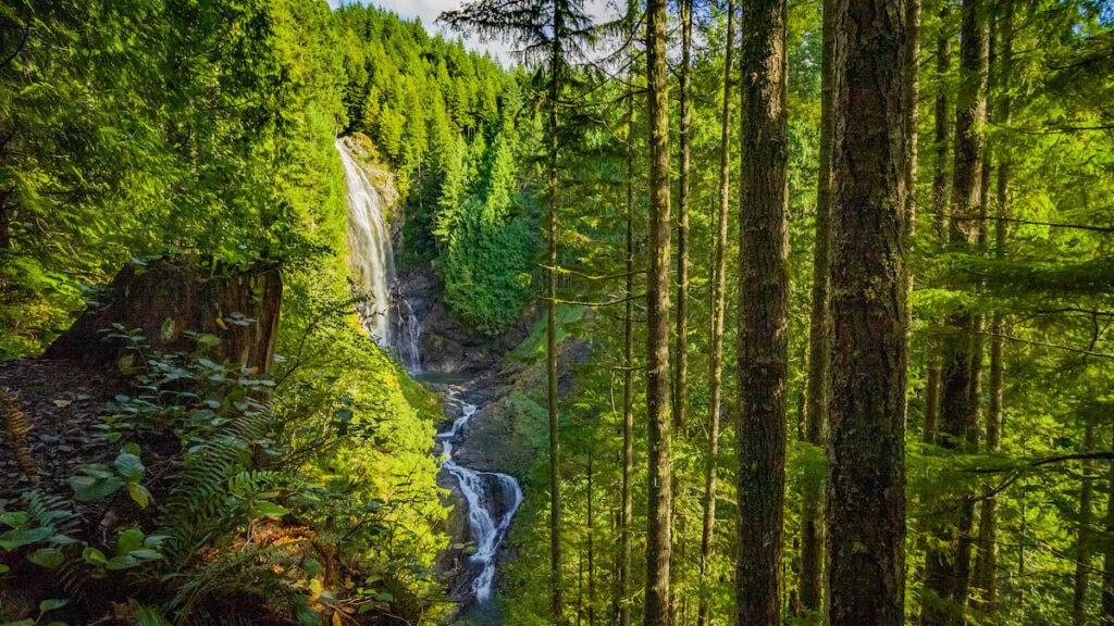
The Woody Trail continues past that spur, offering frequent river views as it winds its way upstream. After 1.5 miles the trail crosses the North Fork Wallace River on a stout bridge for the first close-up view of the river. From here, you’ll soon encounter Lower Wallace Falls and shortly after, Middle Wallace Falls.
From the view of Middle Falls, you’ll also be able to look up at the 250-foot drop of Upper Wallace Falls. The final 0.3 miles from this viewpoint to the Upper Falls is rugged but worth the effort. The Upper Falls drops in a slight double-cascade. This is a very popular waterfall hike very close to the Seattle area, so it can be crowded. To avoid the biggest crowds, visit mid-week in late spring or fall.
To get there: From Monroe, drive east on U.S. Highway 2 (Steven’s Pass Highway) east to Gold Bar. Once in Gold Bar, turn left onto First Street and follow the signs to the park (about 2 miles).
Franklin Falls
- Round-trip distance: 2 miles
- Elevation Gain: 400 feet
- Difficulty: Easy/Moderate
- Pass needed: Federal America the Beautiful
Franklin Falls provides an easy hike to a stunning waterfall just a short distance from the Seattle metro area. And while the trail can be busy, it does draw the hordes many of the other nearby hikes attract, in part because of its location. Some hikers are put off by the thought of walking so near to a major roadway – the Snoqualmie River drops over Franklin Falls between east- and west-bound lanes of Interstate 90. But since those lanes reside on opposite sides of the wide valley and are elevated well above this trail, the road is easy to ignore, though you might not want to if you enjoy exploring history.
The route covered by Interstate 90 today was originally a trading path used by Native Americans and later was a mule trail for fur traders, and then a wagon track used by white settlers and traders carrying between the farmlands of eastern Washington and the ports along Puget Sound. Traces of that old wagon road can still be found near today’s trail.
The trail climbs through the mossy forest, periodically crossing the old carved ruts of the wagon road—those steel-shod wooden wagon wheels cut deep. The path reaches Franklin Falls at 1 mile, and the last pitch climbs steeply on a rocky trail to the base of the falls. Enjoy the spray from a safe distance.
To get there: From Seattle drive east on I-90 to exit 47. Turn left over the overpass and proceed to a T. Turn right and travel 0.25 mile to Denny Creek Road (Forest Road 58). Turn left and drive nearly 3 miles before left onto FR 5830. Park before crossing the bridge.

Twin Falls Trail
- Round-trip distance: 3.5 miles
- Elevation Gain: 700 feet
- Difficulty: Easy
- Pass needed: Washington Discover Pass
The Twin Falls Trail provides an easy hike through lush second growth forest to a pair of stunning cascades less than an hour from downtown Seattle. Twin Falls State Park resides downstream from Franklin Falls and upstream of the car-accessed Snoqualmie Falls. These cascades along the Snoqualmie River offer spectacular year-round waterfall viewing thanks to an annual rainfall of nearly 90 inches in the valley (note that Seattle, just 45 miles west of Twin Falls, receives less than half that amount)
The path climbs gently through moss-laden forest near the river for nearly a mile. This section of trail offers a great exploration of the region’s logging history. The forest is well established second growth but there are great reminders of the old growth harvested more than a century ago. Hikers will find numerous massive stumps sporting springboard notches – cuts that loggers used to support “springboards” they could stand on to cut the tree at a narrower height.
After this long, flat run the trail climbs gently up a series of switchbacks. About 1 mile out, a short spur trail on the right leads to a fantastic overlook of the lower falls, a powerful 150-foot cascade. The main trail continues to climb another 0.5 mile to a bridge over a deep gorge, directly between two of the stair-step upper falls.
To get there: Drive east from Seattle on I-90 to exit 34. Turn south on 468th Avenue SE and immediately before the South Fork Snoqualmie River bridge, turn left (east) on SE 159th Street and drive 0.5 mile to the trailhead parking lot at the road’s end.

Silver Falls
- Round-trip distance: 4 miles
- Elevation Gain: 500 feet
- Difficulty: Easy/Moderate
- Pass needed: Federal America the Beautiful
The Ohanapecosh is a stunning river of crystal-clear waters tumbling past moss-laden banks under the shadow of ancient forests. The entire river valley is picturesque, but the most stunning section encompasses Silver Falls. This stair-step cascade drops over a jagged rocky ledge, creating a noisy splash full of silver ribbons and frothy whitewater.
The hike starts from the Ohanapecosh Campground Visitor Center and is a great Mt. Rainier National Park day hike. The trail runs north through a mix of old growth and second-growth forests surrounding the river. The route provides few views of the river for the first 1.5 miles, but after merging with the Laughingwater Trail, the vistas start to open up. As the route nears the 2-mile mark, the trail moves alongside the river and soon drops onto a stout bridge over a narrow rocky gorge. From the bridge, Silver Falls spreads out in photographic splendor.
Just past the bridge, the trail joins the Eastside Trail on the west bank of the river. Turn left (downstream) and head back to the campground and trailhead.
To get there: From I-90, drive east on US Highway 12. Just past the town of Packwood, turn north onto State Route 123/Cayuse Pass Highway to the Ohanapecosh Campground on the left. Turn into the campground and park in front of the visitor center. The trail is found behind the visitor center.

Big Creek Falls Trail
- Round-trip distance: 1.5 miles
- Elevation Gain: 300 feet
- Difficulty: Easy/Moderate
- Pass needed: Federal America the Beautiful
This easy hike through a rich Douglas fir forest includes interpretive signage to help visitors understand the local native flora, fauna, and geography. The wide, compacted trail meanders through ancient Douglas fir forest before reaching a broad viewing platform overlooking the towering cascades of Big Creek Falls.
The fantail falls leaps into view as you round the last bend of the trail. The river drops over a tall but deeply undercut rock wall and falls into a shallow boulder-strewn basin. The viewing area makes an ideal lunch stop as the mid-day sun baths the cascade in light and the music of the falling water provides a gentle soundtrack for the viewing.
To get there: From I-5, drive east on State Route 503 to the town of Cougar. Continue 25 miles east on Forest Service Road 90 up the Lewis River Valley to the well-marked trailhead on the left.

Washington Waterfall Hike Tips
Safety
Waterfalls can be remarkably beautiful, but also dangerous. The splash spray coming off the falls creates slick conditions on the rocks and ledges surrounding the cascades, so be sure to wear waterproof, sturdy hiking boots. Also, the falling water carries a lot of rocks and other debris along for the ride, so standing directly under the falls can (and all too often has) result in serious injury from rock strikes.
Fees and Permit Information
All of these waterfall hikes in Washington reside on either state or federal public lands. The Washington State Discover Pass allows access to all Washington State Parks, as well as lands owned and managed by Washington Department of Natural Resources (DNR), and Washington Department of Fish and Wildlife (WDFW).
For routes on U.S. Forest Service (USFS) or U.S. National Park Service (NPS) lands, the best option is a Federal America the Beautiful Annual Pass. This serves as an access pass nationwide at federal recreational lands, including those managed by the U.S. Bureau of Land Management (BLM), U.S. Fish and Wildlife Service, USFS, and NPS.
What waterfall hikes in Washington are on your bucket list? Are we missing any great waterfall hikes in the state? Leave us a comment below!