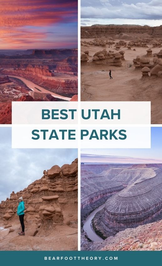
Best Utah State Parks for Hiking and Camping
A complete guide to the best Utah state parks for hiking, camping, and site seeing including our favorite trails and viewpoints in each.
Utah is famous for its Mighty 5 National Parks and many top hikes that draw in crowds of people all year long. While these spectacular places might lure you to the area, you’ll find that there are so many more Utah state parks (45 to be exact) that are just as impressive.
From stargazing to wildlife, jaw-dropping rock formations and slot canyons that you can explore, there’s so much to see and do in Utah’s state parks especially if you’re a hiker. Plus there are tons of FREE, dispersed camping areas nearby if you’d like to make a weekend out of it. To help you narrow it down, we created this guide to some of the best Utah state parks so you can experience this beautiful place and all it has to offer.
Check out the best Utah state parks for hiking and camping as well as top hikes in each one.
Important Reminder: As it goes in all of the destinations we share, please practice good trail etiquette and remember to Leave No Trace. This means packing out all of your garbage (including toilet paper) and following the established rules. In the desert, this also means learning how to protect cryptobiotic soil and how it has a huge impact on our ecosystems.
Map of the Best Utah State Parks
for Hikers
#1 campsite finder app
Try The Dyrt PRO free for 30 days
Get a FREE 30-Day membership to The Dyrt PRO, one of our favorite apps for finding campsites.
Perks include:
• 5,000+ free camping locations
• 1,000+ campground discount network
• $0 extra booking fees
• Get reservations at sold-out campgrounds, and more
Use the code BEARFOOT to get 30 days free!
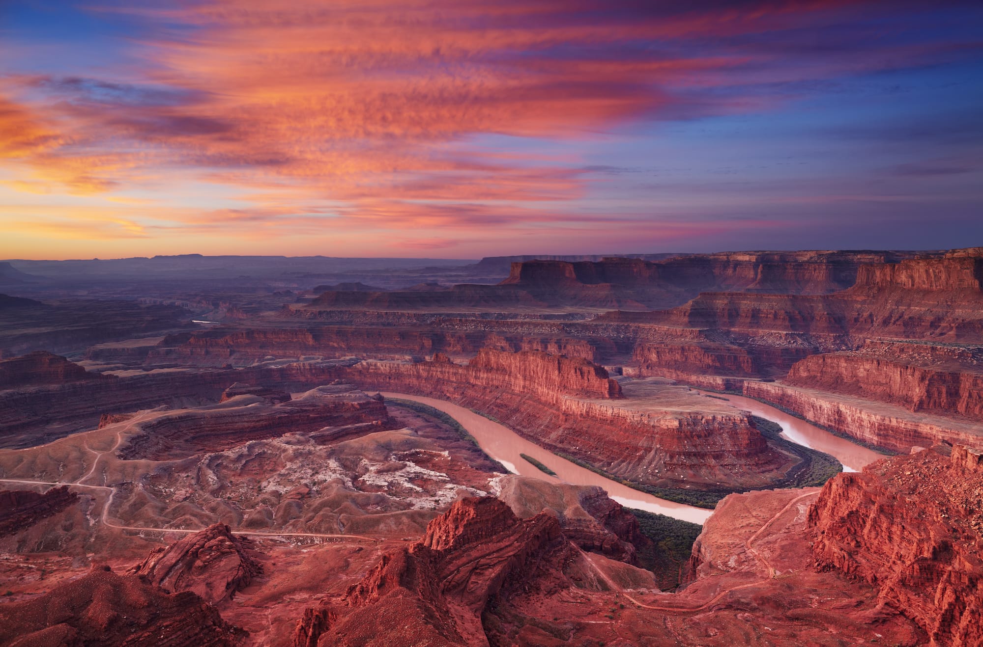
Dead Horse Point State Park
(Moab, Utah)
This beautiful park is located in Moab, Utah and features a mesa that gives visitors a stunning view of the carved-out canyons and rivers that snake through them. Here you can see for miles into Canyonlands National Park or trace the path of the Colorado River. The scenery alone makes it one of the best Utah state parks and is a great destination for photography. In addition, Dead Horse Point has new yurts you can rent for overnight camping that offer warm beds, grills, and amazing views.

Best Hikes In Dead Horse Point State Park:
- The Intrepid Trail System – A series of three loops in Dead Horse Point State Park that are 16 miles in total, consisting of both hiking and mountain biking trails. For a good day hike, check out the Big Chief Trail, a part of the Intrepid Trail System and a moderately trafficked 7.9-mile loop through the park. Dogs are not allowed.
- Dead Horse Rim Loop Trail – This is a pet-friendly 5 mile-long loop trail around the park that’s easy and accessible for all hikers. It’s got great views as you hike from rim to rim so you can take it all in. Plus, it’s well-marked and easy to follow.
Driving Directions To Dead Horse State Park
To get to Dead Horse State Park drive nine miles northwest of Moab on US 191 and then 23 miles southwest on Utah 313 to the end of the highway.
Goblin Valley State Park
(Hanksville, UT)
A unique landscape of otherworldly sandstone formations makes this one of the best Utah state parks. Named for the goblin-esque hoodoos that populate the park, Goblin Valley State Park is a great place for hiking and camping in this unusual but beautifully scenic spot. It’s also conveniently located directly down the road from Little Wild Horse Canyon Trail and Bell Canyon Trailhead, so you can pair your visit here with nearby slot canyon hikes. Dogs are allowed on a leash.

Best Hikes in Goblin Valley State Park:
- The Goblin’s Lair Hike – One of the most popular trails in the park is a 2.4 mile, out and back climb through hoodoos into a cavernous area known as “The Goblin’s Lair”. It’s strenuous and can get slippery when it rains or if there is snow, so be prepared and bring the right gear for those conditions including a pair of hiking shoes with good traction. The payoff is well worth the effort to see these one-of-a-kind geological formations.
- Valley of the Goblins – This one-mile-long loop is a great option for those who want to experience the area on a relatively easy hike. Great for families, dogs and as a less strenuous way to see the sights, Valley of the Goblins will not disappoint.
Driving Directions to Goblin Valley State Park:
To get to Goblin Valley State Park from I-70, exit onto Highway 24 and drive south for approximately 24 miles to the signed park turnoff, which is also the turnoff for Temple Mountain. From Hwy 24 turnoff, follow the paved road for about 12 miles to the parking area.

Thanks to my friend Kristin Addis for taking these photos in Goblin Valley. She runs a solo female travel blog called Be My Travel Muse and has a couple of super helpful posts for Southern Utah planning. Check out her Southwest American Road Trip Guide and her favorite off-the-beaten-path spots in Southern Utah.
Kodachrome Basin State Park (Cannonville, UT)
This colorful and awe-inspiring park is known for its 67 monolithic spires, called sedimentary pipes. What makes it one of the best Utah state parks is the fact that these incredible geologic formations are 180 million years old. A visit to this ancient park is a great alternative to avoid the crowds at nearby Bryce Canyon. Dogs are allowed on a leash.

Best Hikes in Kodachrome Basin State Park:
- Panorama Trail Long Loop – If the name didn’t already give it away, this is a pretty scenic trail with wildflowers and, you guessed it, panoramic views of the park. It’s 5.6 miles long and rated as moderate. You’ll hike through a cave but will mostly be in the sun, so bring sun protection, water, and food. There is also an option to do a 1-mile loop instead of a 5.6-mile hike if you prefer.
- Angels Palace Trail – A 1.4 mile-long loop trail that’s well-marked and good for all ages and skill levels. You’ll get to see all the best features of the park and rumor has it that it’s a great place for photography at sunset.
Driving Directions to Kodachrome Basin State Park:
To get to Kodachrome Basin State Park, drive down UT-12 and follow the signs from the town of Cannonville, which is 300 miles south of Salt Lake City.
>> Read Next: What To Wear Desert Hiking
Snow Canyon State Park
(St. George, UT)
Unlike its name, Snow Canyon State Park in Utah doesn’t receive all that much snow. Instead, it has mild weather, a campground that’s open year-round and red sandstone cliffs with a bit of white that almost looks like the park got a dusting. What makes it one of the best Utah state parks is the red rock landscape, 16 miles of hiking trails and the beautiful scenery that is unique to this area. Dogs are allowed on a leash. Here’s what to pack for your Southern Utah adventure.

Best Hikes in Snow Canyon State Park:
- Petrified Dunes Trail – See the sandstone formations up close on a moderate 1.2 mile out and back hike through the Petrified Dunes Trail. It’s great for beginner hikers who want a leisurely stroll with all views, and expert hikers will appreciate the unique geology of the area. Bring a camera!
- Lava Tube Trail – A 2.3 mile out and back trail that’s rated moderate. Walk through the scenic red rock canyon landscape to see one of the park’s main features: black lava tubes and caves. It requires some scrambling and can get rocky underfoot but provides truly stunning views.
Driving Directions to Snow Canyon State Park:
To get to Snow Canyon State Park, you can take I-15 North or South, which will give you two slightly different routes that ultimately drop you off on Snow Canyon Parkway to Snow Canyon Drive. Once there, you’ll be at the entrance to the park.
Antelope Island State Park
(Salt Lake City, UT)
The best way to see Utah’s Great Salt Lake is by visiting Antelope Island, one of the best Utah state parks. A trip Antelope Island State Park is unique in that its main highlight is the lake rather than canyons and ancient rock formations. In addition to that, the wildlife in this area features its namesake fauna: antelopes, plus herds of famous bison and beautiful wildflowers. Dogs are allowed on leash on all trails except the Frary Peak Trail.

Best Hikes in Antelope Island State Park:
- Lakeside Trail – A 5.6 mile-long, out and back hike that leads you around a point in the park and is rated as easy. On top of the expanse of the Great Salt Lake right in front of you, hikers also have a panoramic view of the Sierra Nevada Mountain Range.
- Frary Peak Trail – This 6.9 mile, out and back hike is a strenuous trek with elevation gains of 2,335 feet, so bring your trekking poles if you like to use them on steeper climbs. You’ll get views of the lush, grassy landscape and of course, the Great Salt Lake directly ahead. Dogs are not allowed on this trail, so plan accordingly before you head out.
Driving Directions to Antelope Island State Park:
To get to Antelope Island State Park, take Exit 332 off Interstate 15, then drive west on Antelope Drive for 7 miles to the park entrance, then another 7 miles across a narrow causeway to the island.
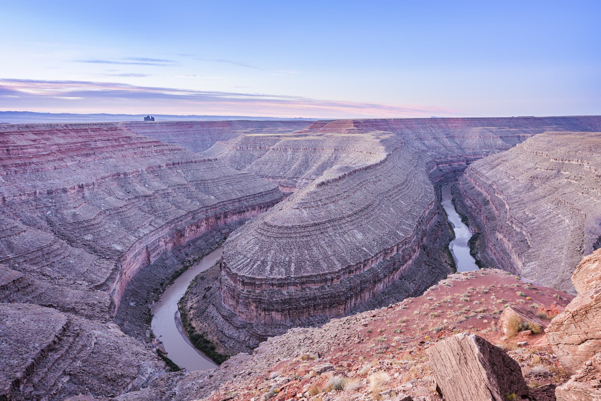
Goosenecks State Park,
(Mexican Hat, Utah)
Visit Goosenecks State Park to see the deep canyons that the San Juan River flows through and the 300 million-year-old rock formations that exist within the canyon walls. While it’s one of the best Utah state parks for hiking, it’s also one of the best spots for stargazing, bar none. Camp at nearby Valley of the Gods, then go hike at Goosenecks and take plenty of photos here and also remember to bring water, since there is no water available in the park. Dogs are allowed on leash.
Best Hikes in Goosenecks State Park:
- Goosenecks Viewpoint Trail – Easily accessible for hikers of all levels, the Goosenecks Viewpoint Trail is a 1.9 mile out and back hike. This short and easy walk delivers big views of the “goosenecks” that were created from the river erosion so long ago. You can do it as a quick stopover while road tripping or a great hike all on its own.
- Honaker Trail – A 4 mile out and back trail that’s rated as difficult for good reason. This rugged hike has a series of steep and rocky switchbacks that can get slippery. It begins as a downhill hike that descends 1,643 feet to the canyon rim and is an uphill hike on the way back. Wear sturdy hiking boots and bring plenty of snacks and water.
Driving Directions to Goosenecks State Park:
To get to Goosenecks State Park, take US 163 or Rt 261 down to the southernmost corner of southeast Utah.
What do you think are the best Utah state parks? Have you visited any? Leave us a comment below!